Minor winter weather impacts before significant weekend storm

-
2:28

Kicking off day two of the Gus Macker Basketball Tournament
-
0:55

Enjoy this weekend
-
0:50

Beautiful weekend starts this morning
-
2:32

Gus Macker Three-on-Three Basketball Tournament is taking over...
-
1:44

Feeling like a sauna next week
-
3:12

How to keep yourself and others protected during firework season
-
0:49

Showers creeping into Michiana
-
1:32

Judge approves $25 million water lawsuit settlement in Benton...
-
1:00

Scattered showers through the day
-
1:53

Hispanic Community Child Safety Meeting: A Call To Action
-
2:51

Obama Presidential Center features work of South Bend company
-
1:54

This week’s ABC57 Cub Reporter is Isaac Knefely

The concern for freezing drizzle and fog continues Tuesday night into Wednesday morning. Slick spots are possible as black ice could form on roads.
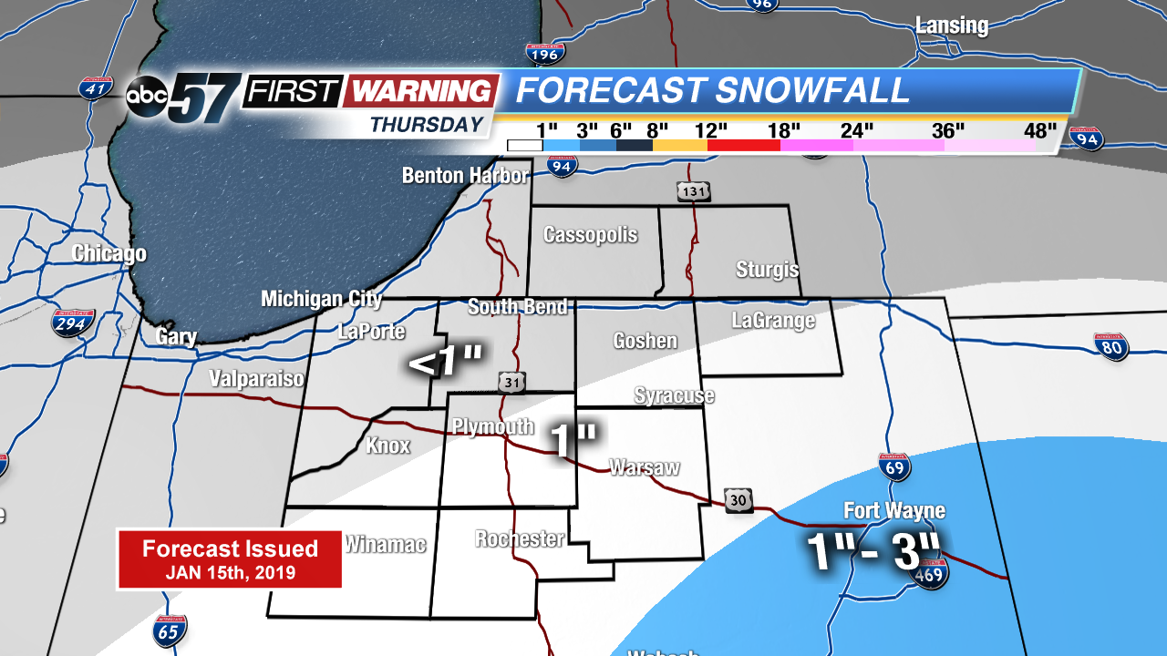
There’s little change in the weather Wednesday, cloudy with highs just peaking above freezing. A weak system brings light snow Thursday, with up to an inch possible. Friday is the lull before the storm. Widespread snow Saturday looks likely, significant snowfall through the Saturday evening. Temperatures fall into the single digits Saturday night and lake effect snow is possible Sunday. The coldest air of the season lasts through early next week.
Tonight: Freezing fog/drizzle possible, cloudy, low of 28.
Wednesday: Cloudy, high of 34.
Thursday: Light snow showers, mostly cloudy, high of 32.
Friday: Mostly cloudy, high of 30.