More extreme heat and humidity this week

-
1:43

Pleasant to start the weekend
-
3:06

Pulaski County weighs stricter solar rules amid resident concerns
-
0:40

Marian High School hosts World Down Syndrome Awareness Walk
-
2:33

South Bend leaders call for an end to gun violence
-
2:01

Tae Johnson, Notre Dame secondary stands out as Irish open spring...
-
2:21

Backup quarterback competition, position battles highlight Notre...
-
2:25

A new Pathway to the Golden Dome
-
2:33

Howard Park aims to install bandshell
-
1:37

March Madness and gambling responsibly
-
1:19

There are two big temperatures drops next week
-
1:48

Longer days for the first day of Spring
-
1:30

Country music star Jake Owen to play at Blue Gate Performing...

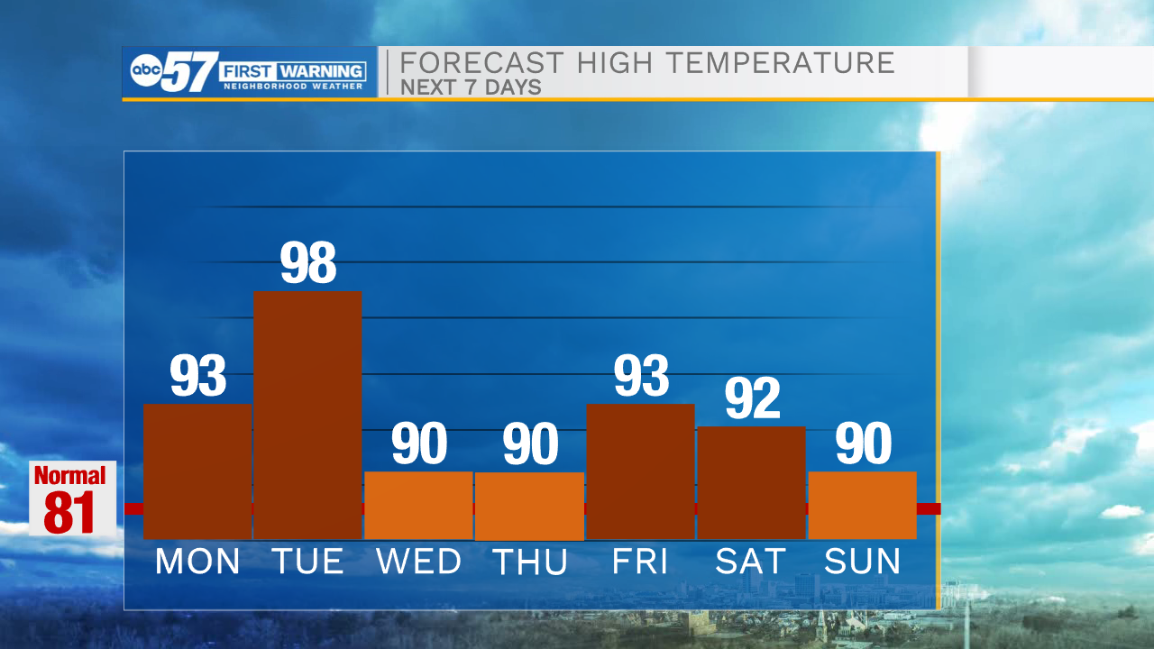
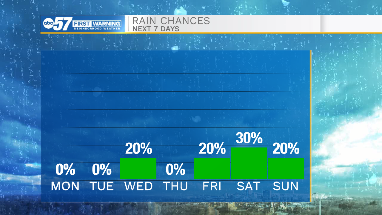
The heat and humidity will continue to climb as we head into the work week. Temperatures tomorrow afternoon will warm into the lower 90s under sunny skies. The warmest day this week will be Tuesday as highs hit the upper 90s with the heat index returning to the triple digits. Our next cold front arrives Wednesday morning bringing a few isolated showers and thunderstorms along with it. The cold front will drop highs into the lower 90s for the rest of the week. Another round of isolated showers and storms are possible Friday and next weekend. Temperatures through the weekend and into the following week will hold in the lower 90s.
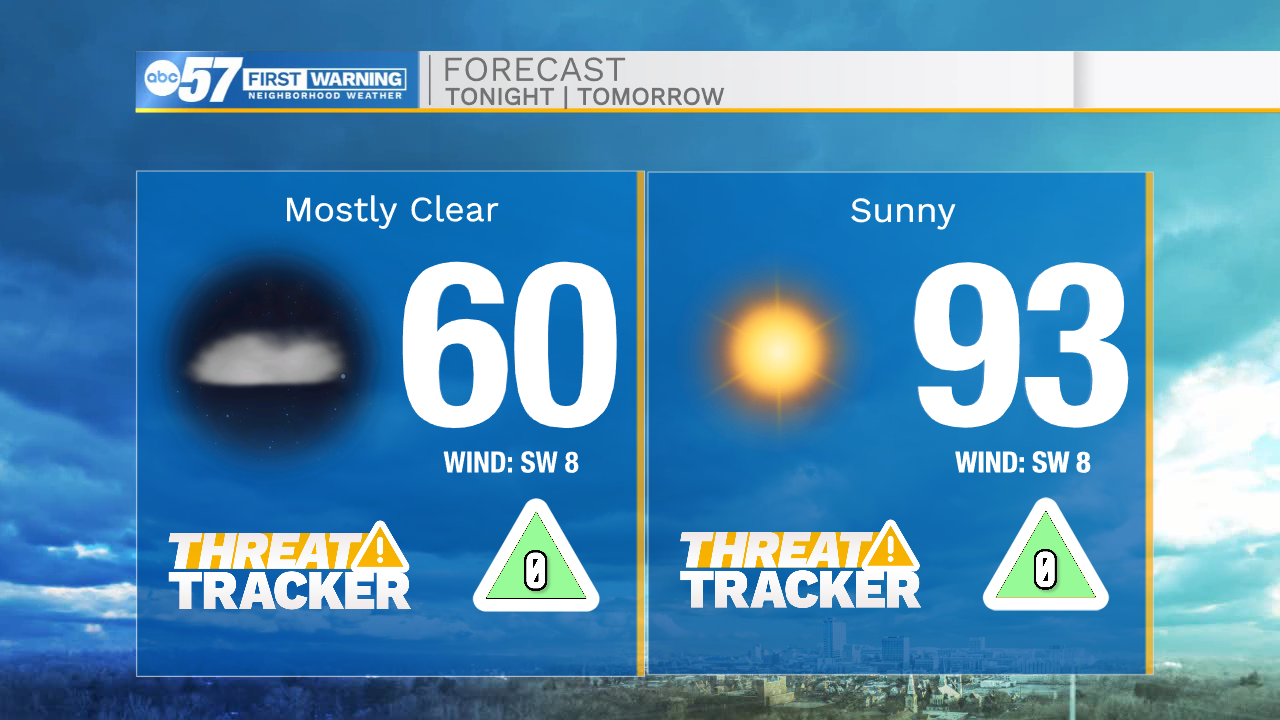
Tonight: Mostly clear. Low 60.
Tomorrow: Sunny. High 93.
Tuesday: Extreme Heat. High 98.
Wednesday: AM showers/storms. High 90.