
-
1:21

How firefighters keep cool in the summer heat
-
1:04

Local Elkhart business hosts Humanitarian Drive for Venezuela
-
3:22

Michigan City officials address privacy concerns as police consider...
-
2:11

Community reviews 62 recommendations by the South Bend Reparatory...
-
4:00

Mishawaka Police Department provides new details on police confrontation...
-
1:35

Vandals hit four mausoleums at Crystal Springs Cemetery
-
0:54

The Extreme Heat starts today
-
4:22

From train tracks to highways, how Indiana became the “Crossroads...
-
0:45

The heat starts now
-
1:15

Showers and storms possible for the holiday weekend
-
2:46

Buchanan celebrates unity during fourth annual Pride event
-
1:53

Mishawaka celebrates America’s 250 with music

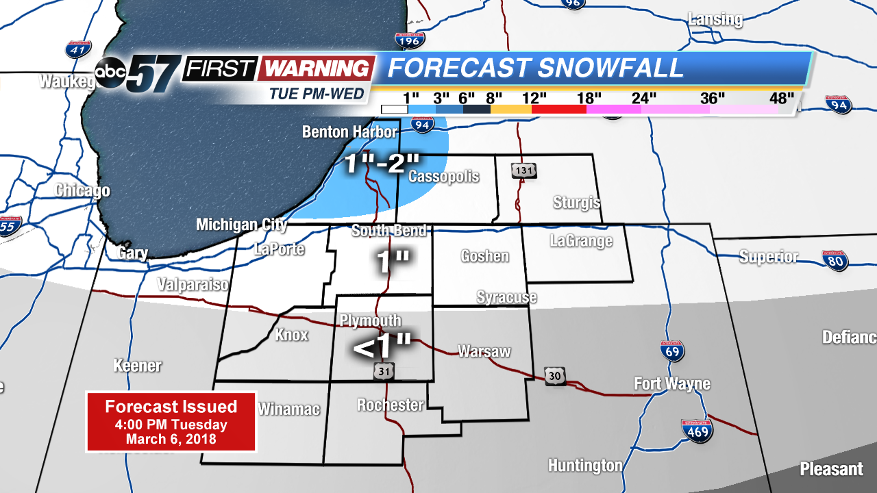
Another night of wintry mix changing to all snow. Accumulation of one to two inches is possible through Wednesday morning. Roads may have a few slick spots for the morning drive.
Snow showers continue Wednesday and cold weather prevails through midweek. As snow showers taper down Wednesday, there still could be some flakes into Thursday but it’s mostly flurries with little accumulation. Temperatures stay below normal through the weekend, before clouds break and temperatures rise gradually next week.
Tonight: Scattered snow showers, low of 28.
Wednesday: Mostly cloudy, light snow and breezy, high of 32.
Thursday: Mostly to partly cloudy, chance of snow, high of 30.
Friday: Mostly sunny, highs in the mid-30s.
Sign up for the ABC 57 Newsletter