More snow on Saturday

-
2:51

Governor Whitmer appeals FEMA federal aid denial for Southwest...
-
3:17

Benton Harbor leaders weigh Jean Klock Park upgrades amid debate...
-
1:40

Pollinator Playpath, a trail for kids, now open at Corson Riverwoods...
-
0:32

Ryan Newman racing Saturday at Plymouth Motor Speedway
-
3:08

Officials recover body of missing teenager in Lake Michigan off...
-
2:45

NCAA’s new eligibility rule could reshape Notre Dame roster...
-
1:08

Storms start this afternoon
-
0:56

Calm morning, storms tonight
-
2:43

South Bend residents see future plans for former Drewry’s Brewery
-
2:45

Damage assessment continues in Elkhart County following EF-2...
-
0:44

Indiana and Illinois set record for tornadoes
-
1:27

Community Build underway at Kathryn Park

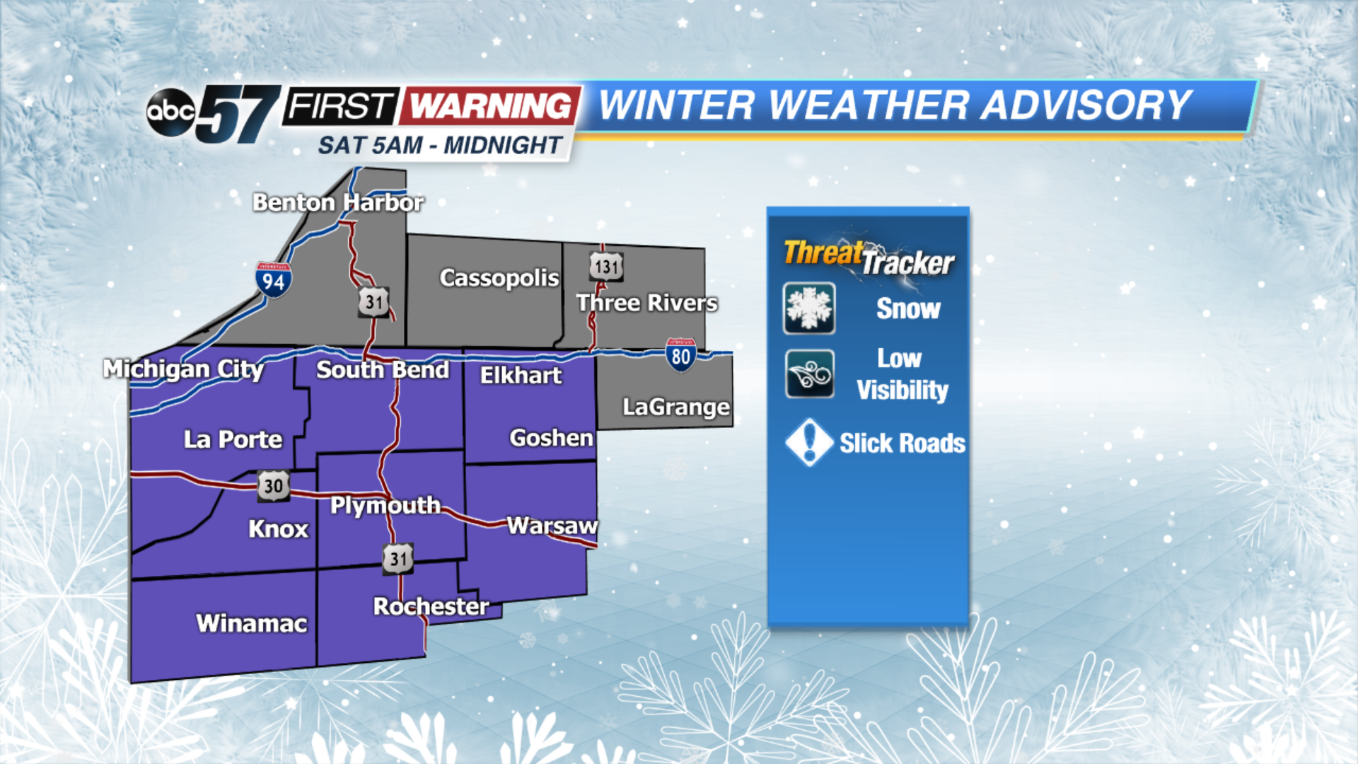
It’s a much quieter day with some sunshine to start us out before skies become overcast in the afternoon. This is ahead of a system that bring us light snow showers on Saturday. This system starts to move in tomorrow morning lasting into the evening. Right now it looks like our Michigan counties will see an inch or less of snow with 1-3” possible in our Indiana counties. We are right on the edge of this winter storm so if the track still adjusts north or south, we could see snow lines change some. It’s quiet again on Sunday with a mix of sun and clouds. Sunshine starts our new work/school week with highs in the mid to upper 30s.
Today: Partly cloudy turning overcast. High of 32.
Tonight: Overcast. Low of 22.
Saturday: Snow showers. High of 32.
Sunday: Partly cloudy. High of 34.