


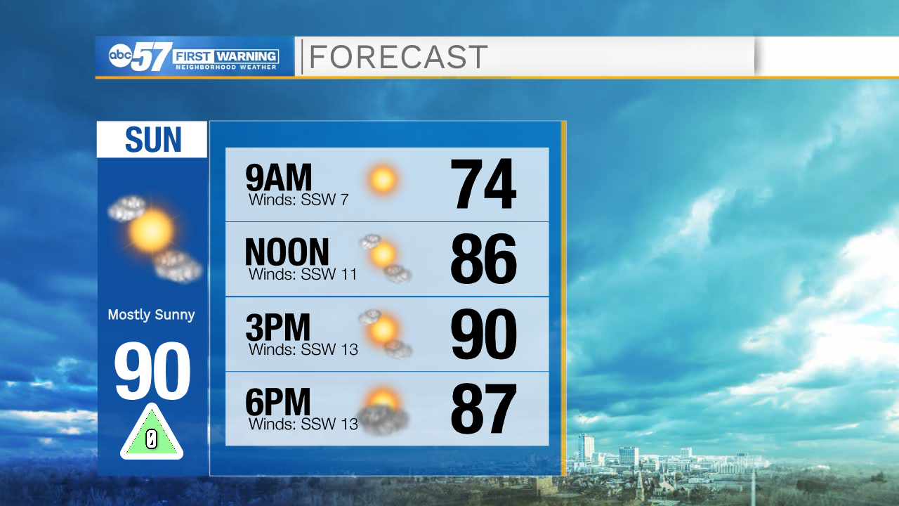
We’ll have another day of beautiful, warm weather to end the weekend. Temperatures once again soar near 90 degrees this afternoon. Cloud cover begins to build later today, and there is a chance for a stray shower or two. Most of Michiana will stay dry.
There’s a better chance for showers and isolated thunderstorms as humidity increases this week. Out the door Monday, most of us should be dry, but have the umbrella ready to go. We’ll see isolated showers and a few rumbles of thunder by afternoon. More of the same with spotty rain and thunderstorms Tuesday, Wednesday, and Thursday.
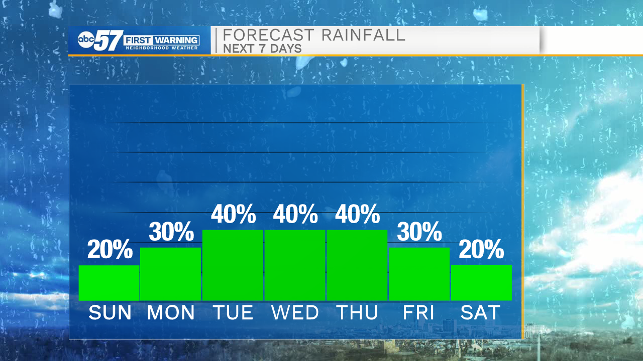
Temperatures stay warm this week, mostly with highs in the mid 80s.
Today: Mostly sunny. Breezy. High 90.
Tonight: Partly cloudy. Chance isolated shower. Low 68.
Monday: Mostly cloudy. Isolated showers/thunderstorms. High 86.
Tuesday: Afternoon showers/thunderstorms. High 85.