
-
1:44

Two rounds of storms Monday
-
1:07

Mini heat wave starts out the door
-
2:23

La Porte community rallies for Sammy Strong Benefit, raising...
-
1:57

The Potawatomi Zoo opens its gates to Zoo Nights Live
-
2:50

Carson Kvapil wins his first O’Reilly Auto Parts Series win...
-
1:10

William Tuffs honored as the only Indiana man who took part of...
-
0:50

Beacon Health held a Health and Wellness fair for the community
-
1:03

Warm conditions start overnight
-
1:02

Another pleasant day
-
0:42

Still cooler out the door
-
2:00

New Carlisle celebrates annual Hometown Days
-
1:40

Ross Chastain leads NASCAR O’Reilly Auto Parts Series practice...

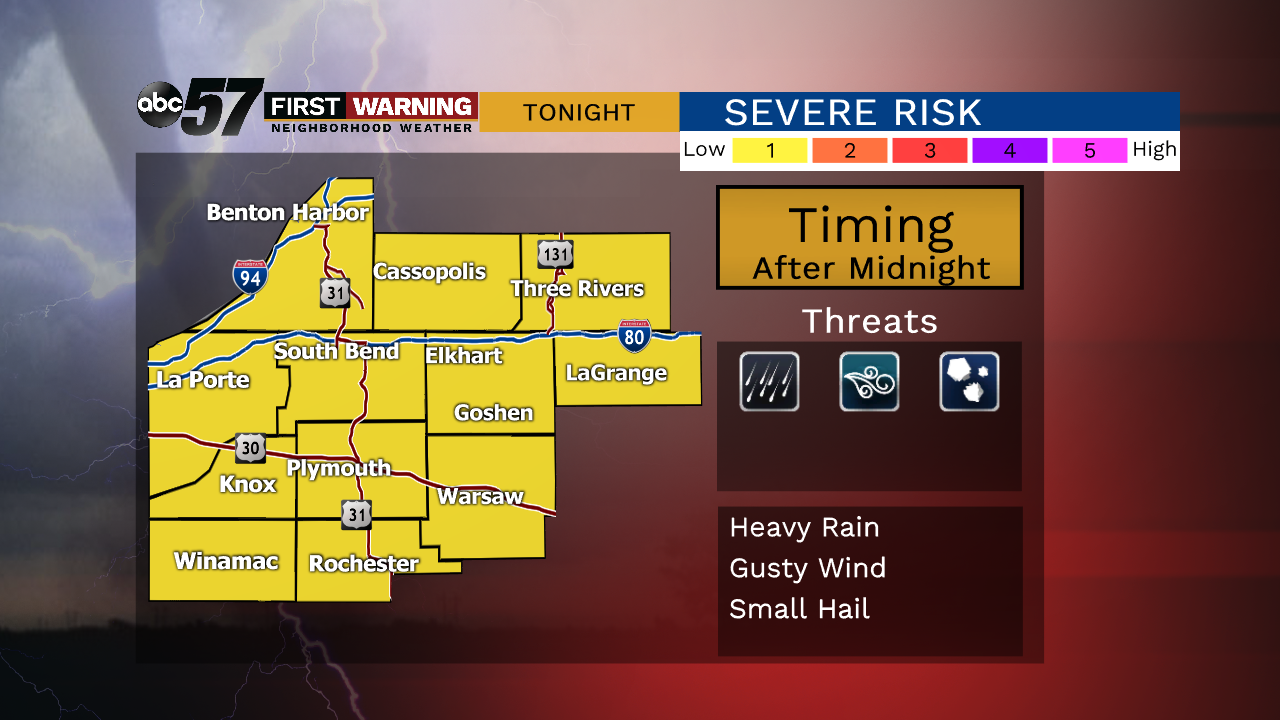
Muggy overnight with scattered showers / storms by morning, some could be loud with thunder, wind and hail.
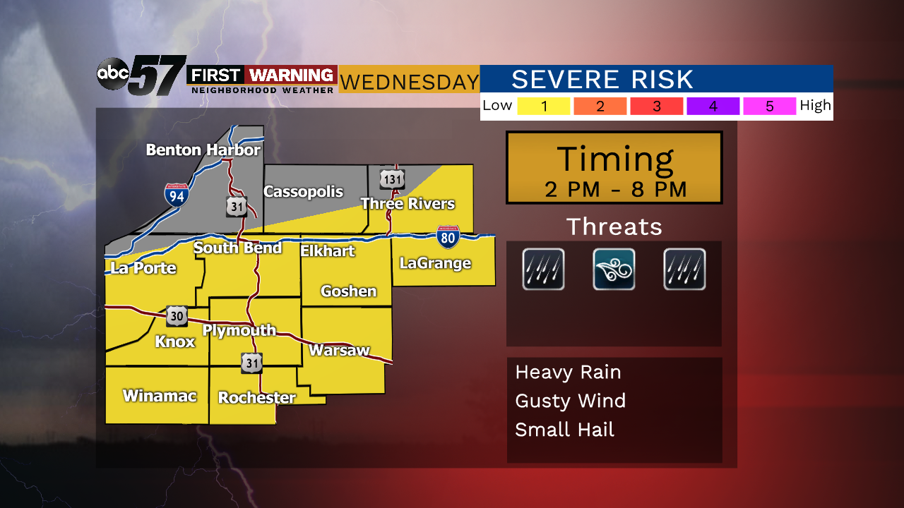
Morning showers and storms Wednesday will play heavily on any afternoon development. The longer clouds linger the less likely a severe storm threat will be later in the day. There will be a lull midday between showers and storms. Then storms develop ahead of a cold front that dives southward across the area. The farther south the higher the severe threat Wednesday afternoon. Skies clear and the humidity drops to end the week.
Tonight: Mostly cloudy, chance of showers/storms after midnight, low of 66.
Wednesday: Morning showers possible, mostly cloudy, then afternoon showers/storms, high of 80.
Thursday: Mostly sunny, high of 74.
Friday: Mostly sunny, high of 78.