
-
2:43

South Bend residents see future plans for former Drewry’s Brewery
-
2:45

Damage assessment continues in Elkhart County following EF-2...
-
0:44

Indiana and Illinois set record for tornadoes
-
1:27

Community Build underway at Kathryn Park
-
2:34

Day two of searching for a missing child continues
-
3:47

The Elkhart community is searching for answers after a 2-year-old...
-
1:04

Overall pleasant for Michiana
-
1:52

South Bend Common Council issues an official apology to residents...
-
0:54

Slightly cool out the door
-
1:54

Suspect identified, charged in fatal hit-and-run of Timothy Johnson
-
0:39

Prairie Street Cemetery works to clear storm damage
-
1:36

Reaching out for support gives father a second chance in life

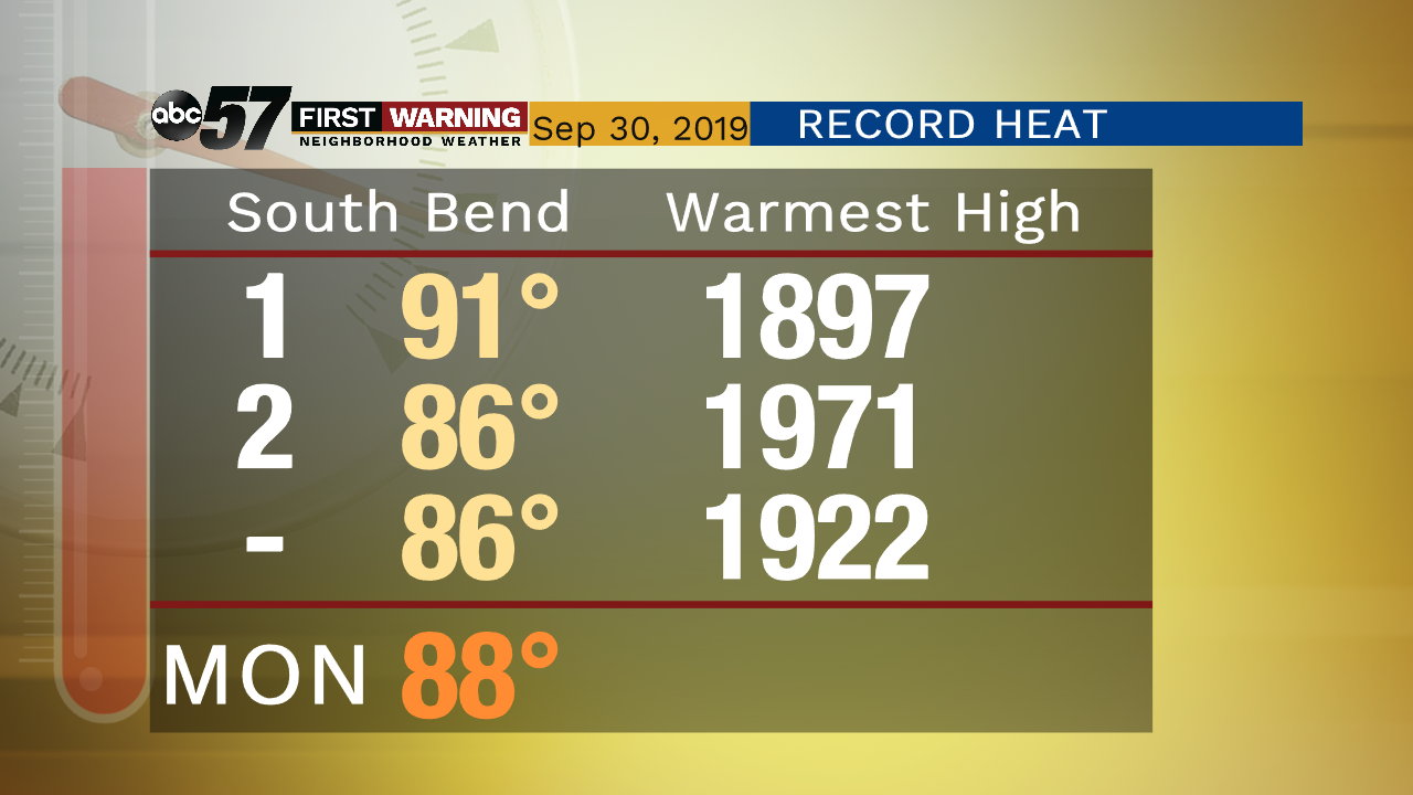
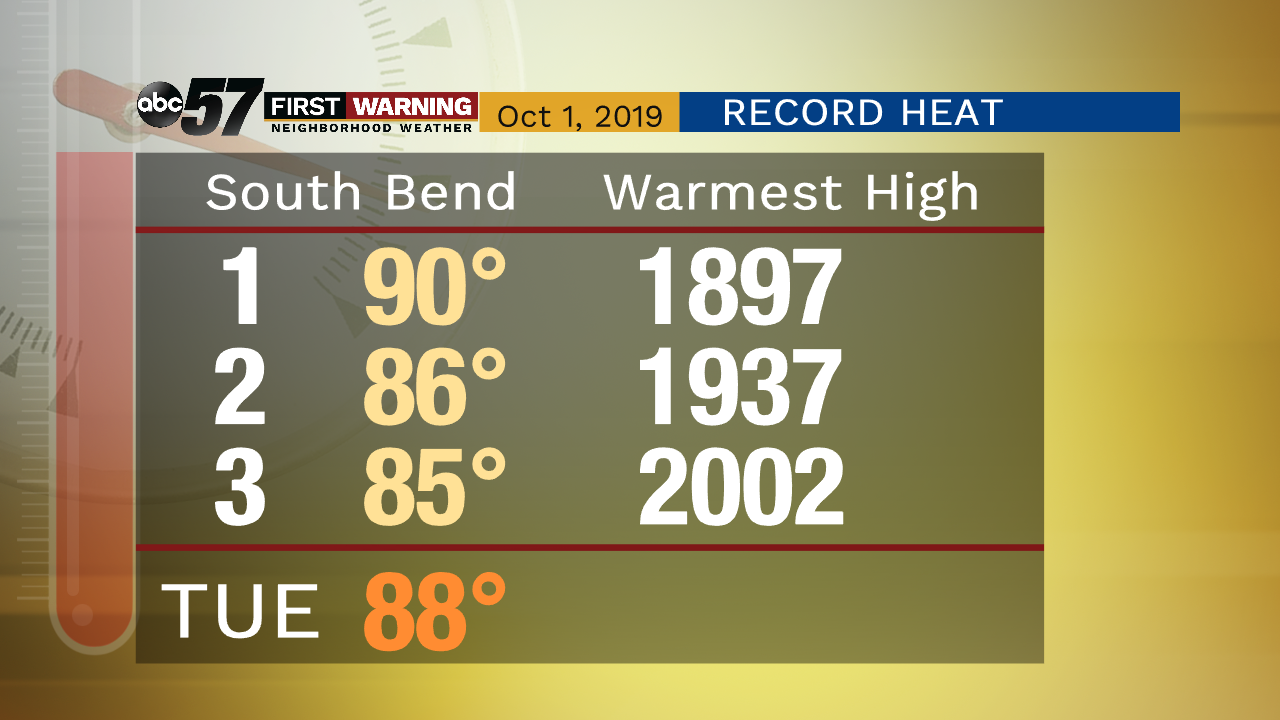
This week is the likely end of summer weather. Tuesday will be another day of near-record heat with highs 20 degrees above normal. Wednesday and Thursday are the transition days, rain is likely as the fall front slides through. Friday will begin a stretch of more typical fall weather with highs in the lower 60s, that continues into the weekend.
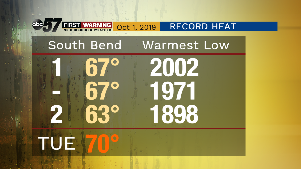
Tonight: Muggy. Low of 70.
Tuesday: Mostly sunny and humid. High of 88.
Wednesday: Cloudy, rain likely, thunderstorms possible. High of 78.
Thursday: Mostly cloudy, morning rain, then clearing. High of 66.
Sign up for the ABC 57 Newsletter