-
1:51

Warm and sunny stretch with a few showers possible this weekend
-
0:30

Prayer vigil held for domestic violence victim in South Bend
-
1:10

Bristol Town Council voting in favor tonight for the annexation...
-
0:52

Official ribbon cutting for The Delta neighborhood in Elkhart
-
1:08

Traveling or booking a trip soon? Here’s what to know
-
0:27

Elkhart Police Department investigating a hit and run on Cassopolis...
-
2:40

Recovery efforts continue after EF-1 tornado devastated Edwardsburg
-
1:22

The March rollercoaster continues
-
0:55

Mishawaka High School Theatre presents ’Chicago! Teen’
-
19:10

How public records requests increase government transparency
-
2:25

Local chef showcasing her food at Pacers game
-
3:46

Local farmers concerned war with Iran will impact fertilizer

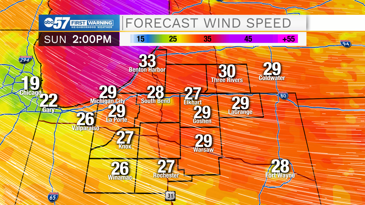
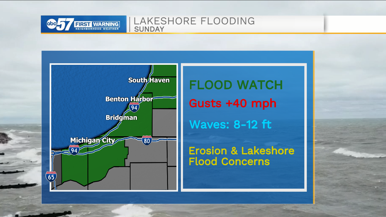
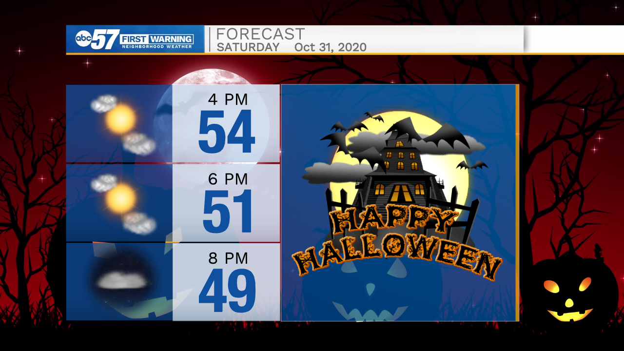
Halloween Saturday is nice and fair, through trick-or-treating, Sunday is a blustery mess with wintry mix possible. A strong cold front with cut through late Saturday night bringing rain. Temperatures fall from the low 40s early Sunday into the 30s by the afternoon. Wind gusts could reach 40 mph and waves on Lake Michigan could be up to 12 feet. The cold breeze across the lake could producer lake effect showers, with temperatures in the mid-30s these showers could be rain or snow. Accumulation is not expected. Next week is extremely mild for early November. The biggest question is could we hit 70 again?
Tonight: Clearing. Low 30.
Tomorrow: Mostly sunny. High 54.
Sunday: Blustery, falling temperatures, lake effect rain/snow showers. High 40.
Monday: Mostly sunny. High 48