 Temperature Outlook for Winter 2018-2019
NOAA
Temperature Outlook for Winter 2018-2019
NOAA
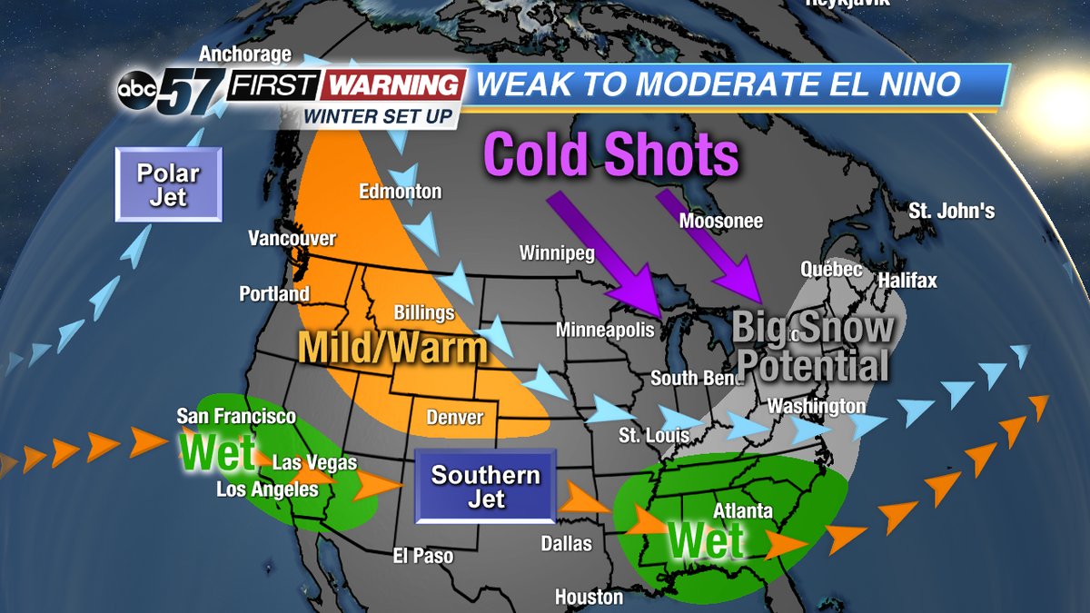
The National Oceanic and Atmospheric Administration issued their first outlook for the upcoming winter season on Thursday. And, it may put a smile on your face. According to NOAA, there is a 70-75% chance of El Nino developing by late fall, and lingering into the first half of winter. It is forecast to be a "weaker" El Nino, which
could throw a few wrenches into the overall outlook. However, NOAA's Climate Prediction Center says it could still influence the weather pattern across the country in the same way a normal El Nino event would.
 Precipitation Outlook for Winter 2018-2019
NOAA
Precipitation Outlook for Winter 2018-2019
NOAA
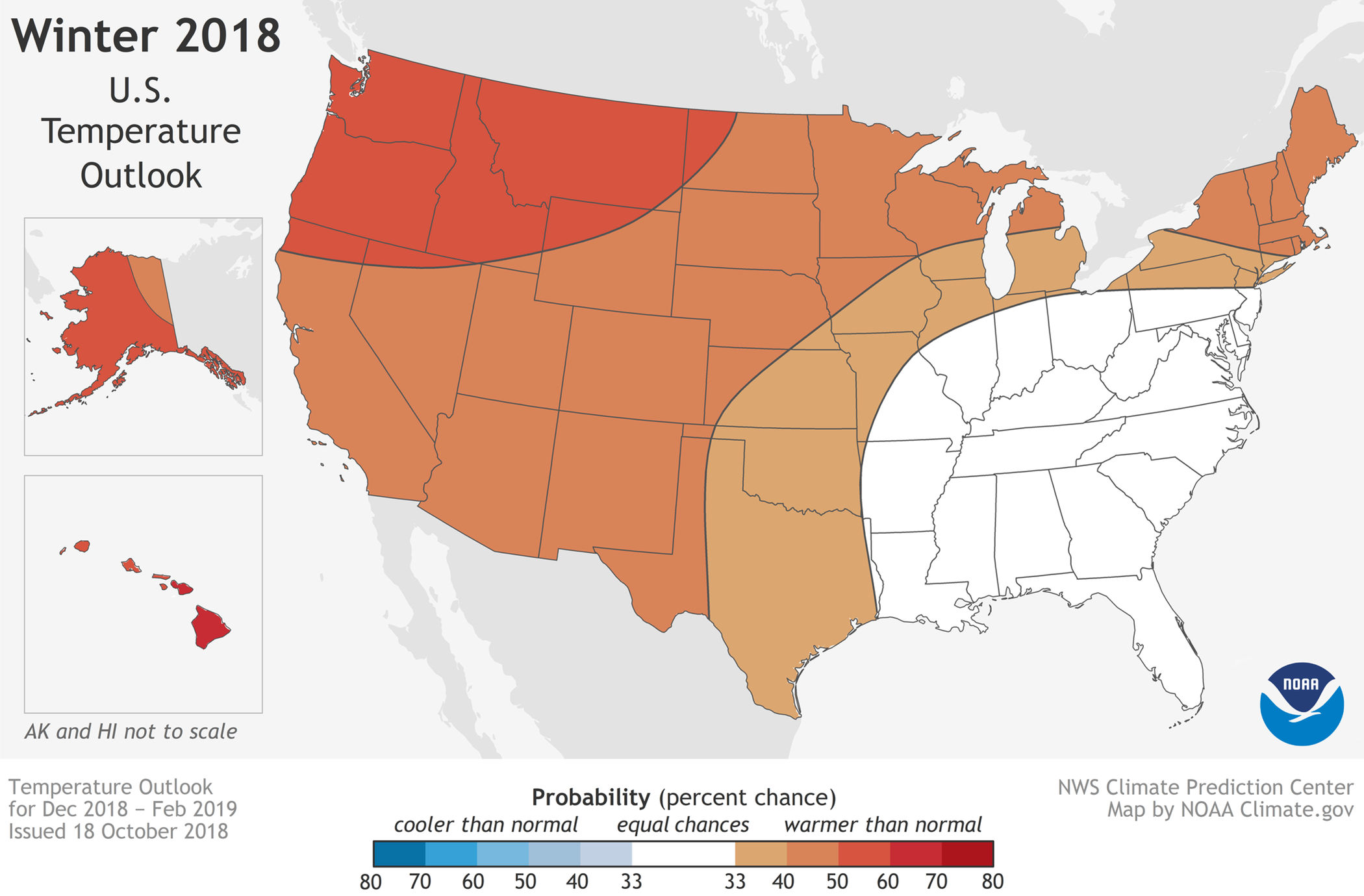
More than half of the country is favored to see warmer-than-average temperatures from December to February. The area with the highest chance of seeing the warmer temperatures is in the West, Upper Midwest and New England. Michiana has roughly a 33-40% chance of above normal temperatures. With average highs in the 30s throughout December, January and February, this would translate to more days spent in the 40s as opposed to the 20s.
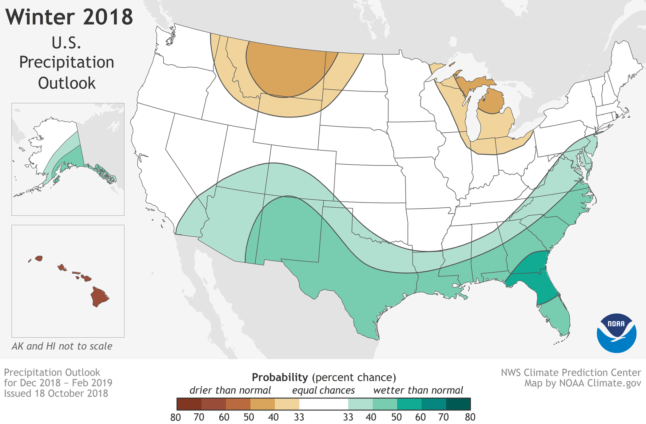
The big question, of course, revolves around snowfall. Unfortunately, it's impossible to accurately predict lake effect snow for a multitude of reasons. Nonetheless, all of Michiana falls in a 33-40% chance of below normal precipitation. In fact, the entire state of Michigan, the northern third of Indiana and the Chicago region all have a good shot at below average rain and/or snow. South Bend averages around 65" of snow per year. This outlook would thus suggest that we see less than that. It's important to keep in mind that weaker El Nino events can have many shots of colder air, which can fuel the lake effect machine. Nothing is set in stone, but after getting buried with snow last winter, this outlook should give us a reason to smile!


