

-
1:22

Much drier and less humid to end the workweek
-
2:50

Judge rules in favor of St. Joseph County Democrats in ballot...
-
2:20

Record setting diesel prices slam truck drivers, soon to affect...
-
0:54

Osceola residents weigh in on crossing safety
-
0:29

NIPSCO gas leak in Osolo Township
-
1:12

Constitution Day celebration at Indiana University
-
1:41

Three human trafficking victims identified during operation in...
-
3:12

“Heaven Is Much Brighter Today“: Marian High mourns two alumnae...
-
22:36

REBUILDING BENTON HARBOR: an ABC57 special
-
2:17

Suspect identified, cause of death revealed after multi-county...
-
1:48

The Luck of the Irish could keep Saturday’s rain at bay
-
1:42

Dirty Roots Pantry fights against period poverty in Michiana

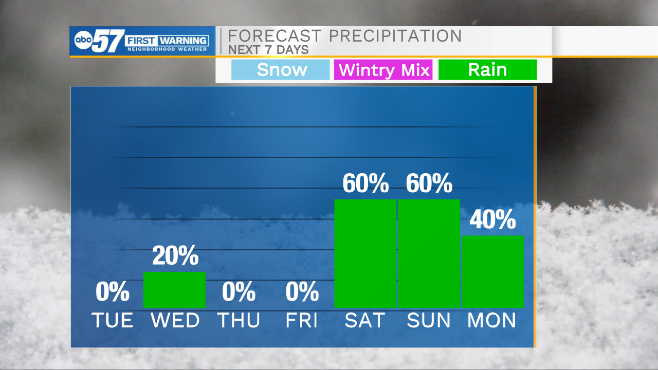
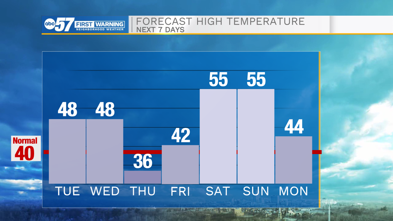
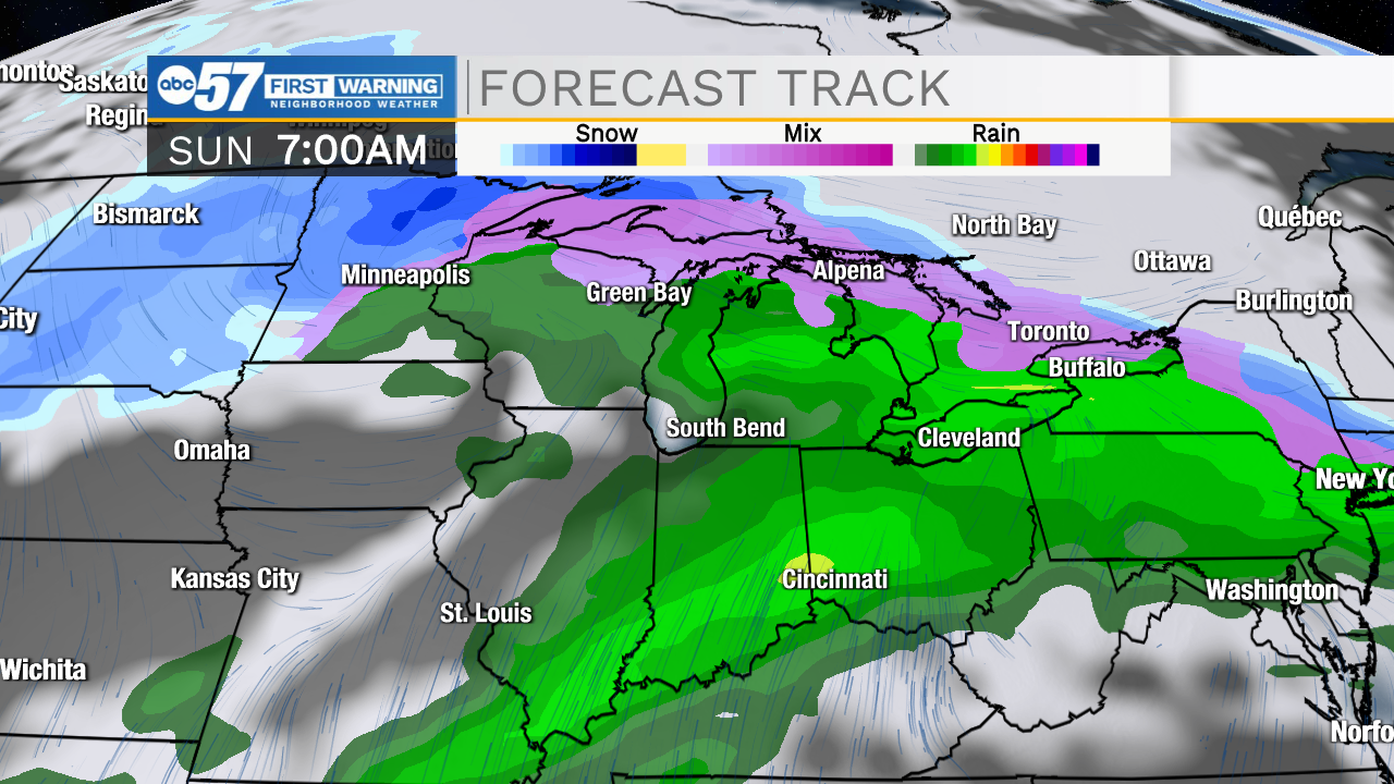
Signs of spring as we being March. Temperatures flirt with 50 Tuesday and Wednesday, a buckling front could split that area, so there's some variability in what could be mid-40s or a surge into the 50s. Temperatures dip Thursday then climb sharply into the weekend. The weekend looks wet, with highs in the mid-50s. There's a chance of rain Saturday through Monday morning. The exact timing will become clearer though the week, leaning towards Sunday night as the wettest timeframe.
Tonight: Partly cloudy. Low 34.
Tuesday: Partly cloudy. High 48.
Wednesday: Partly cloudy. High 48.
Thursday: Partly cloudy. High 36.
Sign up for the ABC 57 Newsletter