One last stormy and steamy day, nice holiday weekend
By: Emily Kennedy
Posted: Jun 30, 2021 2:50 AM EDT

-
2:15

’Political vengeance,’ Drake, GOP leaders respond to swatting...
-
3:14

The snow sticks around
-
1:10

Wintery weather starting in Michiana
-
3:11

Former players and coaches return to Notre Dame to honor Lou...
-
3:17

Notre Dame prepares for funeral of legendary coach Lou Holtz
-
0:56

Shipshewana on the Road takes over Elkhart
-
3:44

Large crowds expected at Notre Dame for Lou Holtz visitation
-
2:48

Storms arrive this evening, Snow Monday morning
-
4:33

Blustery and stormy today
-
0:39

Michiana Home Show continues to bring vendors to South Bend
-
0:58

Cookies and Canvas for the Heart raises awareness for children’s...
-
2:07

Most residents have power restored following high winds

ABC57 First Warning Neighborhood Weather Forecast
Wednesday, June 30th, 2021
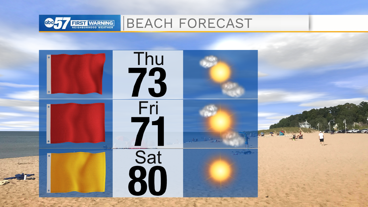
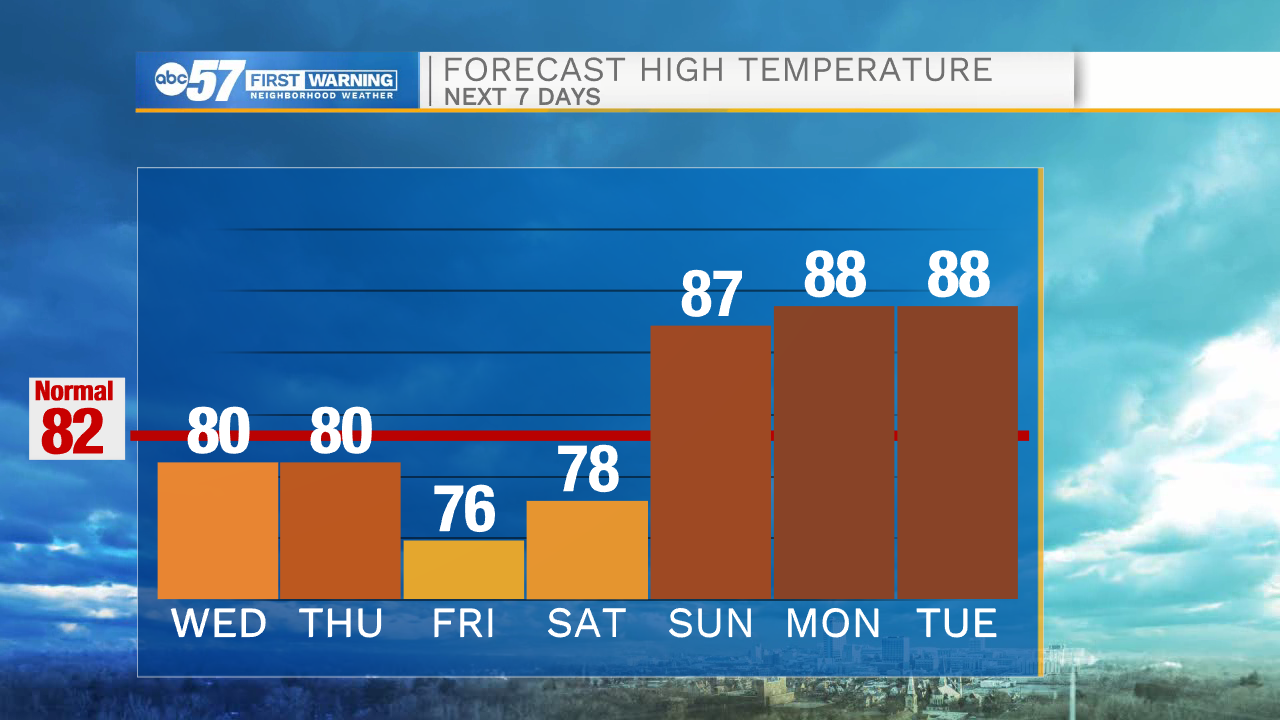
One last wet and humid day to make it through. Scattered showers and storms last on and off through this evening. A cold front moves through Wednesday night into Thursday morning. We may have a lingering shower early, otherwise clouds break up for Thursday. We set up for beautiful weather for the holiday weekend! A lot of great sunshine and comfortable for Friday and Saturday. 4th of July is a little hotter but still nice.
Today: Scattered thundershowers. High 80.
Tonight: Thunderstorms early. Low 64.
Thursday: Partly cloudy, stray shower/storm. High 80.
Friday: Mostly sunny. High 76.
Sign up for the ABC 57 Newsletter