
-
1:16

No shortage of sunshine today
-
1:37

Memorial Day parade forecast
-
4:51

Local band ’The Erly’ stops by ABC57 ahead of June 3 performance
-
1:17

VERY foggy first few hours of the morning
-
1:57

A local taste brings New Carlisle community together on race...
-
0:45

Pancakes help raise funds to support the Alzheimer’s Association
-
1:03

Lighter rain expected into the afternoon
-
1:04

Non-severe storms expected
-
1:16

Showers start this morning
-
1:59

Mac & Cheese festival turns Four Winds Field into a kitchen
-
0:45

Michiana Spring Clay tour encourages people to try and take a...
-
2:56

Fresh Cuts, Fresh Starts: Re-Entry Program Gives Back in Elkhart

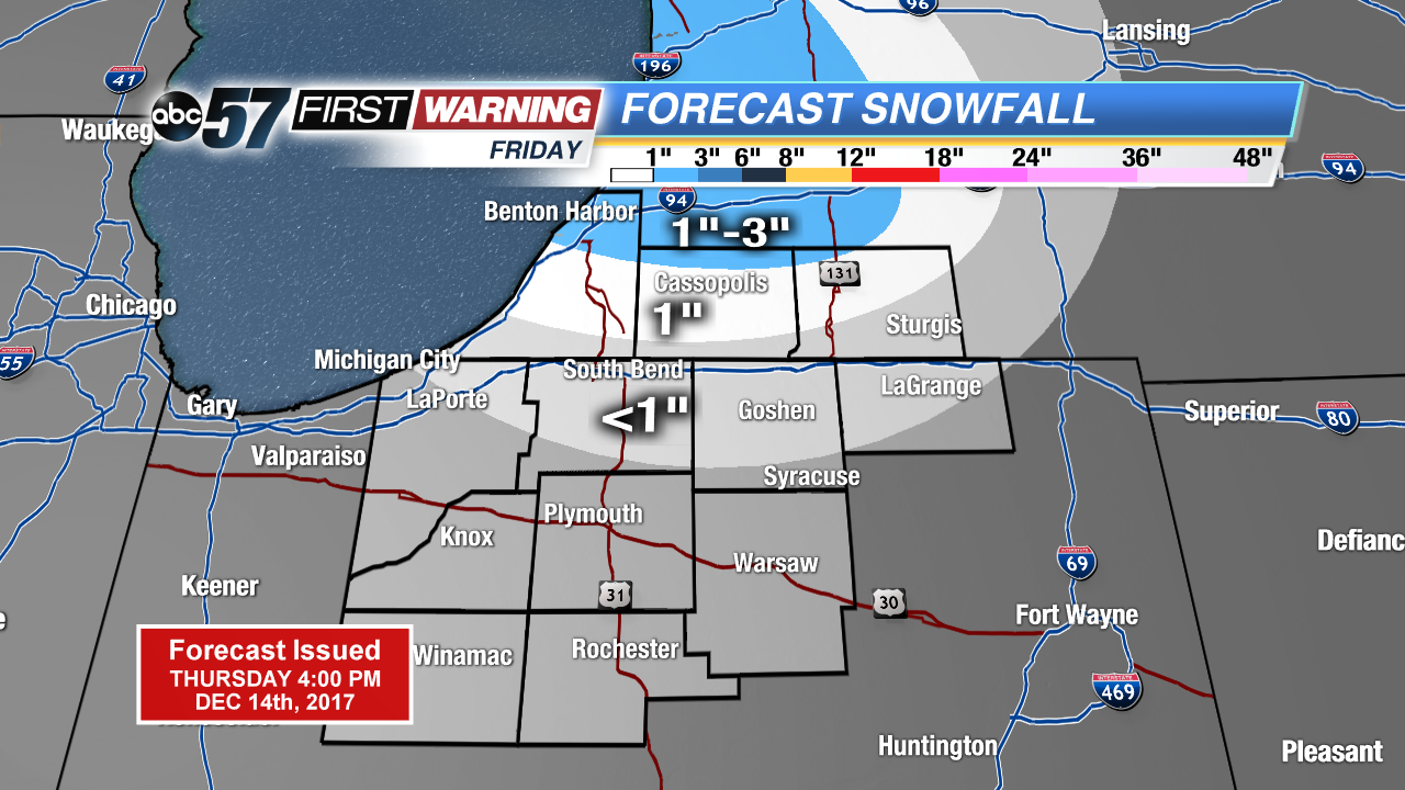
One more cold and snowy day before the pattern changes this weekend and early next week. Friday will start in the teens and lower 20s with a chance of light snow near the state line and northward, ending by midday. Weekend highs will be above freezing, melting snow with a chance of rain by Sunday evening.
Next week looks milder with highs mostly above freezing and little snow in the forecast. We’ll switch back to the cold weather pattern just before Christmas.
Tonight: Mostly cloudy, low of 18.
Friday: Morning snow showers, high of 28.
Saturday: Partly cloudy, high of 38.
Sunday: Mostly cloudy, chance of rain late, highs in the upper 30s.
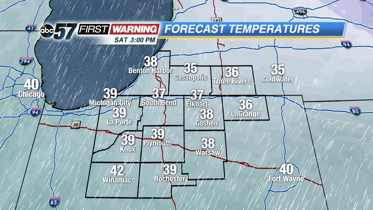 Highs Saturday will be above freezing
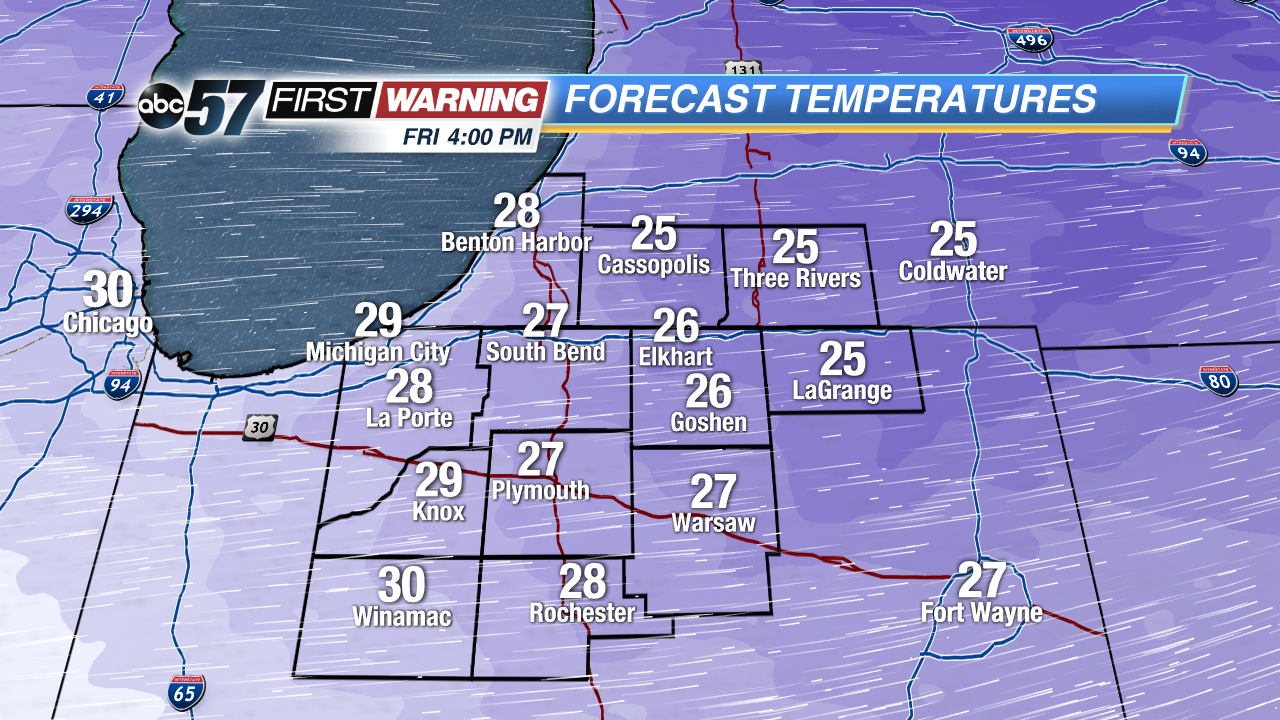 Highs Friday will not break 30°
Sign up for the ABC 57 Newsletter