


One more hot and humid day to battle through – drier, cooler air is here starting Monday. Today though, heat indices once again climb into the mid to upper 90s.
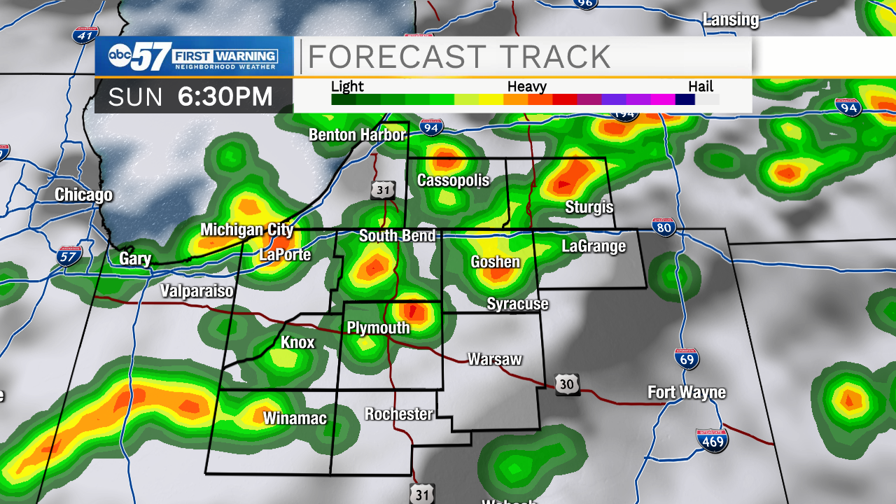
Sunday morning and early afternoon are dry, but by late afternoon, storms make their way into Michiana. Storms continue into the evening and overnight hours. These storms likely won’t be severe, but they could bring periods of heavy rain and gusty winds.
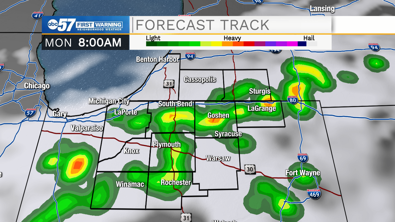
Most rain should be wrapping up Monday morning, then it’ll be a quiet rest of the week. You may need the umbrella out the door tomorrow.
High temperatures are in the low to mid 80s this week. Overnight lows fall into the upper 50s to low 60s with lower humidity.
Today: Hot and humid. PM thunderstorms. High 90.
Tonight: Thunderstorms. Low 68.
Monday: Few showers early. Partly cloudy. High 84.
Tuesday: Mostly sunny. High 82.