
-
2:59

Dusty May leads Michigan back to Final Four with dominant win...
-
0:37

Vendors and cosplayers showcase art at South Bend Anime Fest
-
3:06

Palm Sunday procession in South Bend unites faiths in call to...
-
0:48

2026 Auto Show brings crowd to Century Center Sunday
-
2:34

Warm to start the week, Rainy week ahead
-
2:44

Warmer, breezier, and cloudier than yesterday
-
0:46

Crowds gather for Fins and Feathers Fest at La Porte City Fairgrounds
-
0:46

Paramount School of Excellence hosts teacher fair
-
2:30

Voting advocacy, peaceful demonstrations and donations: South...
-
2:04

Warming to start the week, Showers and storms by Tuesday
-
2:10

Cool, but calm, today
-
1:23

City of South Bend presents an ’Age-Friendly Plan’ to better...

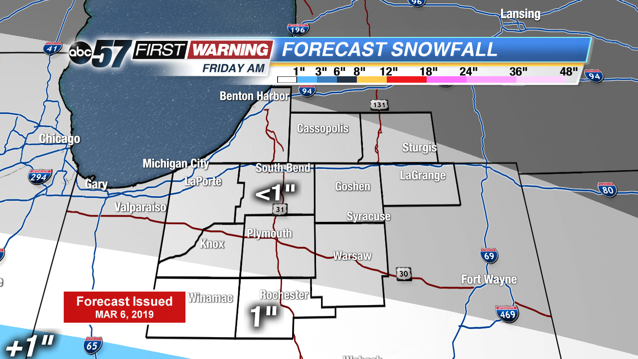
A steady warm-up continues to end the week. Highs warm into the 30s Thursday, near 40 Friday and push 50 by late Saturday. Light snow is possible Friday morning, most the accumulation will range to around an inch at most. The main focus is still on the weekend storm. Rain starts Saturday afternoon and the wind gusts up to 40 mph through Sunday as temperatures fall.
Tonight: Partly cloudy, low of 16.
Thursday: Partly cloudy, high of 30.
Friday: AM light snow, mostly cloudy, high of 38.
Saturday: Rain starts in the afternoon, breezy, high of 48.
Sign up for the ABC 57 Newsletter