Pop-up storm chances continue this week; scattered storms start Thursday night


A few more pop-up showers and thunderstorms are possible early this evening. The rest of the evening and overnight will be dry and partly cloudy. Temperatures will stay in the 90s through about 7 p.m., then will fall into the low 70s overnight.
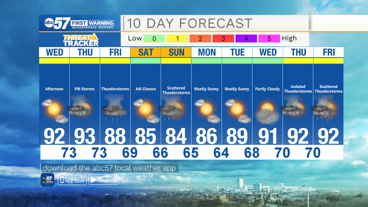
Wednesday is mostly sunny, hot, and humid. There is a chance for another round of pop-up storms Wednesday and Thursday afternoons. Storms will become more numerous Thursday evening and overnight. Scattered thunderstorms continue through the day Friday.
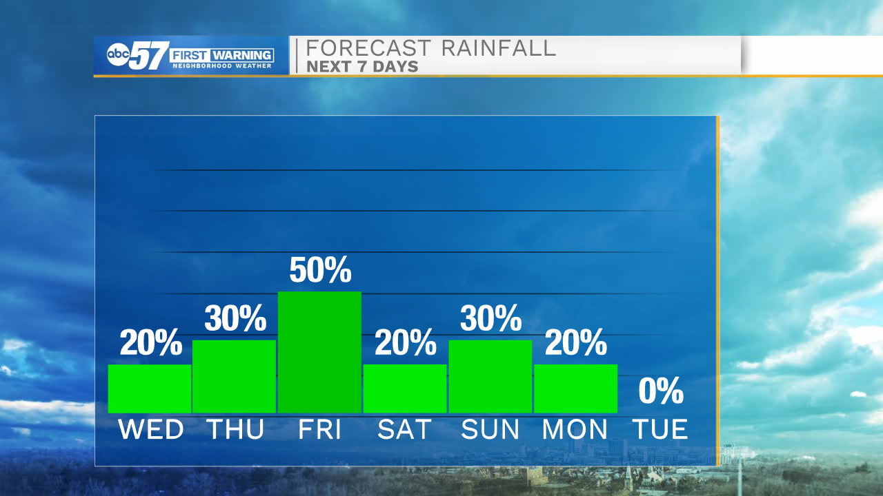
Starting Friday, we get brief relief from the heat, with highs in the mid to upper 80s. These temperatures will last through next Tuesday, then the 90s are back mid next week.
Tonight: Partly cloudy. Low 71.
Wednesday: Mostly sunny, hot and humid. Few afternoon showers/storms. High 92.
Thursday: Mostly sunny, hot and humid. Evening and overnight thunderstorms. High 93.
Friday: Scattered thunderstorms. High 88.