Potent storm to bring rain, storms, very strong winds
Posted: Mar 11, 2019 12:05 PM EDT
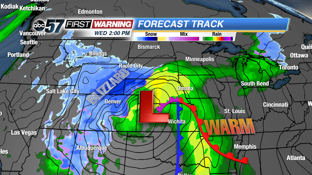
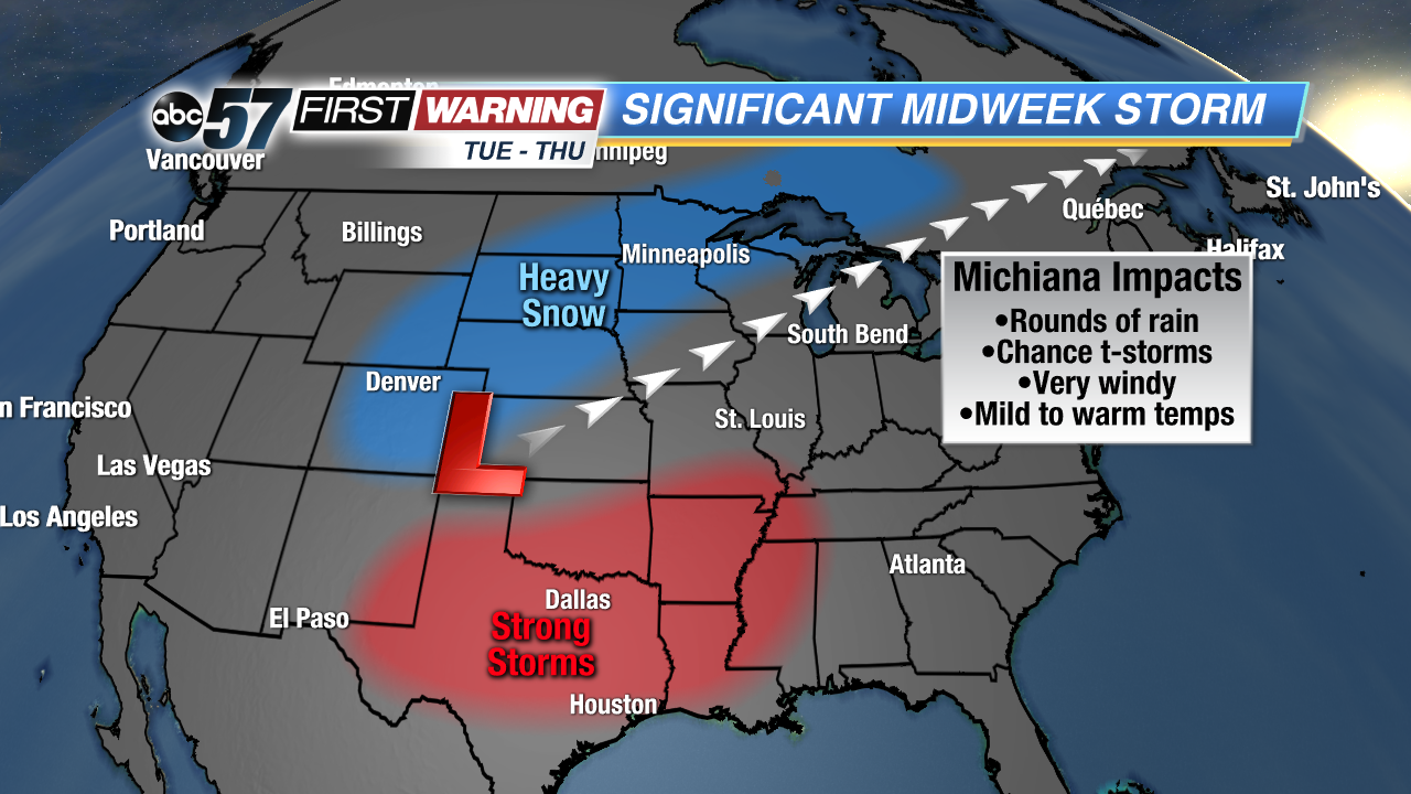
It's beginning to sound like a broken record, but another potent storm system is set to impact the eastern two-thirds of the country. Of course, that includes us right here in Michiana. This one may be the strongest one yet as its central pressure is expected to drop as low as 975 millibars over Kansas. Pressure that low is equivalent to a strong category 1 or weak category 2 hurricane! As a result, this system will bring strong to damaging winds to a huge area from Colorado and Nebraska to Kentucky, Indiana and Michigan.
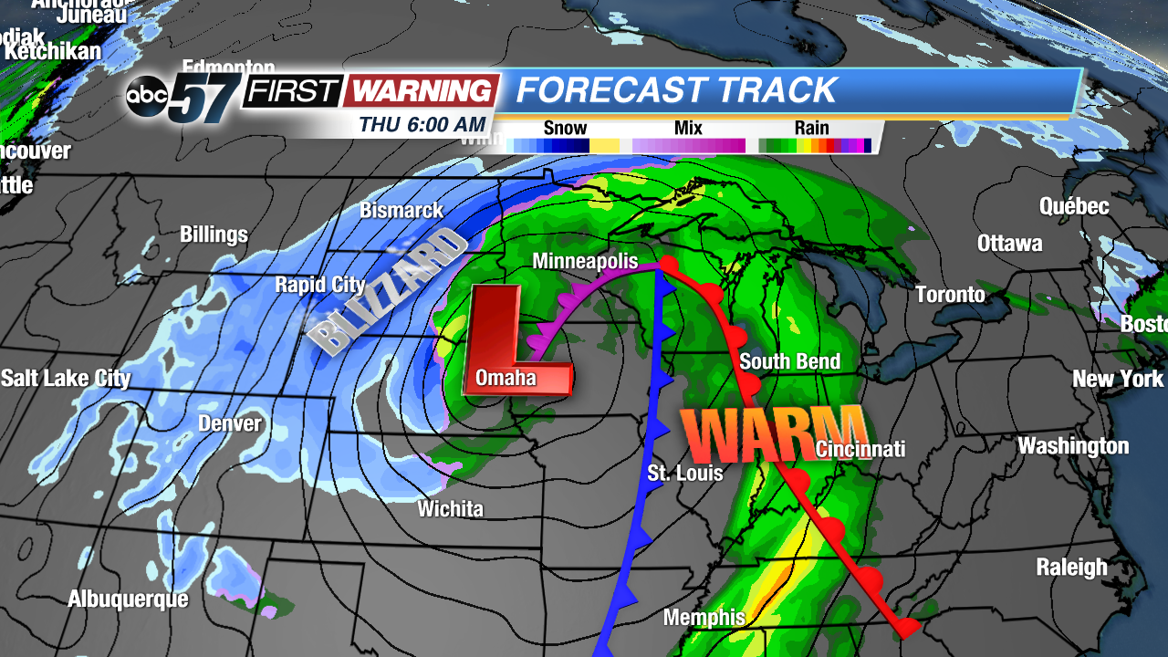
It will also bring several other impactful weather types, ranging from a blizzard to severe thunderstorms. Blizzard conditions are pretty much a guarantee for parts of Colorado, Kansas, Wyoming, Nebraska, the Dakotas, Iowa, and Minnesota Wednesday into Thursday. In fact, there could be extreme blizzard conditions over Colorado, Nebraska and Wyoming Wednesday with wind gusts well over 60 mph and intense snowfall rates. Those kinds of conditions will close down roads and highways, and make travel impossible. Fortunately, we will not see any wintry weather from this system.
In the system's warm sector will exist the threat of thunderstorms. Even more, some of the storms could become strong to severe from New Mexico and Texas into the Mississippi Valley. As of Monday afternoon, there is no substantial severe risk for Illinois, Indiana, Ohio, or Michigan. That could very well change in the coming days as the ingredients will be in place to support at least a chance of severe weather. This is a threat we will iron out as the week moves on. Regardless of any severe weather, very strong winds and a few thunderstorms are certainly in the cards.
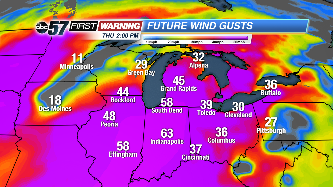
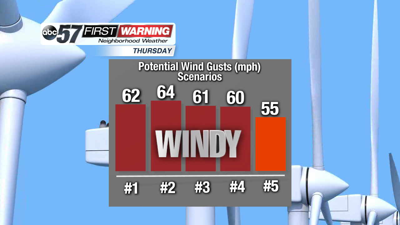
Let's dive into the wind gust potential. As it looks now, strong wind gusts of 35-50 mph will arrive Wednesday evening and last thru Thursday afternoon. The absolute worst of the conditions should occur Thursday late morning and afternoon. This is when the cold front will push through the region. It's during this window that gusts of 50 mph are expected. Depending on just how strong the system is at this point in time, we could be talking wind gusts upwards of 60 mph.
And, unfortunately, many of our forecast models do support that potential. While we are not yet predicting wind gusts of 60+ mph, it's something that is in the realm of possibilities. For perspective, these kinds of winds are similar to what we've seen twice in the last month. Power outages and some damage will once again be possible concerns. The positive aspect of this system will be mild to warm temperatures.
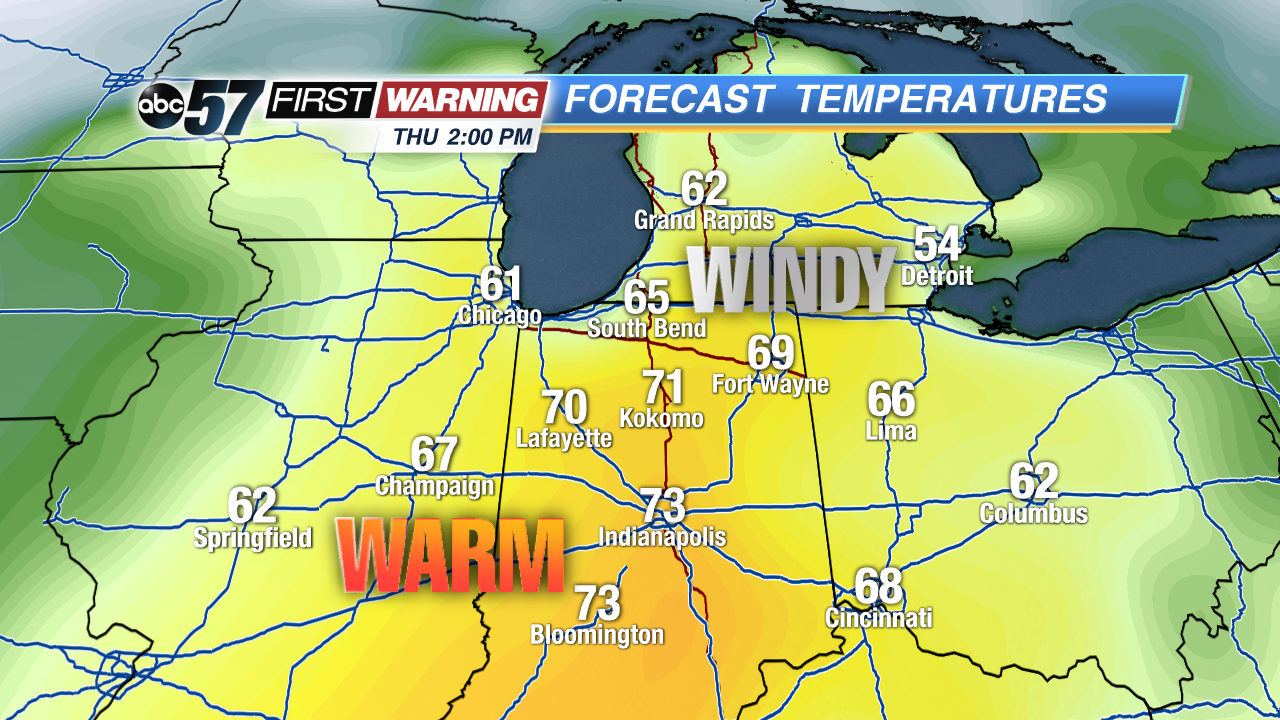
Highs will push 50° Tuesday, 60° Wednesday and 70° by Thursday! We haven't seen a 3-day stretch quite this warm in several months! The last time South Bend saw 60° was on Halloween of last year! The last time the city reached 70° was October 10th of last year! That's 152 days if you're counting. In other words, we will see the kind of warmth we haven't seen in nearly half of a year! It won't last, though. By Friday and this weekend, temps will only reach the 30s and 40s.


