Preparing for the weekend winter storm
By: Erica Horvatin
Posted: Jan 11, 2019 5:48 PM EDT

-
3:11

Former players and coaches return to Notre Dame to honor Lou...
-
3:17

Notre Dame prepares for funeral of legendary coach Lou Holtz
-
0:56

Shipshewana on the Road takes over Elkhart
-
3:44

Large crowds expected at Notre Dame for Lou Holtz visitation
-
2:48

Storms arrive this evening, Snow Monday morning
-
4:33

Blustery and stormy today
-
0:39

Michiana Home Show continues to bring vendors to South Bend
-
0:58

Cookies and Canvas for the Heart raises awareness for children’s...
-
2:07

Most residents have power restored following high winds
-
0:44

26th annual St. Patrick’s Day Parade takes over Downtown South...
-
2:42

Active weather arrives Sunday
-
3:22

Calm today, storms return Sunday

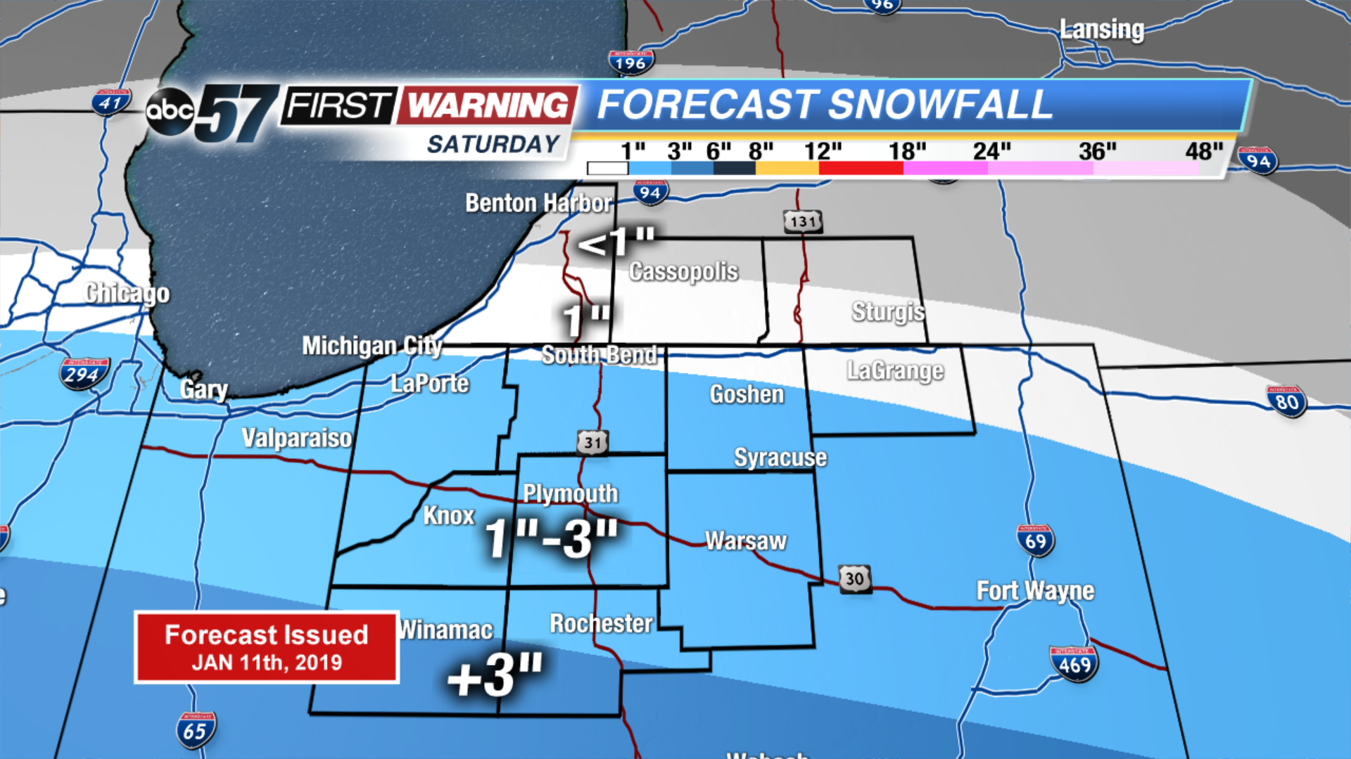
The big Midwest winter storm will move into Michiana Saturday mid-morning, with snowfall peaking in the afternoon.
Cities south of US-30 will have the highest impacts, with over 3" of snow possible throughout Saturday. Avoid driving around during the afternoon if you live in Pulaski or Fulton counties.
Here's a look at potential snowfall totals for Saturday.
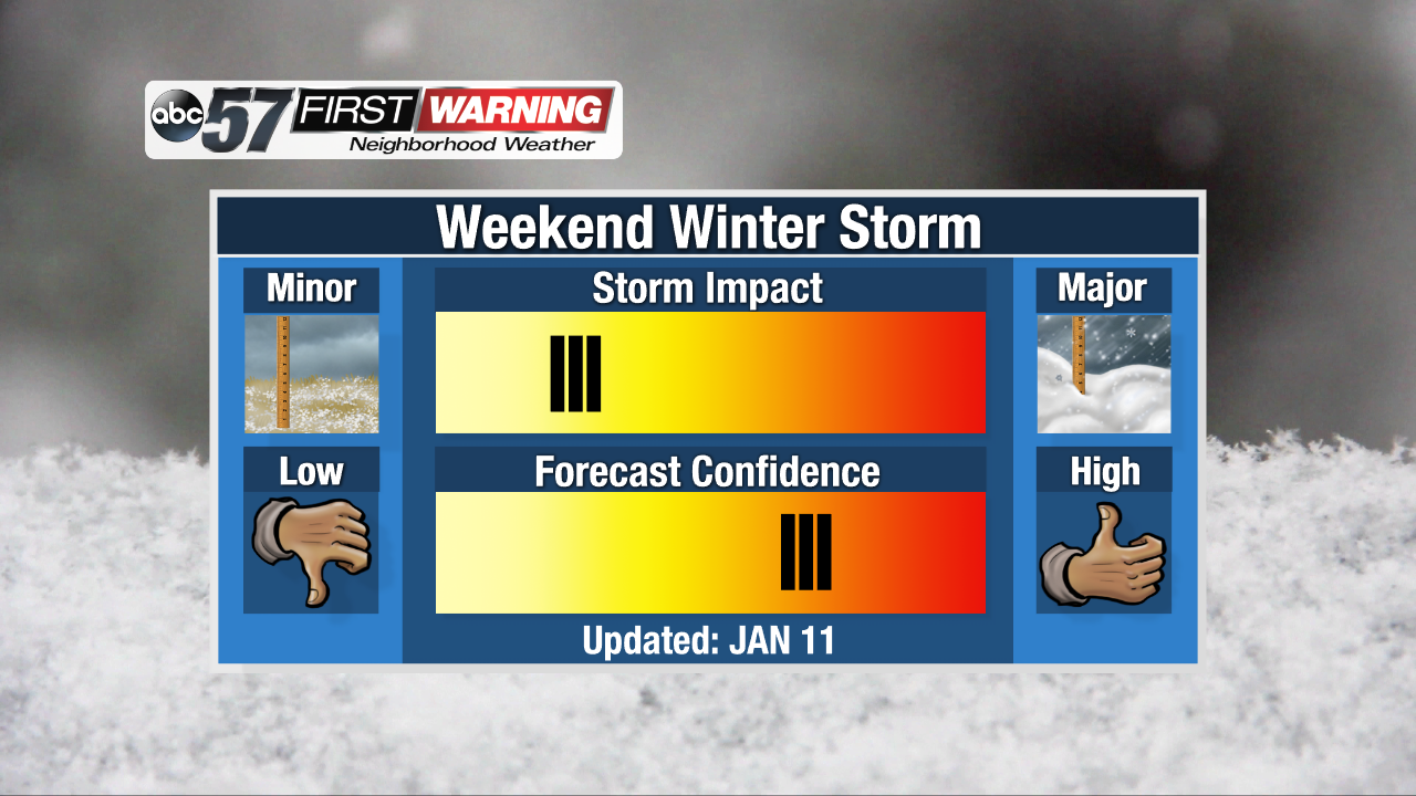
Impacts from this storm will be on the low end, because we receive 1-3" of snow on a regular basis during winter. Confidence in this forecast is on the high end, but not 100%. This is because if the storm shifts north, that could mean more snow for us, and if it shifts south, it could mean less snow.
Sign up for the ABC 57 Newsletter