


Slightly more clouds today compared to yesterday, but the forecast remains dry. Temperatures climb from the low 30s this morning to the mid 50s by afternoon. This evening becomes more breezy and cloudy.
Wind continues to pick up through Monday with our next system. This also brings precipitation, starting after 8 a.m. tomorrow. We’ll see snowflakes or a wintry mix to start. A few slick spots could be possible for your commute.
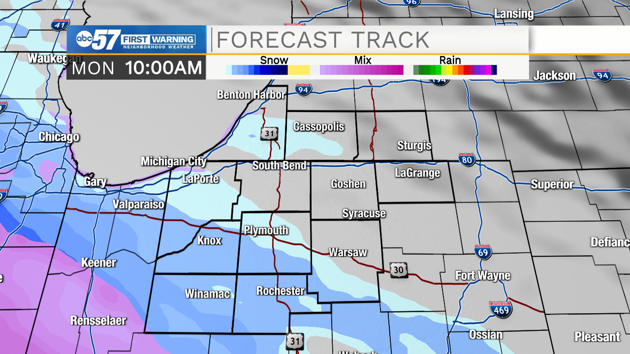
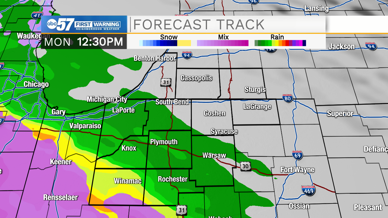
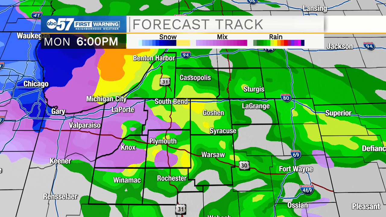
A small, slushy snow accumulation is possible briefly. As temperatures climb to 40 degrees, precipitation switches to rain by afternoon and should wash away any snow. Some showers continue Monday night into early Tuesday.
The rest of Tuesday stays dry. Another system arrives Wednesday evening and leads into a rainy day Thursday. We’ll end the week on a mostly sunny note Friday.
Today: Partly cloudy. High 54.
Tonight: Mostly cloudy and breezy. Low 28.
Monday: Snow/rain mix. Windy. High 40.
Tuesday: Few AM showers. Mostly cloudy and dry day. High 50.