


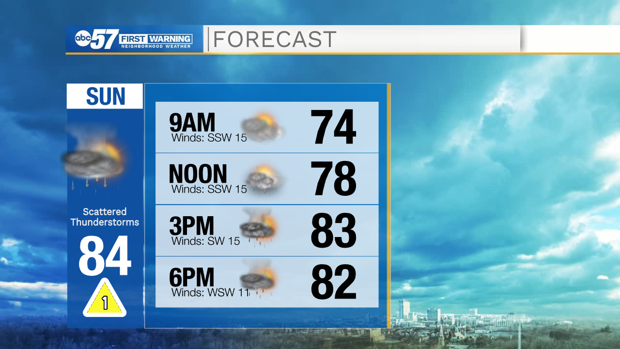
This morning is mostly quiet and dry, although a few showers are possible early. Rain boots are a good idea today, as we still have plenty of puddles across Michiana. Keep the umbrella handy too; there’s more rain and scattered thunderstorms possible this afternoon.
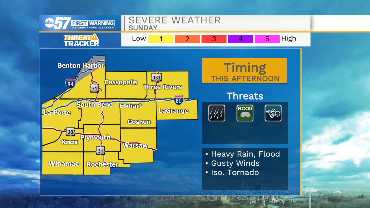
Severe threat looks lower than yesterday, and primary concerns are gusty winds and potential for more heavy rain and flooding, considering all our recent rain.
The week stays warm and humid, so we’ll see rounds of afternoon showers and thunderstorms starting Monday.
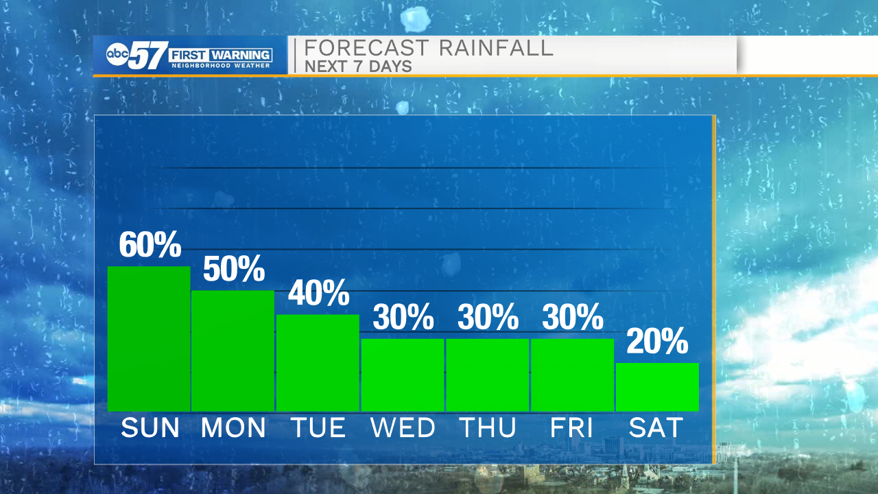
Temperatures do drop slightly into the upper 70s near the end of the week, and we are trending mostly dry over the 4th of July weekend.
Today: Afternoon showers and storms. Breezy. High 84.
Tonight: Scattered showers and storms. Low 70.
Monday: Showers. Few afternoon storms possible. High 84.
Tuesday: Isolated showers and thunderstorms. Mostly cloudy. High 84.