
-
1:44

Feeling like a sauna next week
-
3:12

How to keep yourself and others protected during firework season
-
0:49

Showers creeping into Michiana
-
0:42

Judge approves $25M water lawsuit settlement
-
1:00

Scattered showers through the day
-
1:53

Hispanic Community Child Safety Meeting: A Call To Action
-
2:51

Obama Presidential Center features work of South Bend company
-
1:54

This week’s ABC57 Cub Reporter is Isaac Knefely
-
1:16

Real summer heat returns next week
-
2:28

South Bend storm drain mural project complete
-
5:17

Three local students return as national powerlifting champions
-
1:09

Rain showers to end the work week

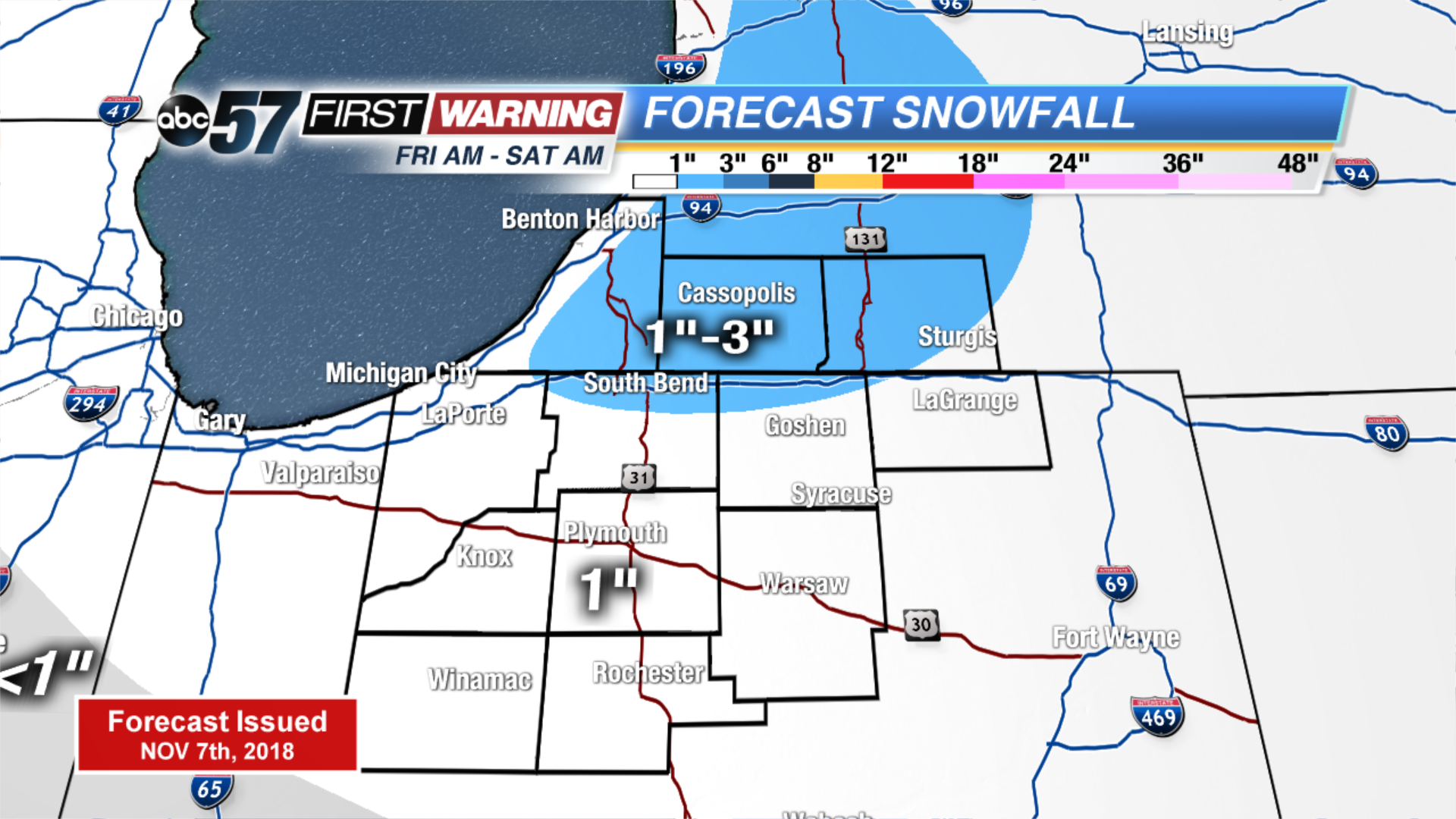
The focus will be on wintry weather Friday and a very cold Saturday. Temperatures continue falling to end the week. Thursday is quiet then clouds increase into Friday, as a storm system will throw rain/snow showers across much of the area by Friday morning. Accumulation is questionable with temps near freezing and the warm ground. Lake effect snow may bring more likely accumulation Friday night as temps dive into the 20s.
Tonight: Mostly cloudy, low of 30.
Thursday: Partly cloudy, high of 42.
Friday: Rain/snow showers, high of 38.
Saturday: Morning lake effect snow, high of 34.
Sign up for the ABC 57 Newsletter