


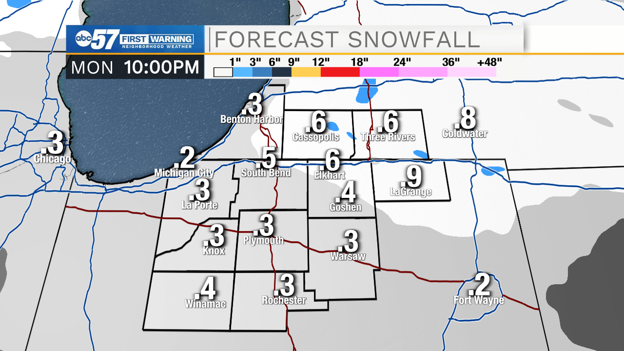
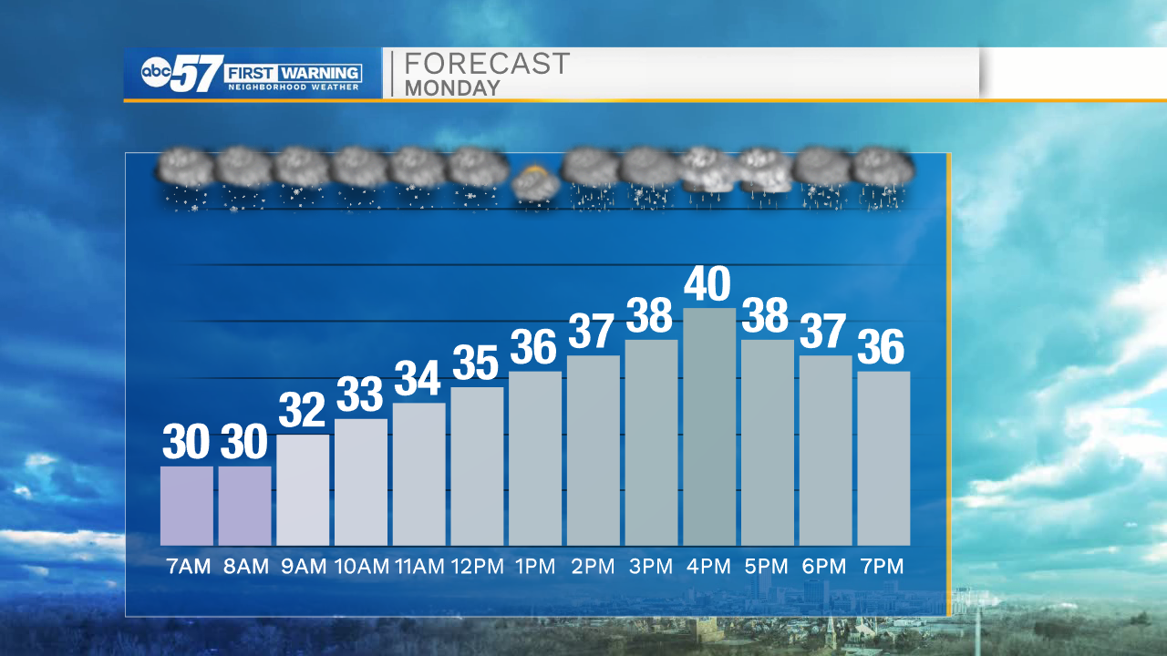
Cloud cover will increase through the overnight hours with temperatures tomorrow morning dropping into the lower 30s. Light snow showers are possible tomorrow morning, but then will begin to taper off closer to lunchtime. As temperatures near 40 degrees tomorrow afternoon a few light rain showers are possible through the evening hours. Rain chances return on Wednesday with highs in the mid 40s. Thursday morning snow will develop again as temperatures drop into the 20s. Snow showers are possible throughout Christmas Eve into Christmas Day. Lows Friday morning will drop into the teens, with a continued chance of snow for portions of Michiana. Highs on Christmas will only top out in the mid 20s.
Tonight: Mostly cloudy. Low 30.
Tomorrow: Rain/snow. High 40.
Tuesday: Partly cloudy. High 40.
Wednesday: Rain showers. High 46.