


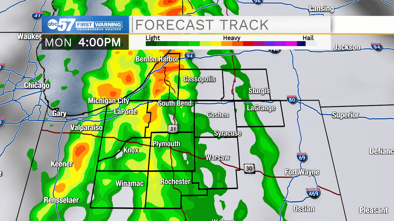
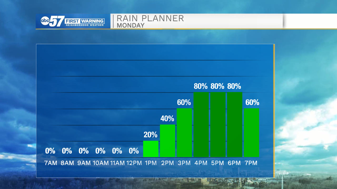
Tomorrow morning temperatures will be in the mid 50s under partly cloudy skies. Cloud cover will increase after lunchtime as a cold front approaches from the west. This front will develop a line of showers and isolated thunderstorms, which will move into Michiana around 3pm. Rain showers will stick with us through the early to mid evening before clearing out to the east. Rain accumulation looks to be around a quarter of an inch in most places. Another round of rain will be possible again on Thursday as another cold front moves into Michiana.
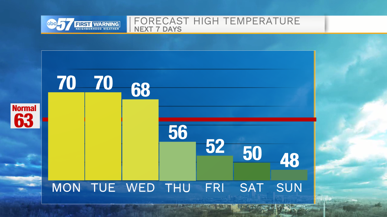
Temperatures as we go throughout next week will begin to slowly drop into the mid 50s by Thursday afternoon. Friday, Saturday, and Sunday low temperatures will drop into the 30s with a few areas here in Michiana hitting the freezing line. Overall, temperatures are trending colder through next weekend and the following week.
Tonight: Partly cloudy. Low 56.
Tomorrow: Scattered showers and storms. High 70.
Tuesday: Mostly sunny. High 70.
Wednesday: Partly cloudy. High 68.