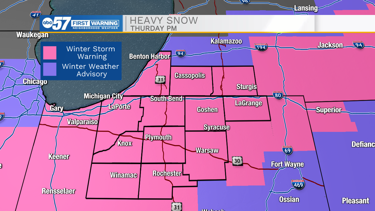
Winter Storm Warning
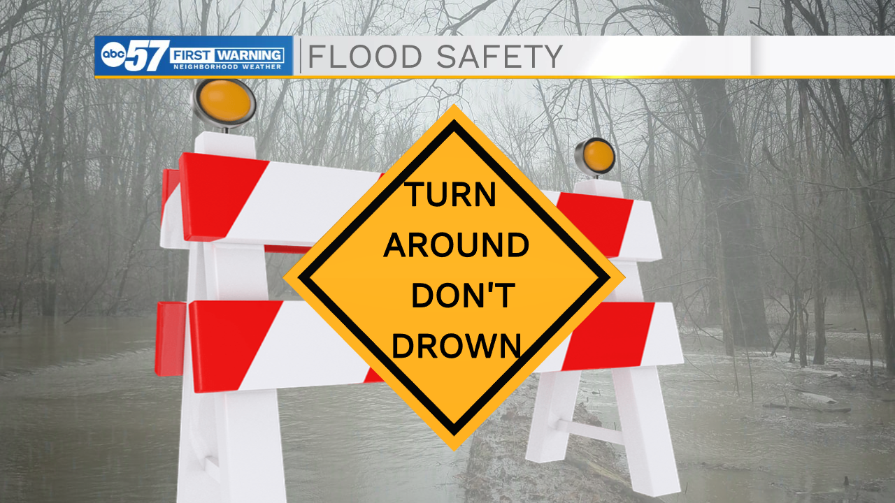
Give yourself extra time for your Thursday morning commute. There are many reports of standing water in roads: remember, turn around, don’t drown. You could also find some fog and areas of low visibility where there is a lot of melting snow this morning.
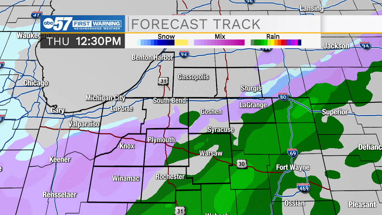
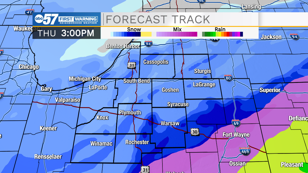
Rain this morning will gradually turn to a rain/snow mix as temperatures fall.
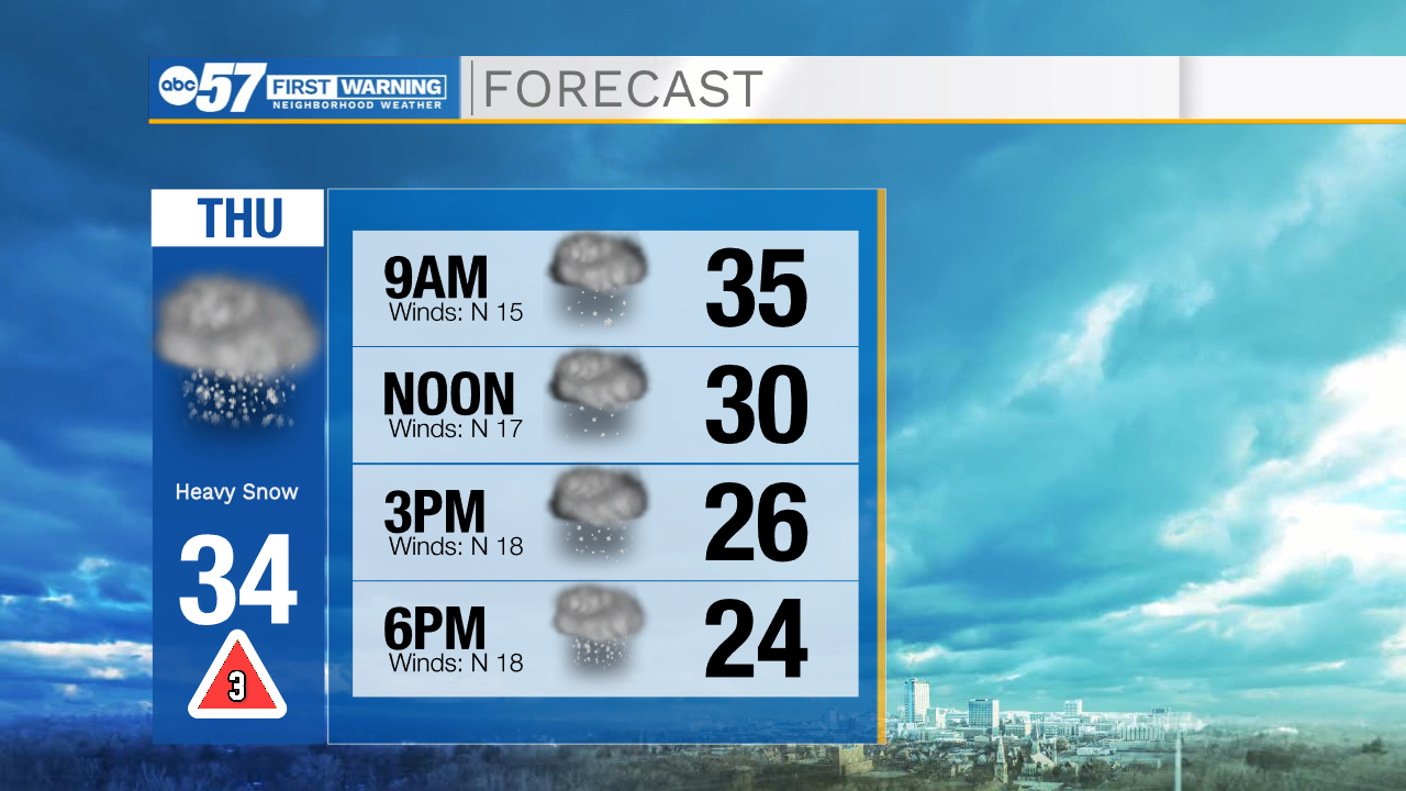
Precipitation turns to all snow by the afternoon. Periods of heavy snow and low visibility are likely through the evening, which will make the evening commute extremely difficult.
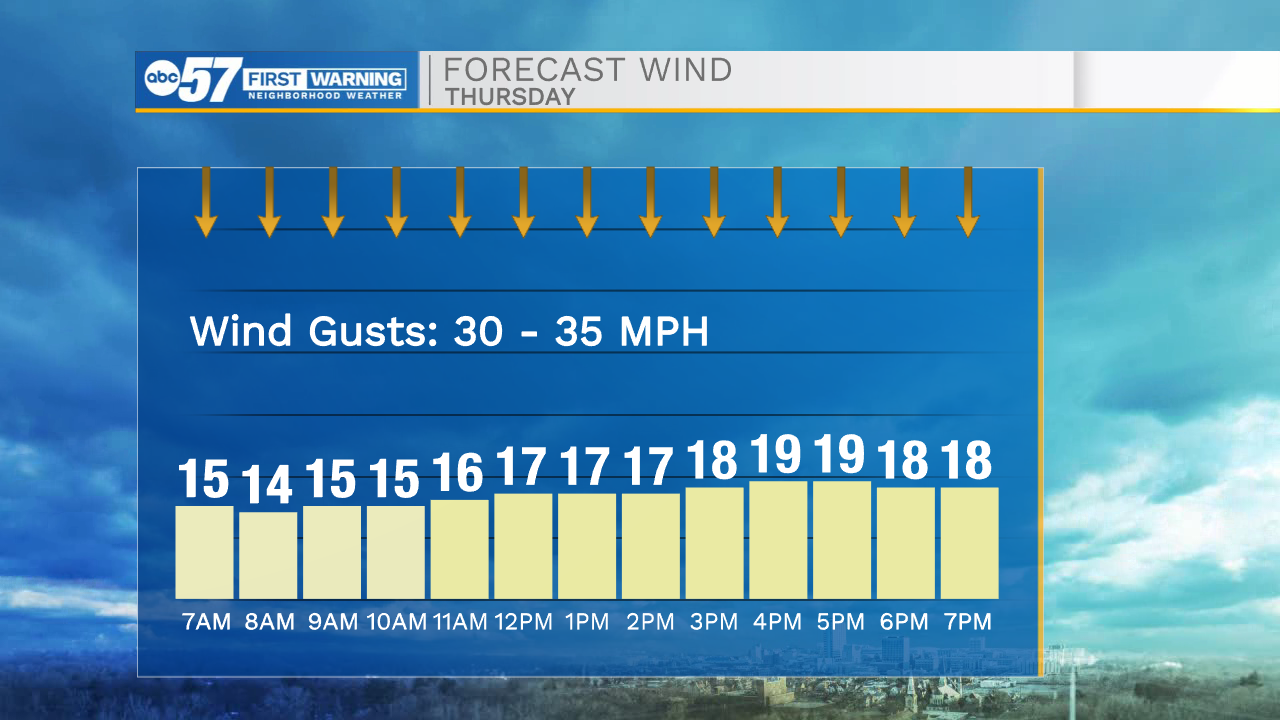
Winds gust up to 35 mph, so blowing snow could also become problematic this evening and overnight.
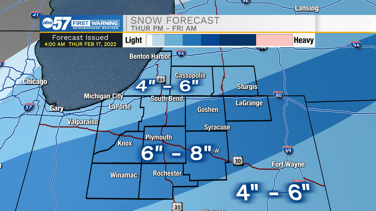
Once snow starts to accumulate, we could accumulate several inches of snow quickly this evening across all parts of Michiana. Snow tapers off by midnight tonight, which is when the winter storm warning ends for all counties.
Temperatures continue to fall into Friday morning, so roads are likely still slick/snow covered for tomorrow’s commute.
The weekend looks quiet, with improving temperatures by Sunday. Temperatures stay in the 40s Monday and Tuesday. Another chance for rain in the forecast starting Monday night of next week.
Today: Rain ending in the morning, snow starting in the afternoon. Heavy snow after 3 p.m. Temperatures in the 30s fall to the 20s by afternoon.
Tonight: Snow early. Low 12.
Friday: Partly cloudy. Windy. High 24.
Saturday: Partly cloudy. High 24.
Sunday: Mostly sunny. High 42.


