
-
5:10

Pop-Up Kitty Cafe coming to Michigan City
-
2:51

Nappanee will soon be home to the World’s Largest Cabinet
-
0:38

Drying out and warming up
-
1:15

Cold and bleak weather to start off the day
-
3:49

Asking for Accountability: Michiana Elected Officials on on-going...
-
3:37

South Bend Cubs explain weekend washout
-
4:02

Early voting is underway as Indiana prepare for its May 5 primary...
-
3:27

Tax-related scams to watch out for
-
0:09

Crews repair weekend washout under Coloma train track
-
0:58

Chilly and sunny Tuesday ahead
-
0:41

Elkhart police investigating Monday night shooting
-
3:47

Elkhart Police Department accepting applications to Citizens...

Rain, soft hail and a few rumbles of thunder are likely Thursday evening. Wind gusts of 40 mph are possible near downpours.
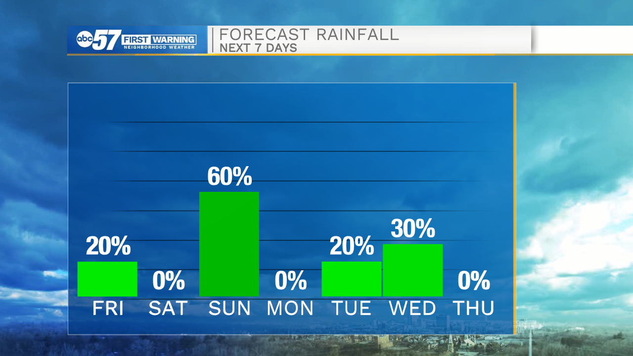
Friday is a cool, fall day. High temperatures run about ten degrees below normal, struggling to reach 55. Lake effect rain showers / drizzle is possible in the morning before clouds break gradually into the afternoon. Friday night is chilly as lows dip into the 30s. The weekend continues with cool October weather and another round of rain Sunday. The cool temps should help bring on more fall color into early next week before temperatures rise again.

Tonight: Rain showers. Low 42.
Friday: Mostly cloudy. High 54.
Saturday: Partly cloudy. High 56.
Sunday: Rain showers. High 54.
Sign up for the ABC 57 Newsletter