
-
1:46

A chilly and calm start to the weekend
-
1:00

NIPSCO workers rally in South Bend for new contract
-
1:53

Severe weather threat is over, MUCH colder Friday
-
3:43

South Bend Mayor James Mueller delivers 2026 State of the City...
-
0:52

Family and friends of Adrian Cruz voice frustration in sentencing...
-
2:13

Potawatomi Zoo prepares for opening day with new attractions
-
2:54

Local expert weighs in on landmark social media decisions
-
1:33

Round one of storms moving east, Round two arriving soon
-
2:38

Bourbon residents recall tornado as severe weather strikes again
-
1:34

Tornado threat decreasing, but severe weather still expected...
-
1:42

Damaging winds and hail move in this evening
-
2:51

Severe weather expected in Michiana later today

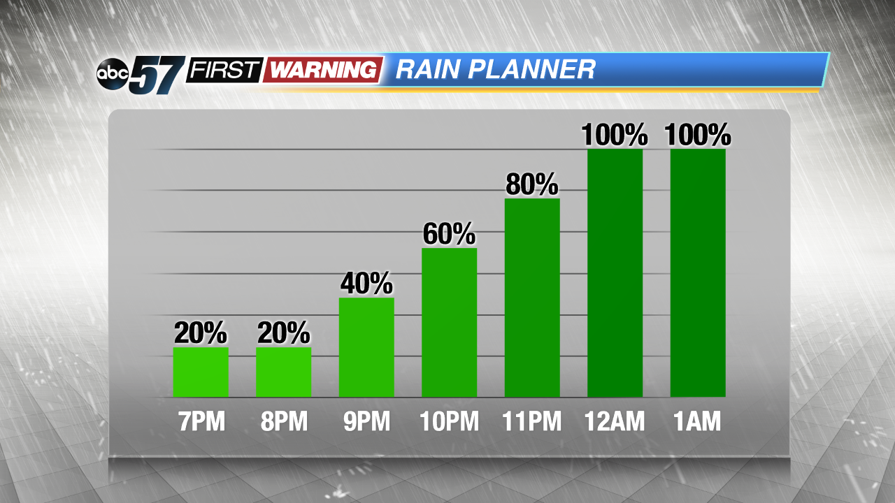
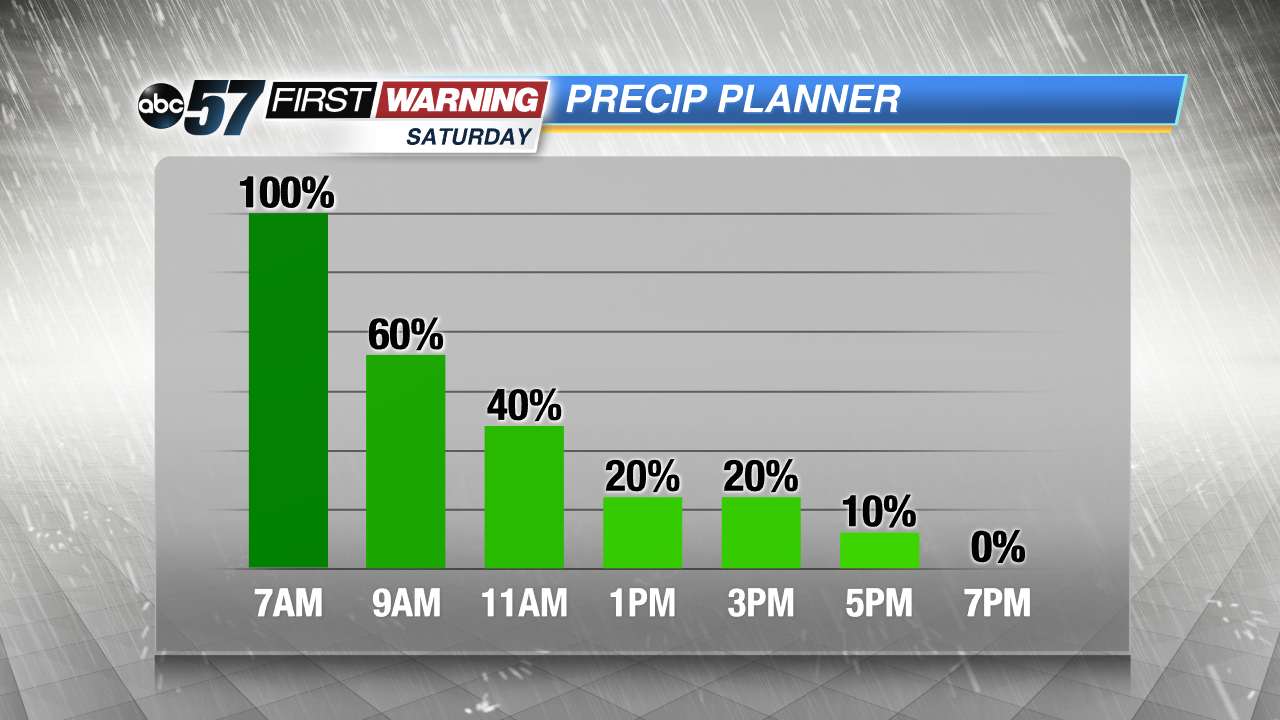
Soaking rain, heavy at times Friday night through Saturday morning. More than one inch of total rainfall is possible, which could lead to standing water on roads.
A wet start to the weekend as temperatures fall through Saturday. The rain tapers-off by midday, if the timing is just right colder air could turn a few of those last raindrops into snowflakes but accumulation is unlikely. Skies clear and temperatures drop into the 20s Sunday morning. Sunday is sunny but chilly as highs struggle to reach 40. Next week starts sunny again as temperatures quickly rebound.
Tonight: Rain likely by midnight, low of 42.
Saturday: Rain early then gradual clearing, temperatures falling from 44.
Sunday: Mostly sunny, high of 38.
Monday: Sunny, high of 50.