


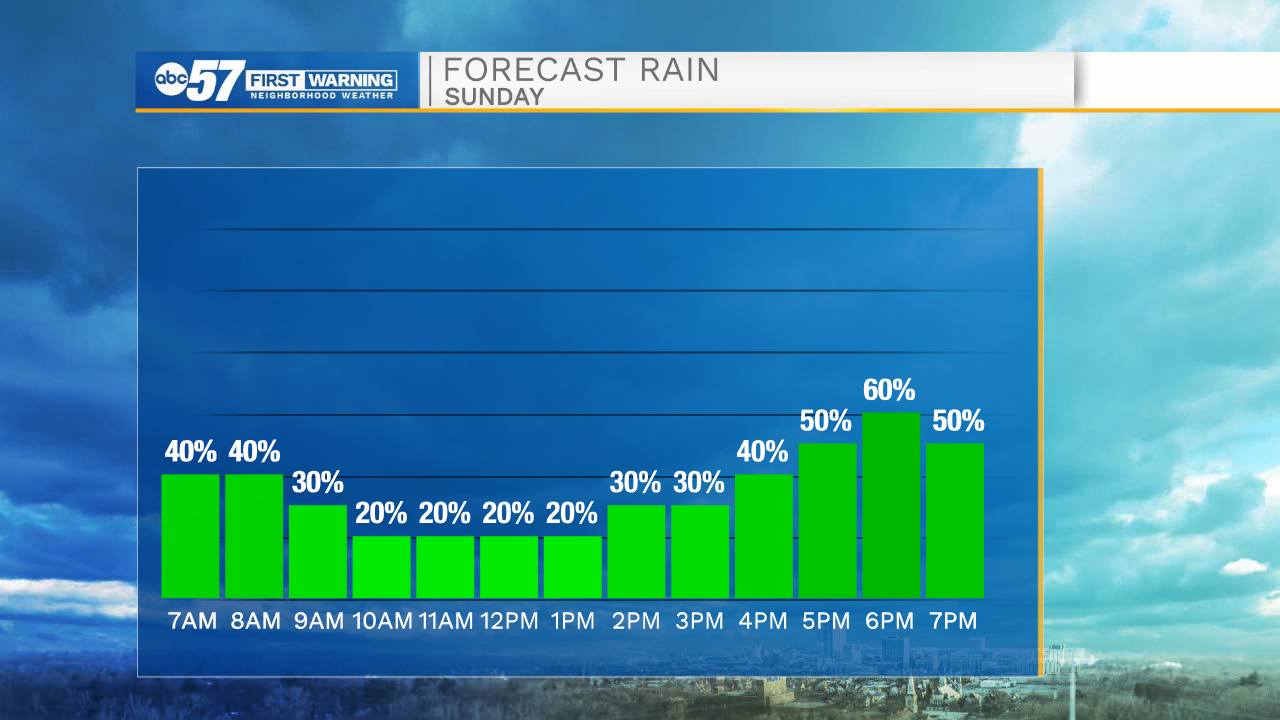
There are scattered rain showers today ahead of a rainy work week. Showers are mostly likely this morning and again late this afternoon/evening. It looks like it should stay mostly dry from 11 AM through 3 PM.
Temperatures start in the low 50s this morning, then only warm to a high around 56 this afternoon. It is still breezy today, with wind calming overnight.
Temperatures fall into the mid 30s overnight, which means Monday morning will be chilly as you head out the door. If there are any showers early Monday morning, it's possible that it could turn into a wet wintry mix because of the low temperatures.
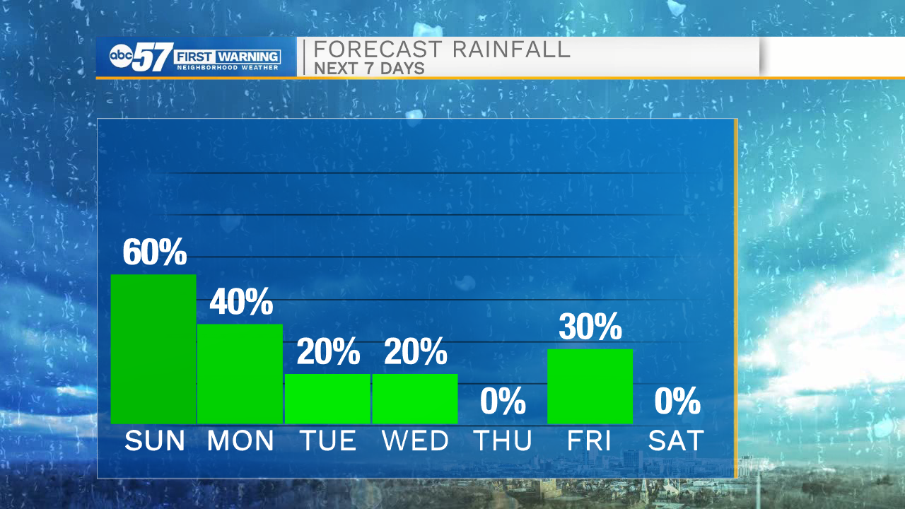
There are additional rain chances: Monday afternoon and evening, Tuesday evening, Wednesday, Thursday evening, and Friday morning.
Daytime high temperatures are in the 50s Monday and Tuesday, then warm to the low 60s Wednesday. Thursday is the warmest day of the week, and could warm near 70.
Today: Cloudy with scattered rain showers. Breezy. High 56.
Tonight: Rain showers. Cloudy. Low 36.
Monday: Mostly cloudy. Isolated rain chances. High 51.
Tuesday: Mostly cloudy. PM rain chances. High 56.