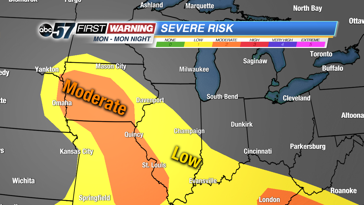
 Severe thunderstorm risk zone Monday evening and Monday night.
Storm Prediction Center
Severe thunderstorm risk zone Monday evening and Monday night.
Storm Prediction Center
After a brief 48-hour stretch of quiet weather and even sunshine, rain and storms are back in the forecast. A strong system will pass through Tuesday into Wednesday, bringing with it a good chance of at least
some rain and thunderstorm activity. Some of the rain could certainly be heavy and a few of the storms could be quite strong. Thru early Tuesday afternoon, though, it should stay relatively quiet as the threat for rain, storms and severe weather will stay well to our west across parts of Iowa and Missouri.
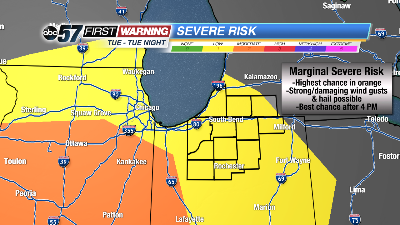 Severe thunderstorm risk zone Tuesday and Tuesday night.
Storm Prediction Center
Severe thunderstorm risk zone Tuesday and Tuesday night.
Storm Prediction Center
By late Tuesday afternoon, a warm front will lift into the area, providing our first chance of showers and a few thunderstorms during the 1 PM - 6 PM period. This round should remain tame and below severe limits. As the front pushes through, the atmosphere will become more supportive of stronger thunderstorm activity for the Tuesday evening and night period. For this reason, the Storm Prediction Center has placed all of Michiana in a low-end "Marginal Risk" for severe weather for late Tuesday and Tuesday night. Not everyone will see strong or severe storms, but the chance is there for a few storms to be intense and produce heavy rain, hail and damaging wind gusts.
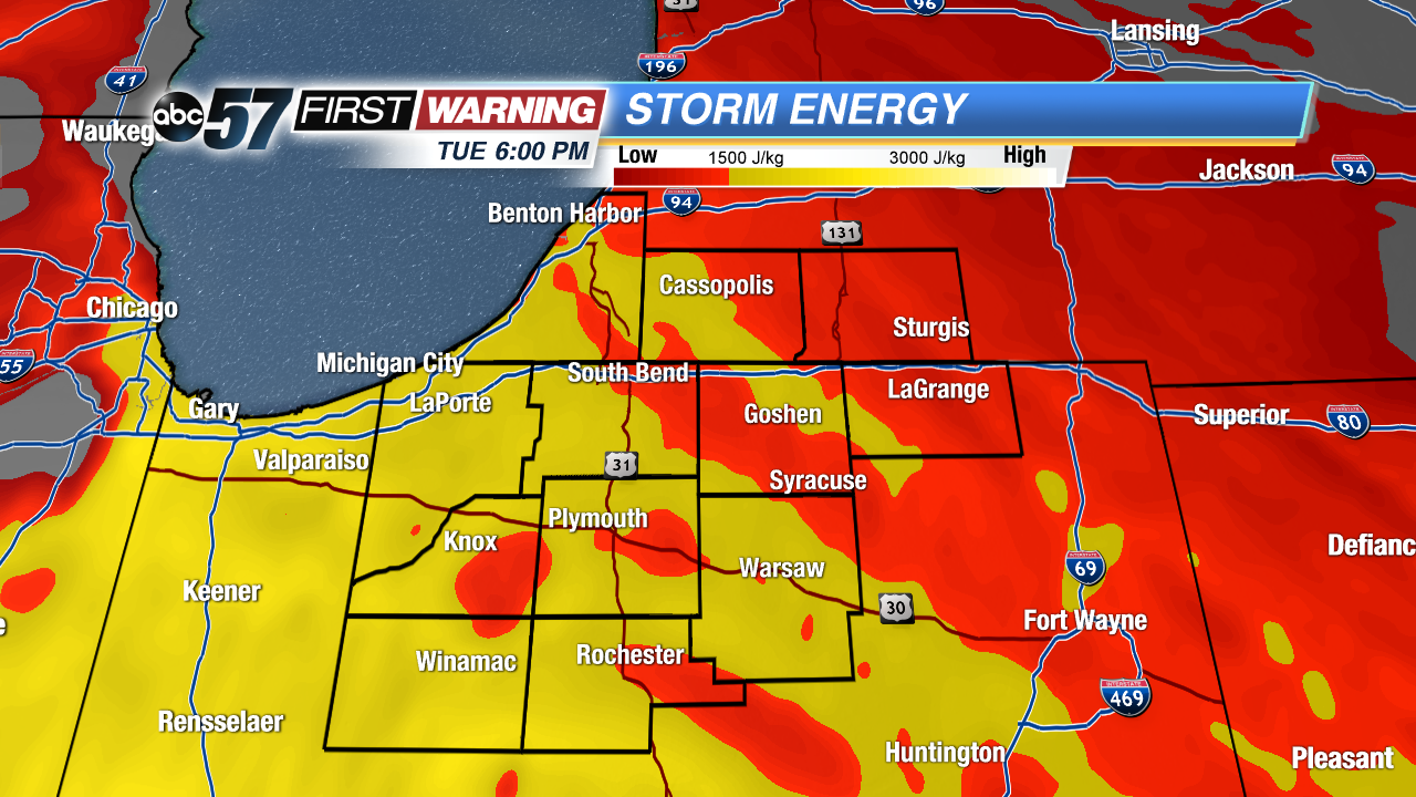 Storm energy available for thunderstorms Tuesday evening.
The best chance of severe weather for Tuesday and Tuesday night will be across Illinois, Missouri and closer to Lafayette in Indiana. Those locations could see many more thunderstorms capable of damaging winds, hail and even a tornado or two. Even if we don't see any severe weather in Michiana, the threat will still exist for locally heavy rain and instances of flooding. The atmosphere will have an abundance of moisture in it, and the humidity will be very high. The result will be the potential for heavy rain with any showers or storms that push through.
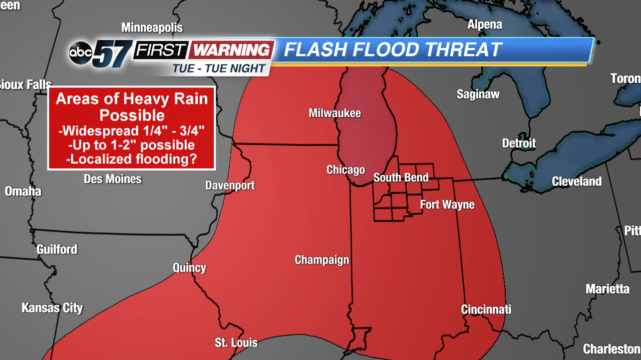 Flash flood threat zone for the Tuesday - Tuesday night period.
Weather Prediction Center
Flash flood threat zone for the Tuesday - Tuesday night period.
Weather Prediction Center
The Weather Prediction Center currently has the entire region in a "Slight Risk" for excessive rainfall that could lead to instances of flash flooding. Remember to avoid standing water and areas of flooding as it only takes 6" of running water to sweep a person off their feet. A typical car can be swept away in just 12" of moving water. Stick with ABC 57 News throughout the day Tuesday for additional updates on the chance of threatening weather.


