
-
1:43

Pleasant to start the weekend
-
3:06

Pulaski County weighs stricter solar rules amid resident concerns
-
0:40

Marian High School hosts World Down Syndrome Awareness Walk
-
2:33

South Bend leaders call for an end to gun violence
-
2:01

Tae Johnson, Notre Dame secondary stands out as Irish open spring...
-
2:21

Backup quarterback competition, position battles highlight Notre...
-
2:25

A new Pathway to the Golden Dome
-
2:33

Howard Park aims to install bandshell
-
1:37

March Madness and gambling responsibly
-
1:19

There are two big temperatures drops next week
-
1:48

Longer days for the first day of Spring
-
1:30

Country music star Jake Owen to play at Blue Gate Performing...

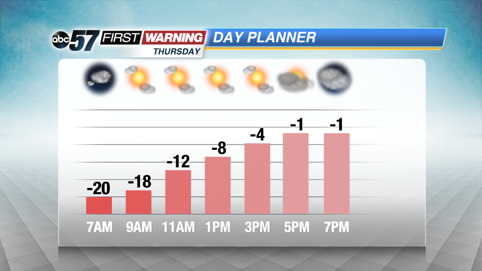
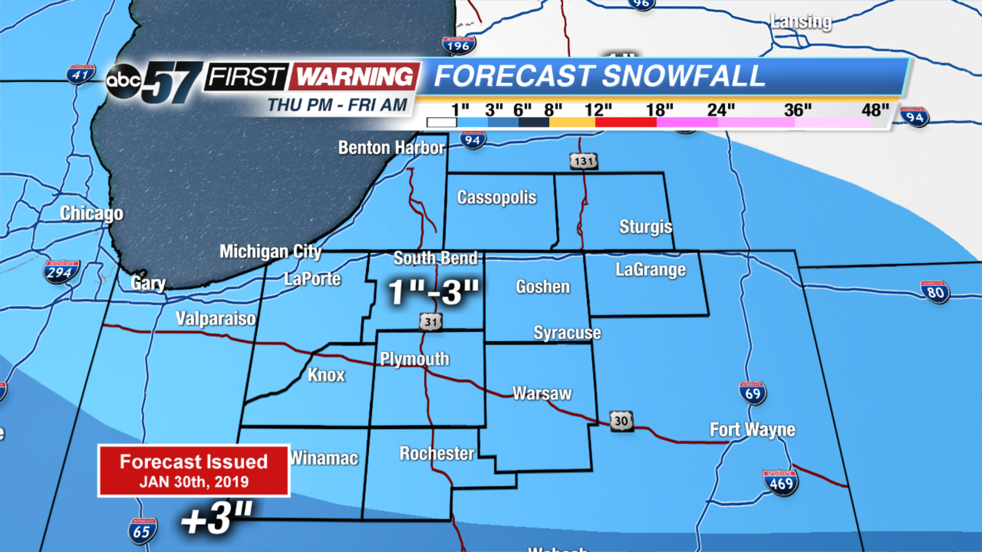
There’s no place to go but up. After temperatures hit rock bottom around -20 Thursday morning, there’s a warm-up towards zero by early Friday. The next round of snow will impact many as they head back to work / school Friday. A clipper brings a quick one to three inches by Friday morning. Temperatures swing warmer this weekend, into the 50s by Monday with rain in the forecast. The thaw and rain will likely cause minor flooding.
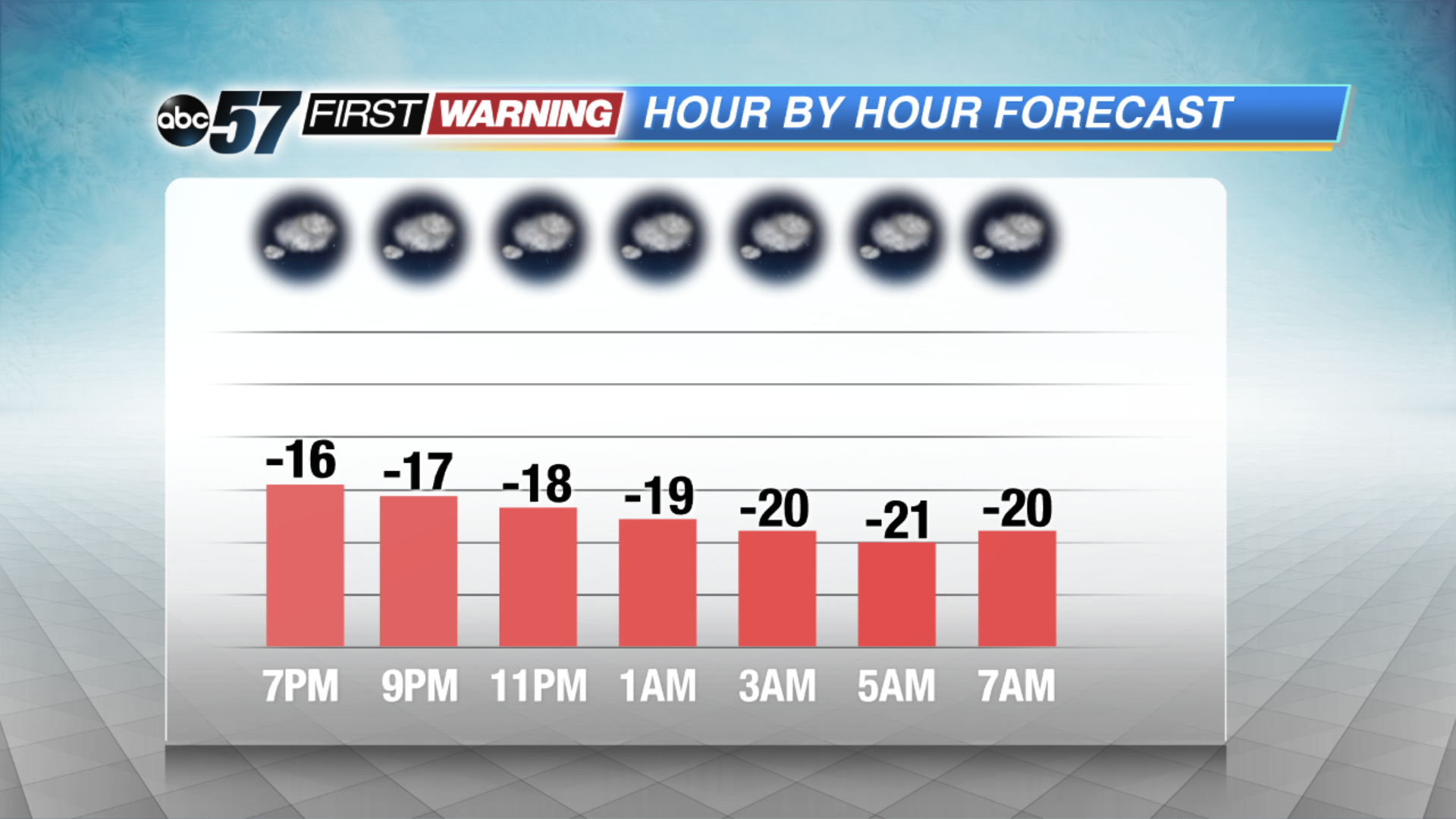
Tonight: Extreme Cold. Partly cloudy with continuing L.E. snow showers. Low of -22.
Thursday: Extreme Cold. Mostly sunny, warming towards zero by midnight.
Friday: AM snow showers. High of 22.
Saturday: Partly cloudy, high of 40.
Sign up for the ABC 57 Newsletter