
-
1:08

Storms start this afternoon
-
0:56

Calm morning, storms tonight
-
2:43

South Bend residents see future plans for former Drewry’s Brewery
-
2:45

Damage assessment continues in Elkhart County following EF-2...
-
0:44

Indiana and Illinois set record for tornadoes
-
1:27

Community Build underway at Kathryn Park
-
2:34

Day two of searching for a missing child continues
-
3:47

The Elkhart community is searching for answers after a 2-year-old...
-
1:04

Overall pleasant for Michiana
-
1:52

South Bend Common Council issues an official apology to residents...
-
0:54

Slightly cool out the door
-
1:54

Suspect identified, charged in fatal hit-and-run of Timothy Johnson

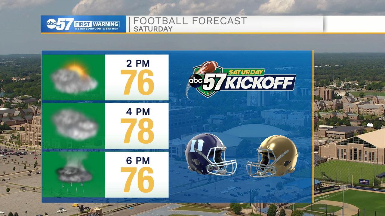
Clouds break Friday as the wind turns out of the south and temperatures begin to warm ahead of the next storm system. Saturday clouds and temperatures increase, high near 80 before showers and storms in the late afternoon and evening. Impact on the Notre Dame home opener are likely minimal at this time, shower may not start until after the game. The wind turns northwest Sunday, skies clear and high temperatures fall back into the mid-70s. The forecast is fair through early next week.
Tonight: Mostly cloudy. Low 58.
Friday: Partly cloudy. High 72.
Saturday: Increasing clouds, PM t-showers. High 80.
Sunday: Mostly sunny, breezy. High 75.
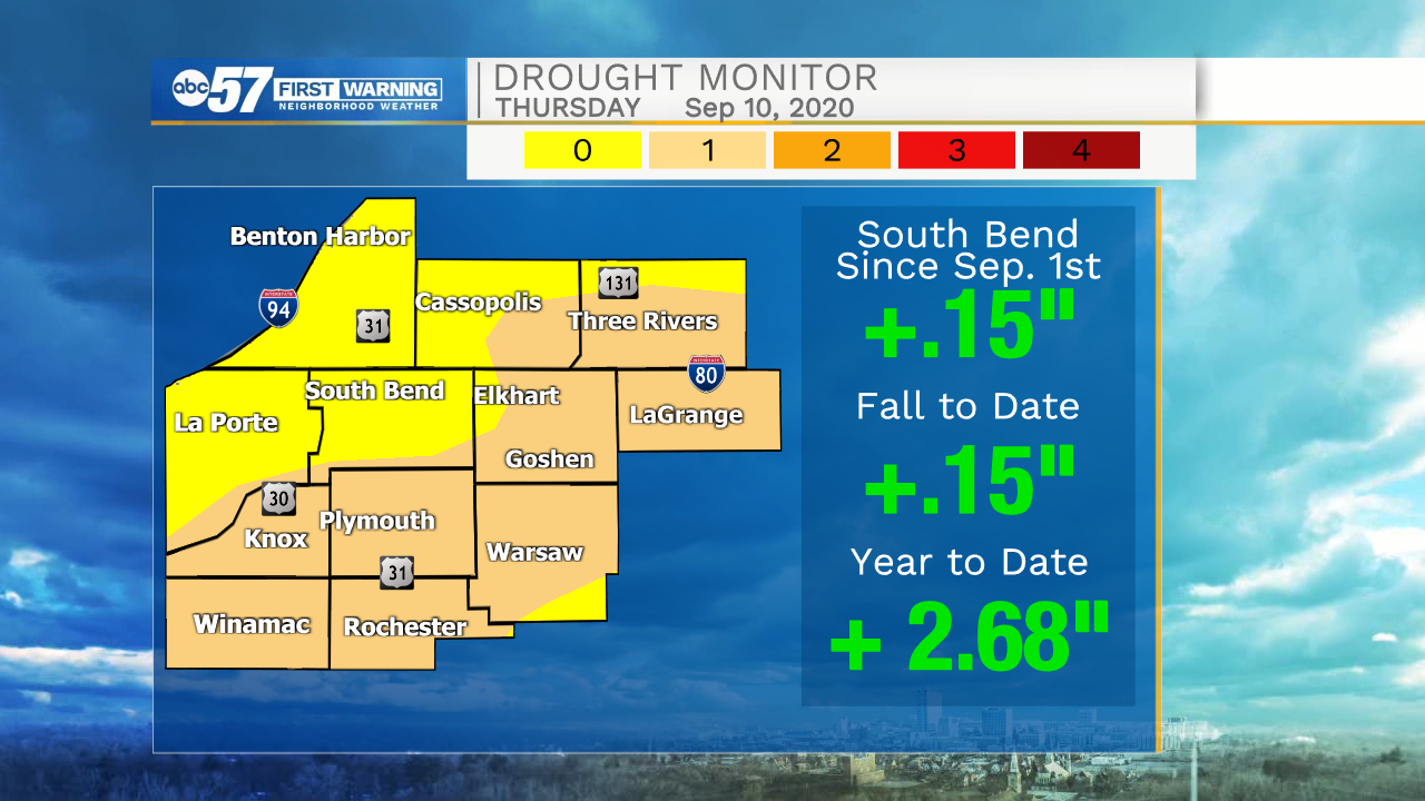
More rain is needed to recover from the summer drought.
Sign up for the ABC 57 Newsletter