Scattered showers and isolated thunderstorms are in the forecast


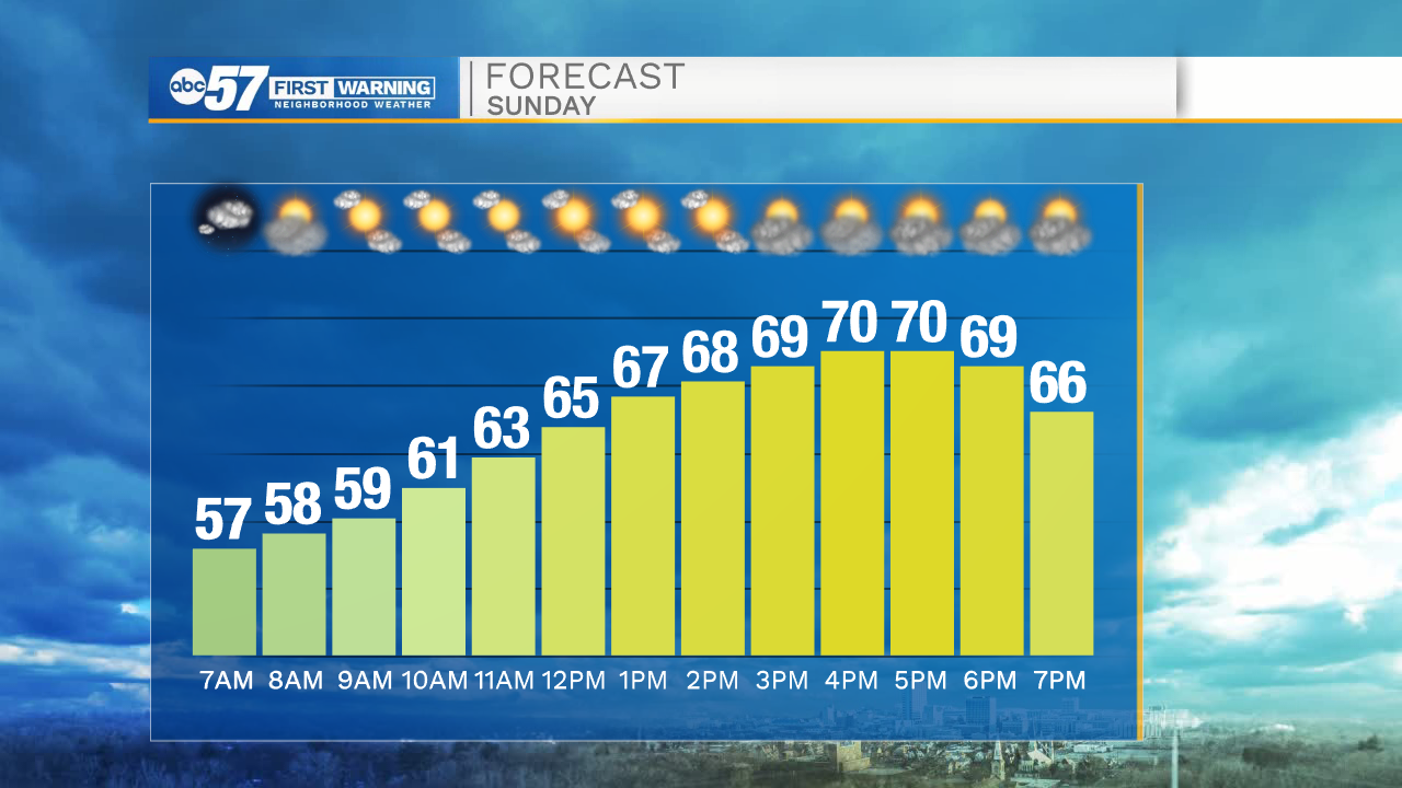
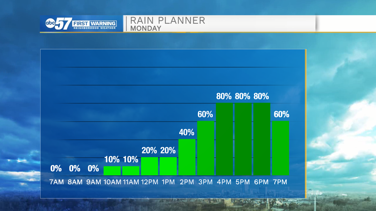
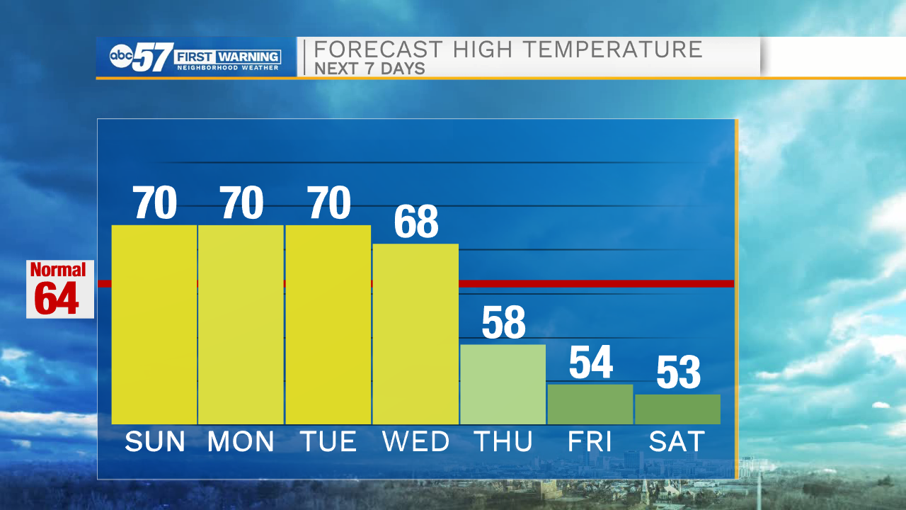
Partly cloudy skies will stick around through the morning, but then turn mostly sunny by this afternoon. High temperatures today will top out in the upper 60s to lower 70s. A cold front will move into Michiana tomorrow bringing scattered rain showers and isolated thunderstorms along with it. A few heavy downpours are expected. Rain activity will clear by the mid to late evening. Tuesday afternoon sunshine returns and temperatures will hold in the lower 70s.
Another cold front moves in late Wednesday into early Thursday, bringing colder temperatures back to Michiana. High temperatures on Thursday will be in the upper 50s. Lows next Friday and Saturday will drop into the mid to upper 30s. Overall colder conditions look to stick around through the extended forecast.
Today: Mostly sunny. High 70.
Tonight: Partly cloudy. Low 56.
Tomorrow: Scattered showers and storms. High 70.
Tuesday: Mostly sunny. High 70.