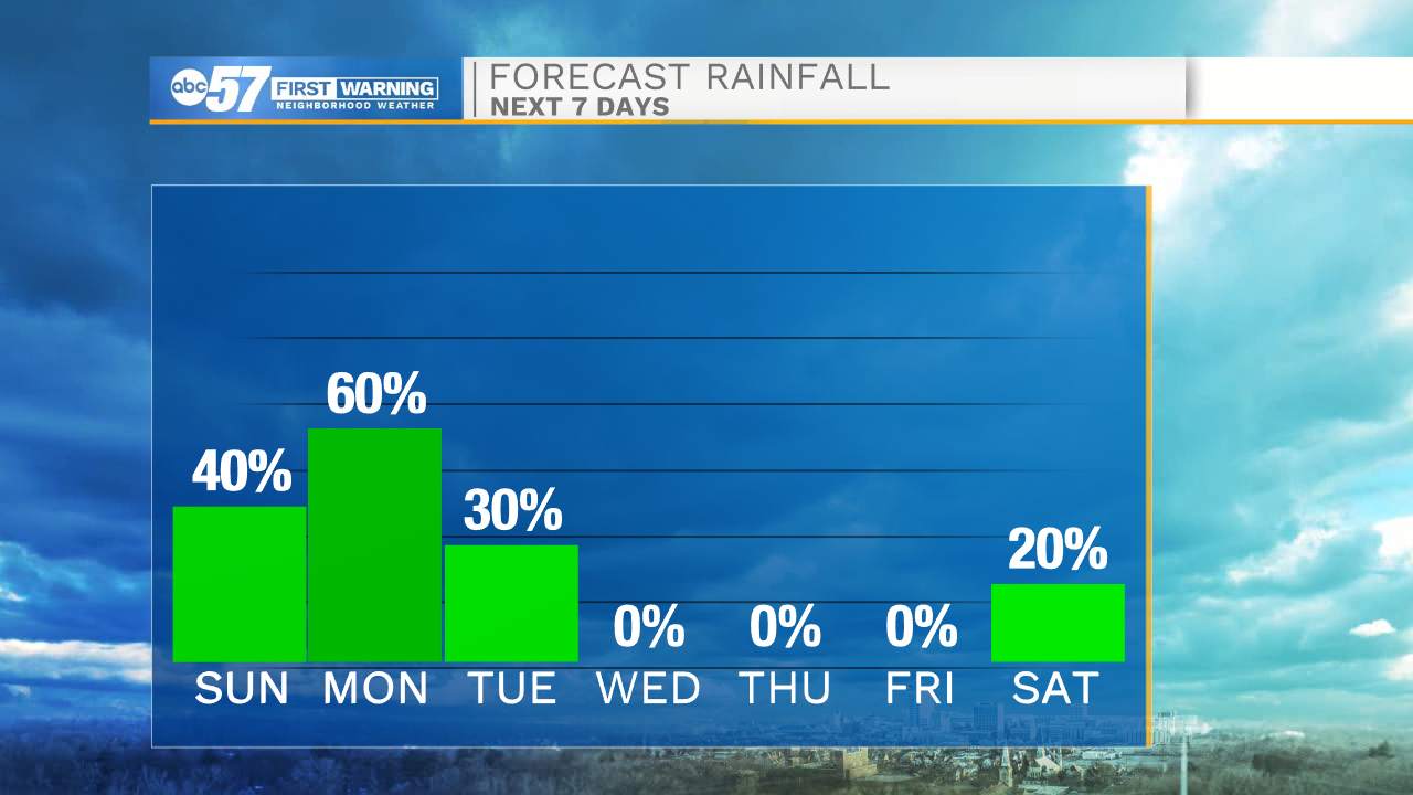
Scattered showers tonight, More rain chances heading into next week


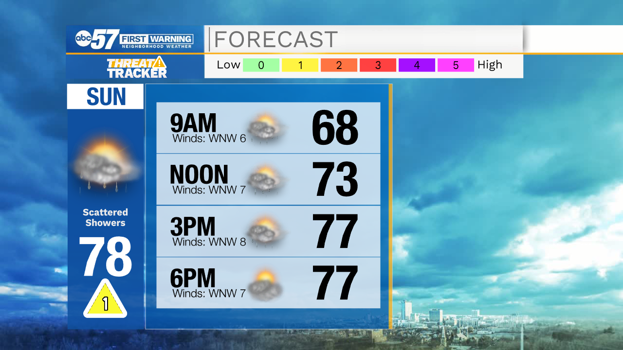
Scattered showers will move into Michiana this evening and linger through the overnight hours. Low temperatures tomorrow morning will be in the mid 60s. Rain showers will turn mostly isolated during the mid-morning hours, and last through the afternoon. High temperatures tomorrow will top out in the upper 70s under partly cloudy to mostly cloudy skies. Tomorrow night into Monday morning, more scattered showers are expected. Rain activity should remain in place throughout most of Monday, and the overnight hours into Tuesday. High temperatures Monday and Tuesday will be in the mid to upper 70s.
Below average temperatures remain in the forecast through all of next week. We will catch a break from the rain by mid-week, so make sure to get outside and take advantage of the dry sunny weather. Next Friday night and Saturday morning rain showers return to the forecast. We should get another chance to dry out by next Sunday.
Tonight: Showers and possibly a thunderstorm overnight. Low 64.
Sunday: Mostly cloudy with a few showers. High 78.
Monday: Showers and isolated storms likely. High 76.
Tuesday: Isolated showers during the morning. High 74.