Scattered snow showers and turning colder

-
1:42

Damaging winds and hail move in this evening
-
2:51

Severe weather expected in Michiana later today
-
2:15

Severe weather likely for portions of Michiana later today
-
2:34

Open House for a new pedestrian bridge leaves Riverside Residents...
-
2:16

Notre Dame’s CJ Carr embraces growing expectations while leading...
-
2:34

Injuries sideline key linebackers as Notre Dame leans on depth...
-
0:58

U.S. Army increases maximum enlistment age from 35 to 42
-
2:08

Large hail, damaging winds and tornadoes possible Thursday
-
1:40

Nicholas Stanley appears in court, prosecutors push to prevent...
-
3:18

Expert breaks down high gas prices and factors impacting price...
-
2:08

Westview community rallies around boys’ basketball team headed...
-
2:06

The threat for severe weather has increased

Wednesday, February 26th, 2020
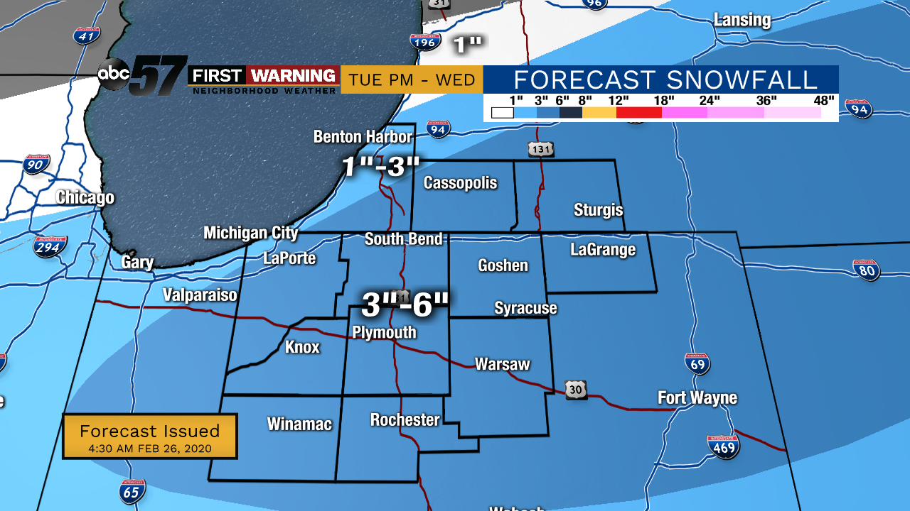
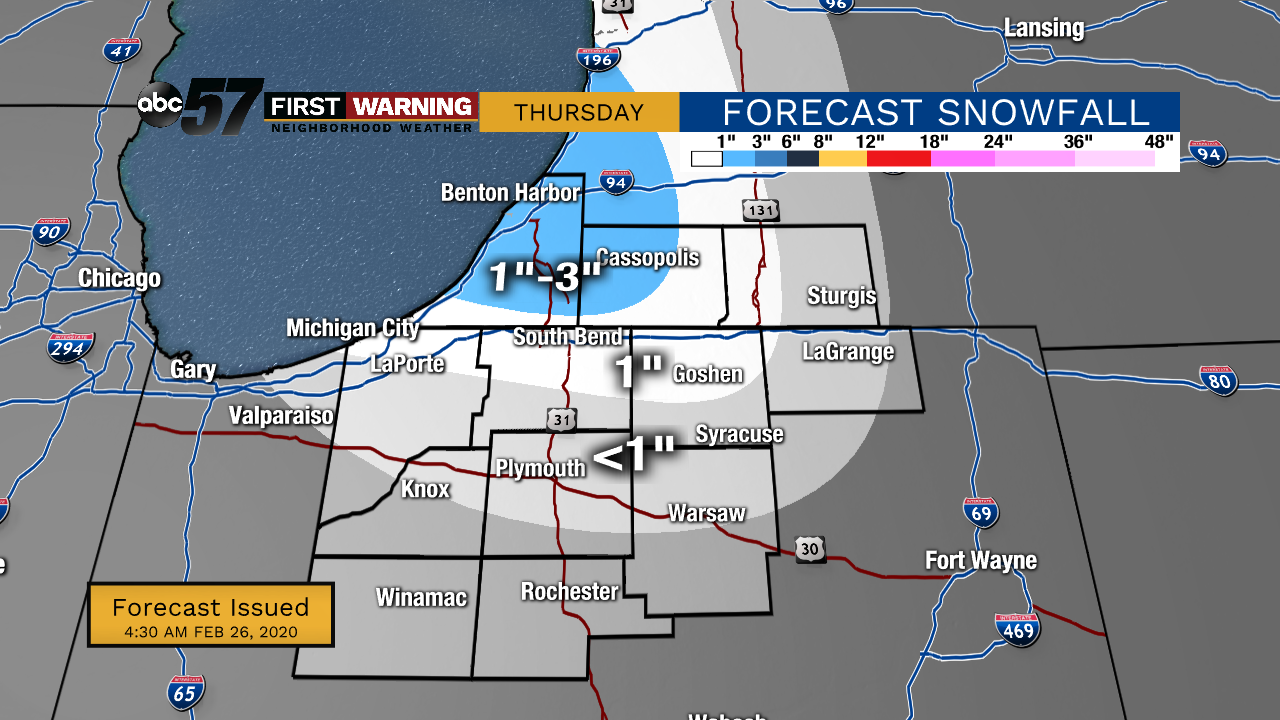
Scattered snow showers last into early this evening before moving out. It still looks like most will see 3-6”, many falling closer to the lower end of that range. Lake effect snow then develops tonight into Thursday as cold air rushes in behind the system. A few flurries will likely linger into Friday morning as well.
It’ll be a blustery couple of days, with daytime highs in the mid-20s and wind making it feel even colder. This will create more lakeshore flooding issues along with possible erosion. We’ll start to see more sunshine this weekend with temperatures gradually warming for early next week.
Wednesday: Scattered snow showers. High 31.
Tonight: Lake effect snow possible. Low 20.
Thursday: Lake effect snow, cold and breezy. High 25.
Friday: AM flurries, mostly cloudy. High of 25.