Severe weather plows through Midwest

-
1:00

NIPSCO workers rally in South Bend for new contract
-
1:53

Severe weather threat is over, MUCH colder Friday
-
3:43

South Bend Mayor James Mueller delivers 2026 State of the City...
-
0:52

Family and friends of Adrian Cruz voice frustration in sentencing...
-
2:13

Potawatomi Zoo prepares for opening day with new attractions
-
2:54

Local expert weighs in on landmark social media decisions
-
1:33

Round one of storms moving east, Round two arriving soon
-
2:38

Bourbon residents recall tornado as severe weather strikes again
-
1:34

Tornado threat decreasing, but severe weather still expected...
-
1:42

Damaging winds and hail move in this evening
-
2:51

Severe weather expected in Michiana later today
-
2:15

Severe weather likely for portions of Michiana later today

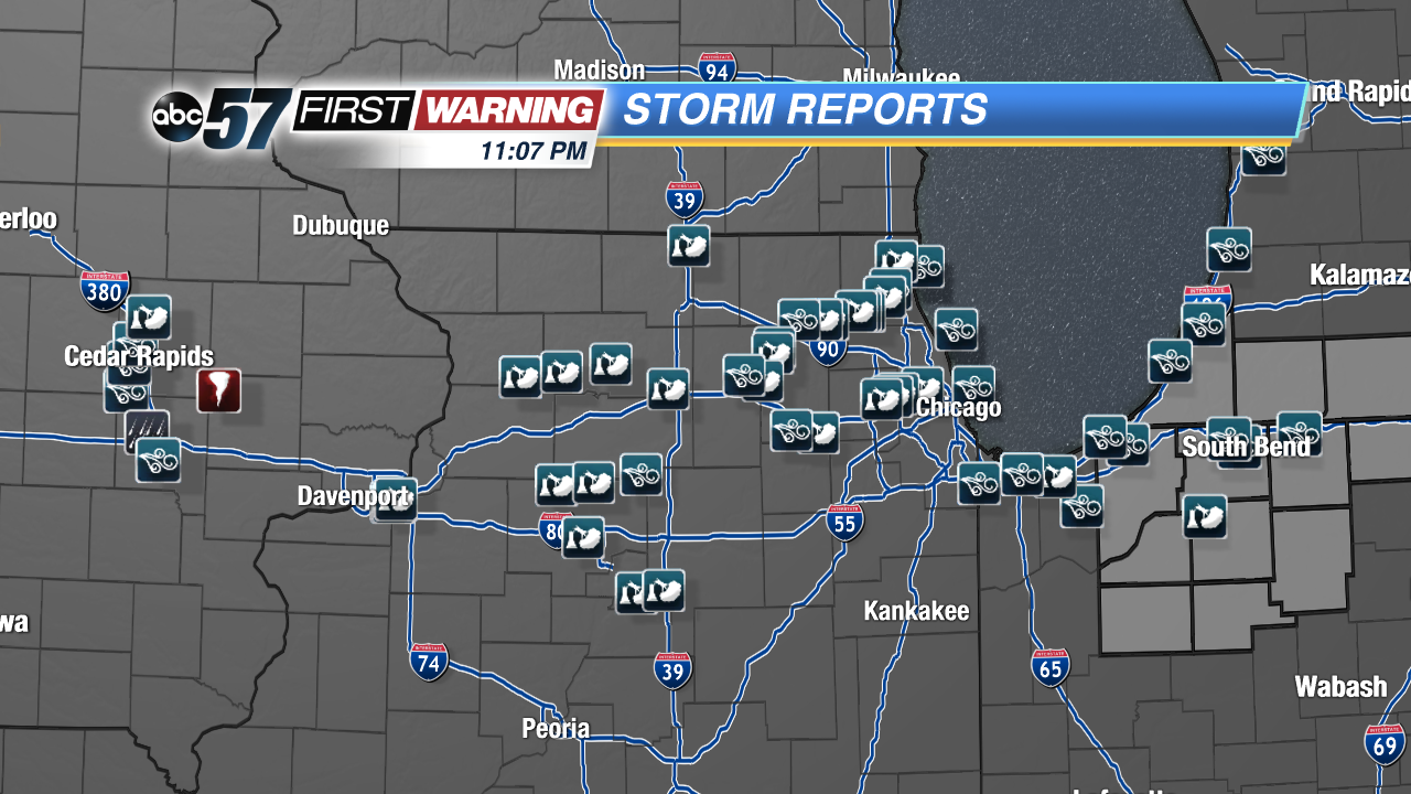
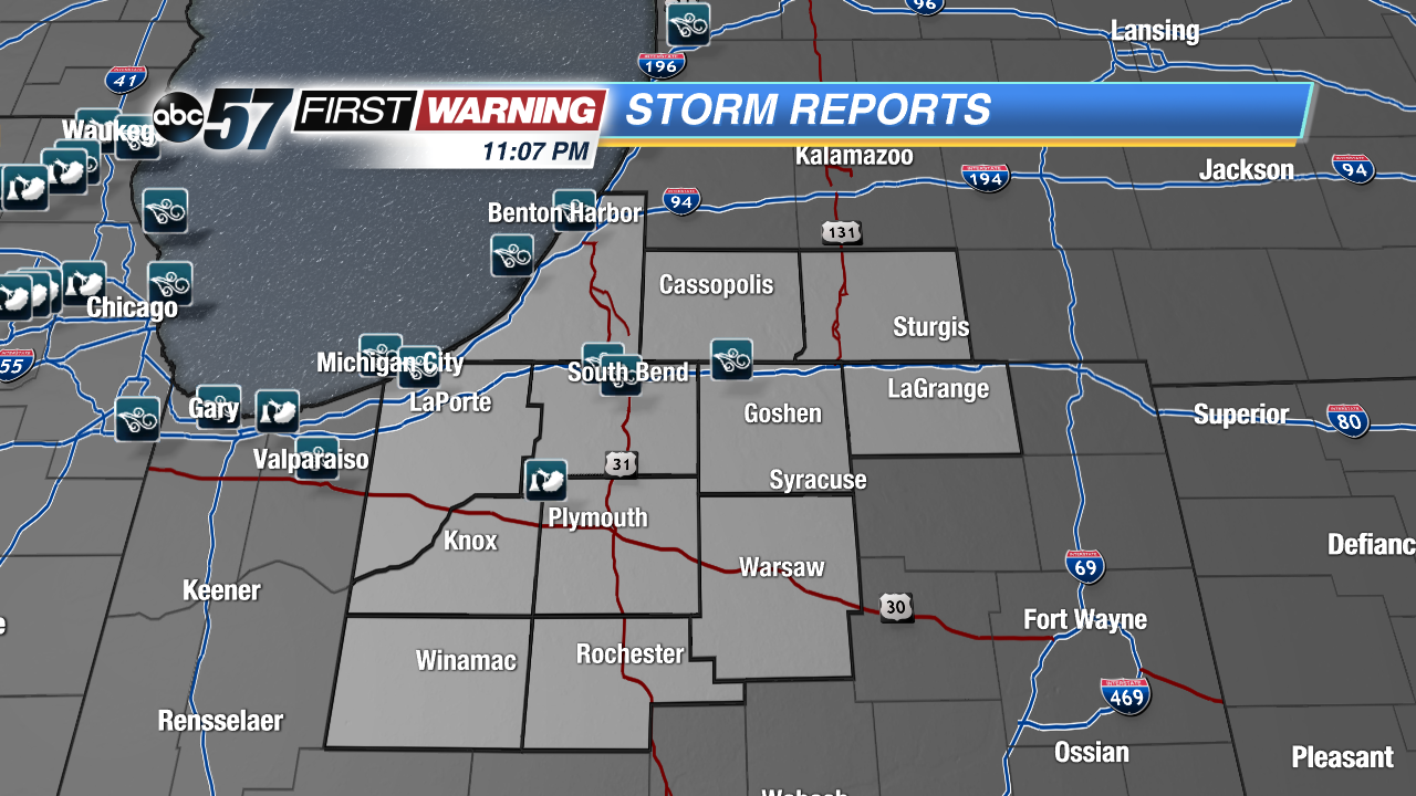
Severe storms plowed through Michiana after 8 PM Tuesday evening, with very heavy rain, a ton of lightning and strong winds.
Wind reports came in at 51 MPH in South Bend, 50 MPH in Simonton Lake, 48 MPH in Michigan City and 43 MPH in Benton Harbor. There was only one storm report of a tree that fell on a vacant car in Koontz Lake.
Damage was more widespread in Illinois and Iowa where the storms moved in during the peak heating hours of the day and were therefore stronger. Northern Illinois is dotted with wind reports, with one of 70 MPH in Huntley, McHenry County, and an estimated straight line wind gust of 90-100 MPH in Moline. Damage reports in Illinois included trees and power lines. In Iowa, a tornado touched down southeast of Cedar Rapids, damaging grain bins and corn, and more trees and power lines came down because of high wind.