
-
2:23

La Porte community rallies for Sammy Strong Benefit, raising...
-
1:57

The Potawatomi Zoo opens its gates to Zoo Nights Live
-
2:50

Carson Kvapil wins his first O’Reilly Auto Parts Series win...
-
1:10

William Tuffs honored as the only Indiana man who took part of...
-
0:50

Beacon Health held a Health and Wellness fair for the community
-
1:03

Warm conditions start overnight
-
1:02

Another pleasant day
-
0:42

Still cooler out the door
-
2:00

New Carlisle celebrates annual Hometown Days
-
1:40

Ross Chastain leads NASCAR O’Reilly Auto Parts Series practice...
-
2:27

Backpacks for Berrien hosts their Stuff-a-Bus event, ultimate...
-
2:59

Ludacris Opens Elkhart County 4-H Fair Concert Series Amid Ticket...

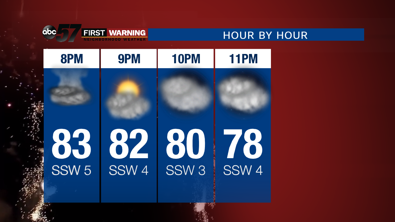
Isolated showers and storms Thursday evening, most activity will fade by fireworks time but heavy rain is possible under some cells.
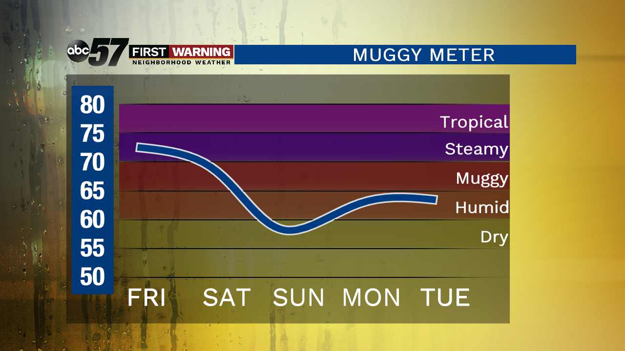
Hot and humid weather ends the week and Friday looks to the best chance of rain with scattered showers and storms likely in the afternoon. That chance of rain continues into Saturday as a front slides through dropping humidity and clearing skies into Sunday. Early next week looks fair with highs in the low to mid 80s.
Tonight: Isolated storms possible, partly cloudy, low of 72.
Friday: Partly to mostly cloudy, scattered thunderstorms, high of 88.
Saturday: Scattered storms, high of 85.
Sunday: Mostly sunny, high of 80.
Sign up for the ABC 57 Newsletter