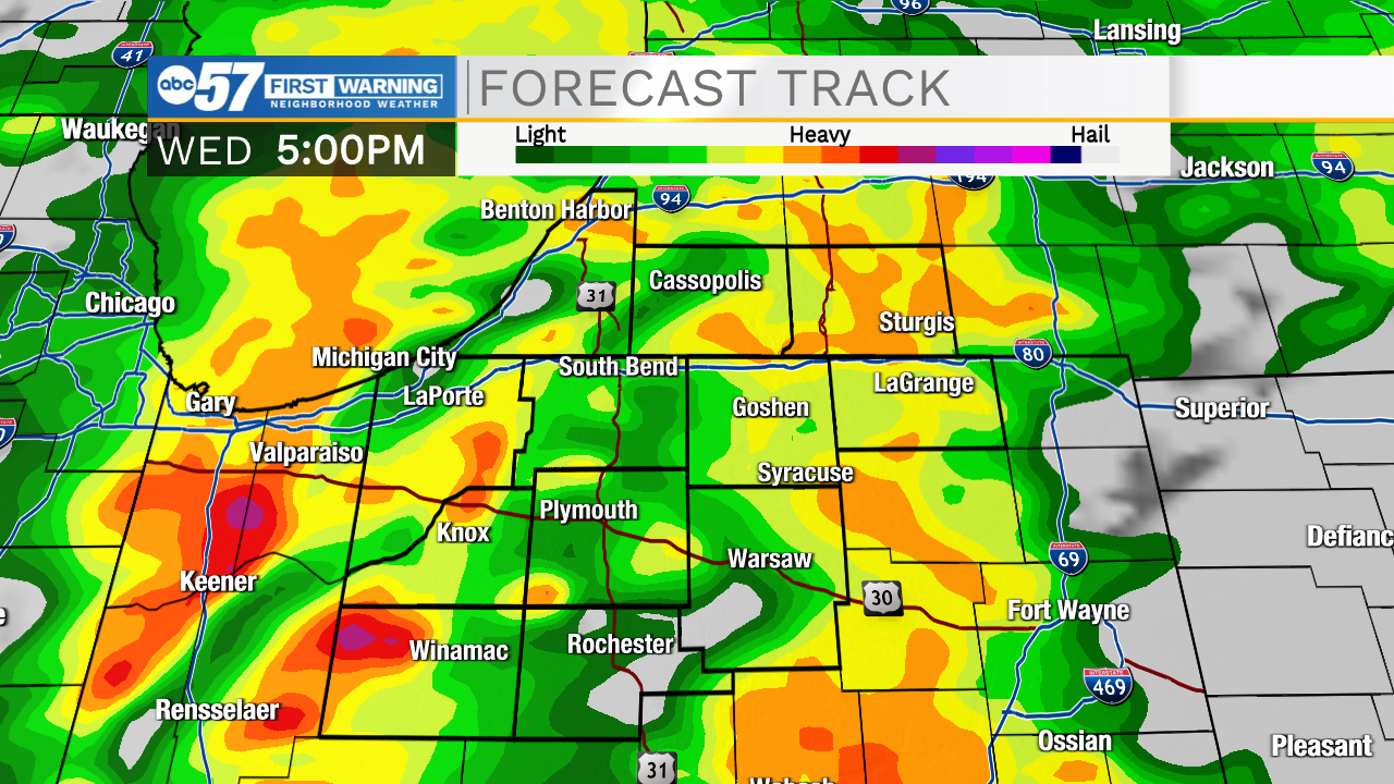
Showers and storms will move into Michiana this afternoon


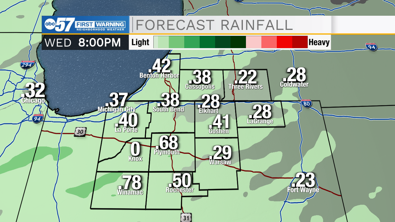
Rain showers return to the forecast around lunchtime today. Once we hit the afternoon, scattered showers and thunderstorms will impact most of Michiana. Thunderstorms activity should remain sub-severe. Rainfall accumulation looks to total around a quarter inch for most, but a few isolated areas could be closer to half an inch with the heaviest downpours. Temperatures this afternoon will top out in the upper 60s to lower 70s. Tonight rain showers will clear then sunshine moves in for tomorrow afternoon. Our next round of rain is possible Friday afternoon and evening. We look to stay mostly dry heading into the weekend, but low rain chances are possible for portions of Michiana Saturday night and Sunday. High temperatures this weekend will hold in the mid 70s. Temperatures will return to the 80s for next week.
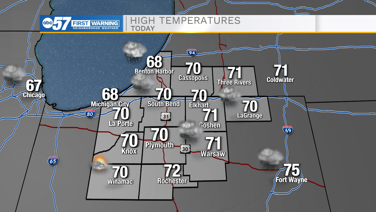
Today: Scattered showers/storms. High 70.
Tonight: Mostly/partly cloudy. Low 54.
Tomorrow: Mostly sunny. High 74.
Friday: Scattered showers. High 72.