
-
3:37

Indiana District 2 Candidates talk Iran, accountability and...
-
3:22

Elkhart County Sheriff Candidates debate ahead of May 5th Primary
-
2:52

Police say widely shared video of man held captive, beaten was...
-
4:14

Where do our local politicians stand on the war in Iran?
-
2:26

Notre Dame offensive line searching for continuity as Ashton...
-
3:48

ABC57 sits down with candidates running for Elkhart County Sheriff...
-
1:51

Charlie Partridge already making early impact on Notre Dame defensive...
-
3:12

County officials hopes to call further attention to littering...
-
6:06

Candidates for Indiana state senate speak following President...
-
0:57

Sunny and windy today
-
5:10

Pop-Up Kitty Cafe coming to Michigan City
-
2:51

Nappanee will soon be home to the World’s Largest Cabinet

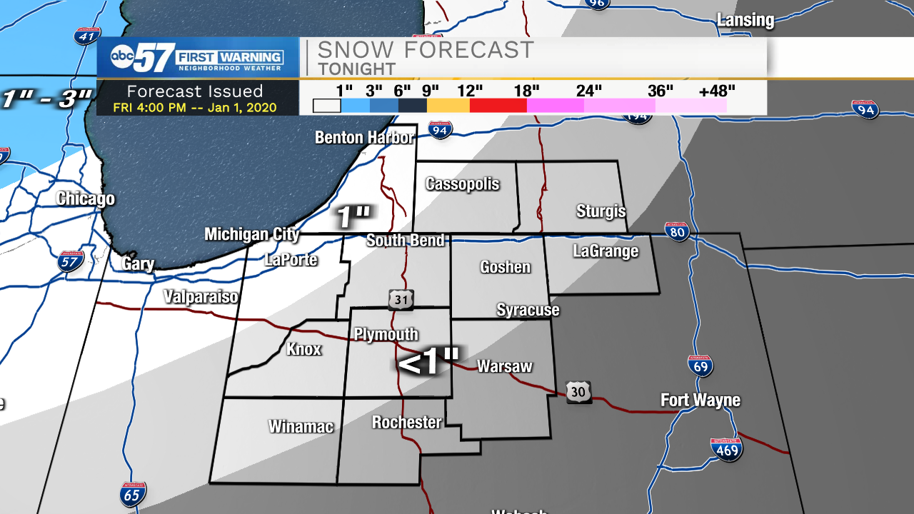
Tonight: Slick travel is still a concern. A wintry mix changing to snow around midnight could add up to an inch of snow to an already slippery situation. Temperatures stay below freezing overnight.
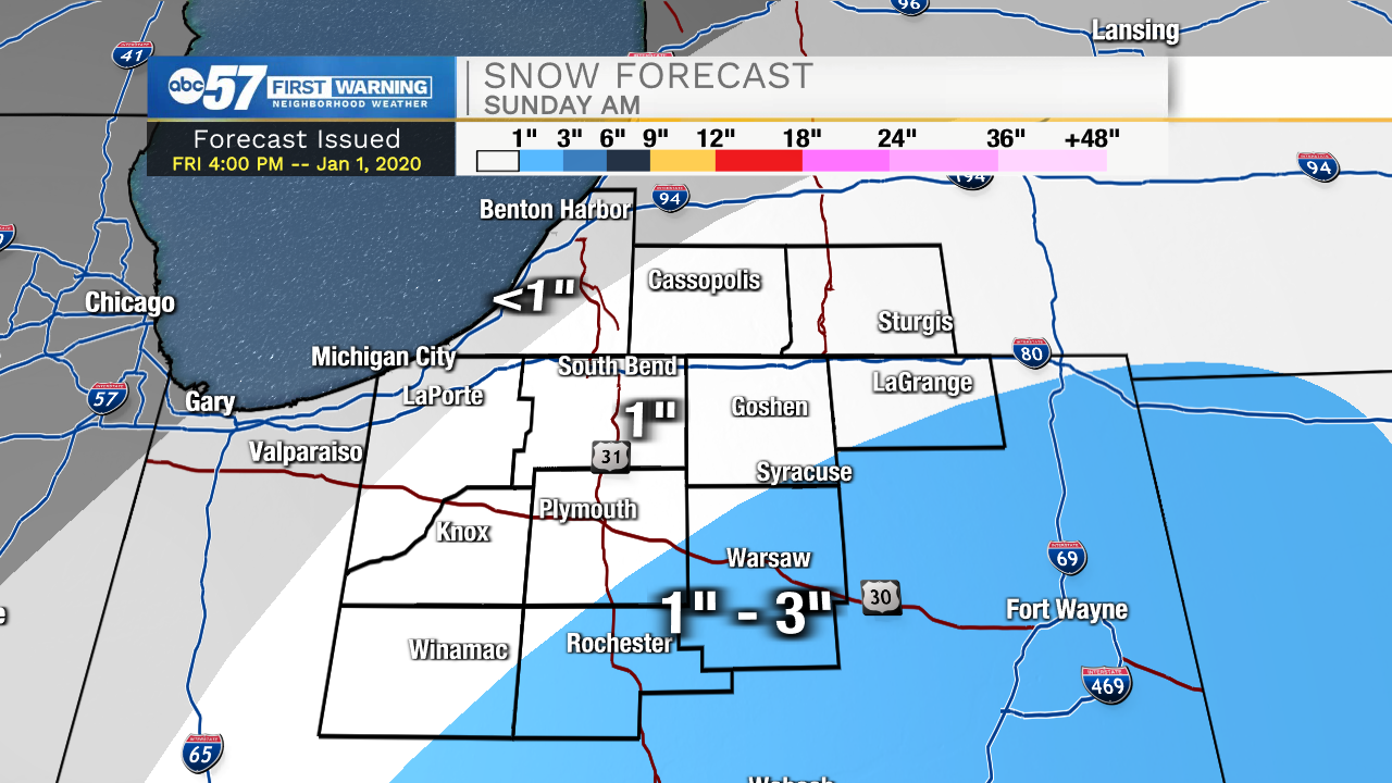
Saturday should bring some relief from slick conditions with some sunshine and highs in the mid-30s. The next storm system skirts the area Sunday morning, favoring the most snow towards the southeast where up to three inches are possible. The snow will melt next week with highs in the upper 30s to low 40s. A relatively mild start to January.
Saturday: Mostly cloudy. High 36.
Sunday: Morning light snow, mostly cloudy. High 36.
Monday: Mostly cloudy. High 38.
Sign up for the ABC 57 Newsletter