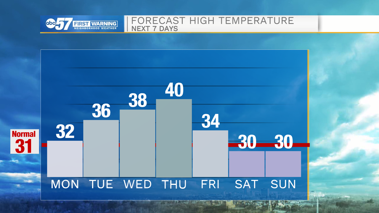
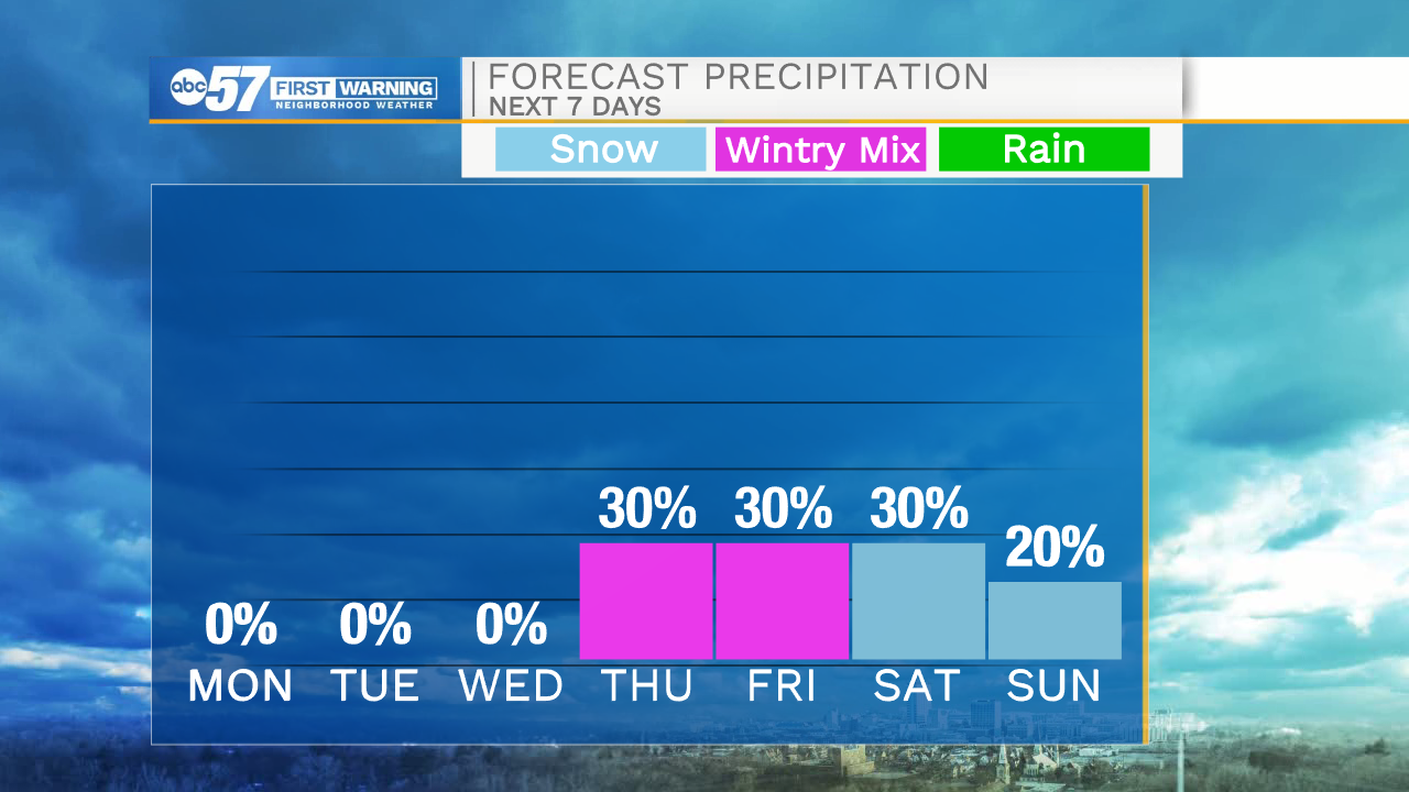
Snow chances and colder temperatures return later this week


Mostly cloudy skies will remain in place through the overnight hours. A few isolated snow flurries are possible in our northern Michiana counties. Tomorrow morning temperatures will again drop into the lower 20s. We will see a little clearing in the cloud cover tomorrow afternoon, but temperatures will still remain on the colder side in the lower 30s. Dry weather is expected through Wednesday afternoon. High temperatures Thursday afternoon will top out around 40 degrees. Rain and then snow chances move back in Thursday evening. Isolated snow showers will remain in the forecast through the first half of next weekend. Temperatures next weekend will only top out in the upper 20s to lower 30s.
Tonight: Mostly cloudy. Low 22.
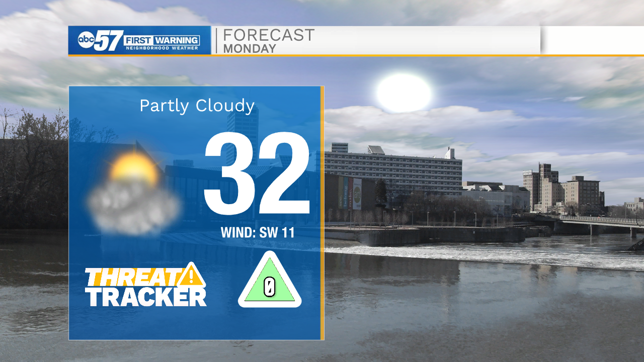
Tomorrow: Partly cloudy. High 32.
Tuesday: Mostly cloudy. High 36.
Wednesday: Partly cloudy. High 38.