
-
2:43

South Bend residents see future plans for former Drewry’s Brewery
-
2:45

Damage assessment continues in Elkhart County following EF-2...
-
0:44

Indiana and Illinois set record for tornadoes
-
1:27

Community Build underway at Kathryn Park
-
2:34

Day two of searching for a missing child continues
-
3:47

The Elkhart community is searching for answers after a 2-year-old...
-
1:04

Overall pleasant for Michiana
-
1:52

South Bend Common Council issues an official apology to residents...
-
0:54

Slightly cool out the door
-
1:54

Suspect identified, charged in fatal hit-and-run of Timothy Johnson
-
0:39

Prairie Street Cemetery works to clear storm damage
-
1:36

Reaching out for support gives father a second chance in life

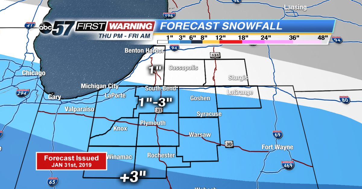
The deep freeze is over as temperatures warm above zero overnight. Light snow will bring a range of one to three inches of snow through Friday morning. Snow ends before the morning drive.
Temperatures are on the rise, a weekend thaw will bring highs in the 50s by Monday. Once temperatures rise above freezing Saturday, they are likely to stay there through Monday evening. The melt will be steady but flooding concerns are nowhere near last February when six to eight inches of rain and meltwater were released. This round looks to be maybe two inches max.
Tonight: Overnight snow, temperatures warming from -2.
Friday: Mostly to partly cloudy, high of 22.
Saturday: Partly cloudy, fog possible, high of 42.
Sunday: Mostly cloudy, chance of showers, high of 48.