
-
1:00

Another pleasant day for our area
-
1:00

Slightly cooler out the door today
-
1:03

Mentone Egg festival brings a clutch of people to enjoy its history
-
0:46

9th annual Hall of Heroes Comic Con concludes its first day
-
2:39

South Bend Barber celebrates retirement after 59 years
-
0:45

OC fireworks reveal their new showroom
-
0:57

Thousands take part in Sunburst Run to raise funds
-
2:00

Annual Studebaker car show takes over Ironwood Plaza
-
0:55

Beautiful weekend expected
-
1:05

Truly wonderful conditions
-
0:41

One person left with serious injuries after high-speed pursuit...
-
2:15

Fort Wayne Tin Caps put an end to the SB Cubs winning streak

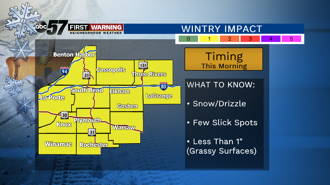
A round of light snow, possibly mixed with drizzle, will move through Michiana Saturday morning. Impacts will be minor, with most areas picking up less than an inch of snow, which will mainly fall on grassy surfaces. We’re still expecting a sudden warm-up with sunshine and spring-like temperatures Sunday and Monday. With highs nearing 50, we’ll be flirting with all-time record warmth. Rain develops across the area Monday night ahead of our next round of rain and snow Tuesday, Wednesday and possibly Thursday.
Today: Light snow/drizzle in the morning, then cloudy. High 38.
Tonight: Cloudy. Low: 32
Sunday: Mostly sunny and breezy. High 50.
Monday: Mostly cloudy. Rain develops at night. High 47.
Sign up for the ABC 57 Newsletter