Snowfall in April...really?


It'll be a dynamic couple of days here in Michiana as the seasons collide right over our heads. Spring will dominate today, as the 50s and 60s roll in farther south and thunderstorms look likely this afternoon/evening. Some of the storms will be strong to severe, with some small hail and strong winds possible. But, winter comes back with a vengeance for tomorrow morning as snow showers roll back into Michiana again. Some in the northwestern portions of the area could see accumulations, mainly at or below 1" for most.
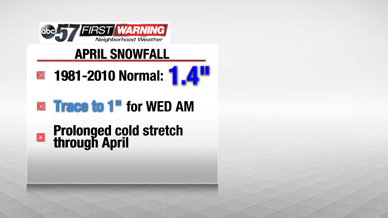 We only see 1.4 inches of snow on average for the entire month of April. A few could see almost this much in one morning!
It's not uncommon to see snow in the early portions of April and this long, cooler period will definitely be enough to support the snowfall that's coming our way. In Michiana, our normal snowfall total for the entire month is only 1.4"! Some isolated spots could see that exact amount from Wednesday's snowfall alone. And, as temps continue to hold onto the below-average side of the scale, more wet snow and rain chances could move through in the next couple of days so be sure to stay updated with the latest forecast!
And many are probably wondering...when will spring be here to stay? Well, it looks like the cooler air hangs out throughout a good portion of April but some milder air looks to return for the tail end of the month and into May so we those spring weather fans just need to hold on a couple more weeks!
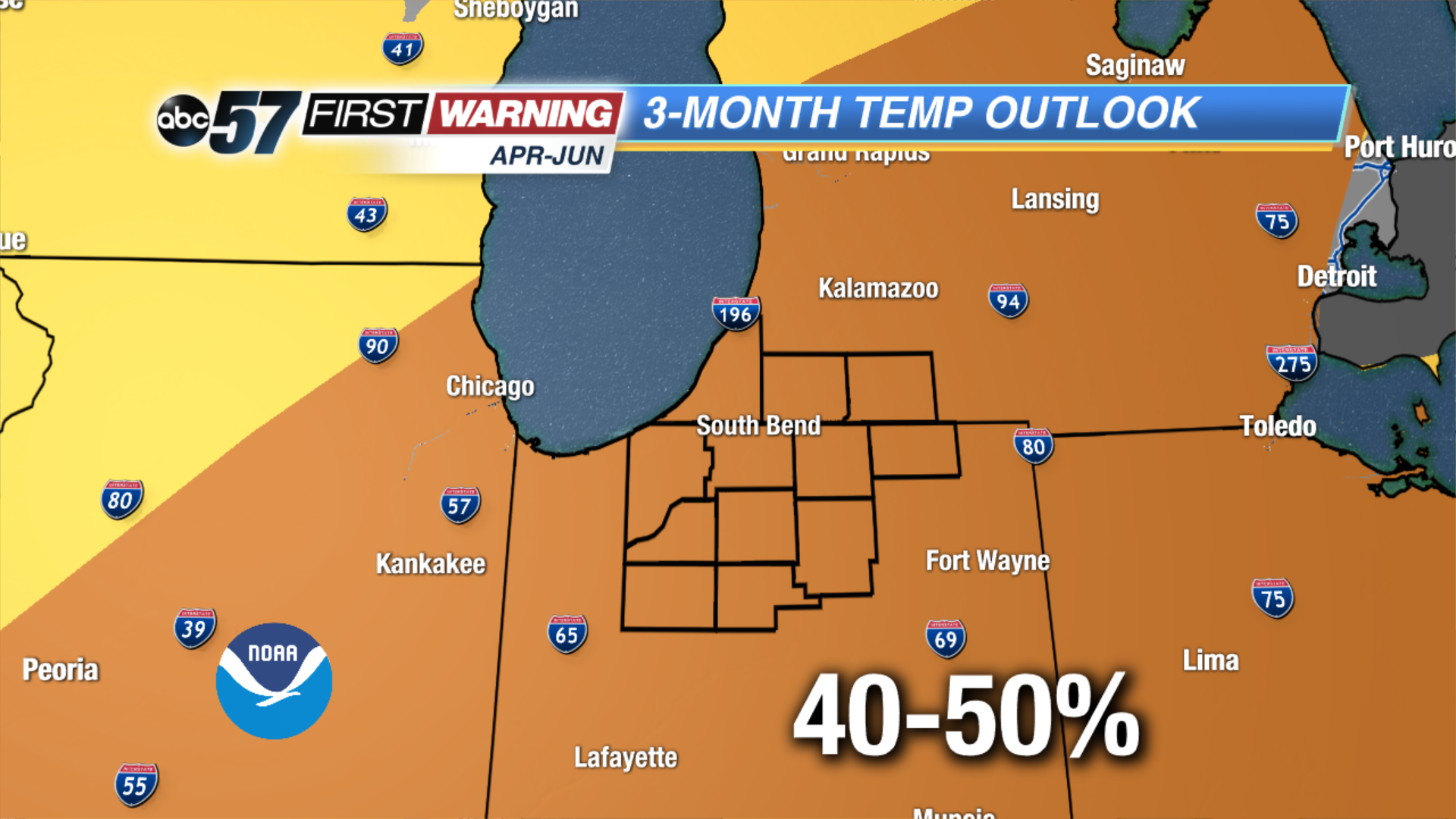 By the second half of April into May, the 50s should creep back into the forecast more consistently, much like the 40s now.