Snowy Friday evening, extreme winter weather next week

-
1:00

A pleasant day for Juneteenth
-
3:42

Family of 24-year-old Timothy Johnson killed in Cass County hold...
-
2:24

Sun shines on Elkhart Jazz Fest
-
2:33

Juneteenth celebration kicks off Elkhart Jazz Fest
-
0:34

New county park in Kosciusko
-
2:10

Meet Andy Stephenson, Goshen’s new Chief of Police
-
3:53

’Beetlejuice’ takes the Morris stage over the weekend
-
1:25

Mild for now, Rainy Father’s Day
-
1:59

Madison Lifestyle District Development construction is underway
-
1:45

Latest rain reports, Much quieter today
-
0:52

Benton Harbor moving forward with Buss Avenue property renovations
-
1:38

Community tornado shelters open in rural counties ahead of storm...

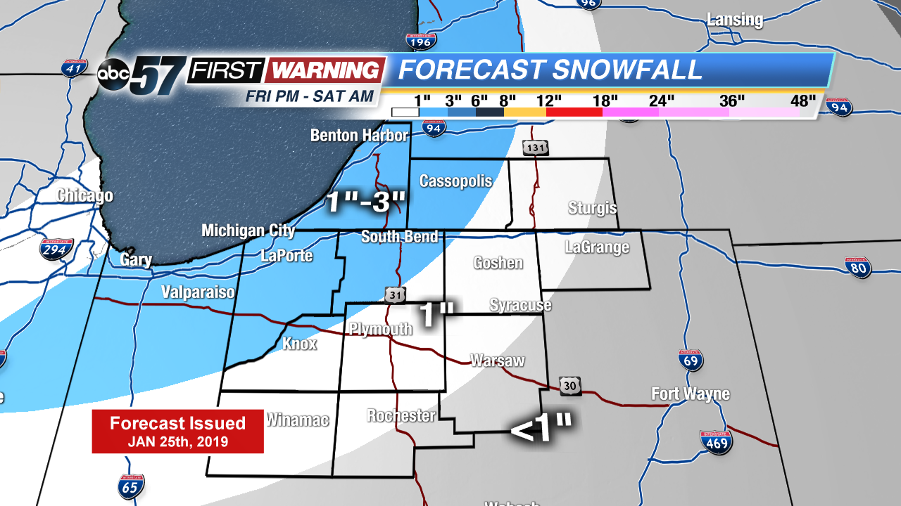
Another burst snow will impact Michiana Friday evening. The total amount will not be overwhelming but the initial burst may slow travel significantly during the evening hours. A range of one to three inches is expected.
The weekend is cold with a few snow showers, none of any major significance. The focus then turns to Monday’s possible snow storm. There are many scenarios, from a wintry mix and minor accumulation to heavy snow of more than six inches. Right now likelihood of three to six inches is the best probability. The pattern then turns dangerously cold for the middle of next week. Next Wednesday could be one of the coldest EVER in Michiana.
Tonight: Evening snow showers, low of 4.
Saturday: Morning flurries, mostly cloudy. High of 16.
Sunday: Chance of snow, mostly cloudy. High of 18.
Monday: Snow likely. High of 28.