
-
2:28

Kicking off day two of the Gus Macker Basketball Tournament
-
0:55

Enjoy this weekend
-
0:50

Beautiful weekend starts this morning
-
2:32

Gus Macker Three-on-Three Basketball Tournament is taking over...
-
1:44

Feeling like a sauna next week
-
3:12

How to keep yourself and others protected during firework season
-
0:49

Showers creeping into Michiana
-
1:32

Judge approves $25 million water lawsuit settlement in Benton...
-
1:00

Scattered showers through the day
-
1:53

Hispanic Community Child Safety Meeting: A Call To Action
-
2:51

Obama Presidential Center features work of South Bend company
-
1:54

This week’s ABC57 Cub Reporter is Isaac Knefely

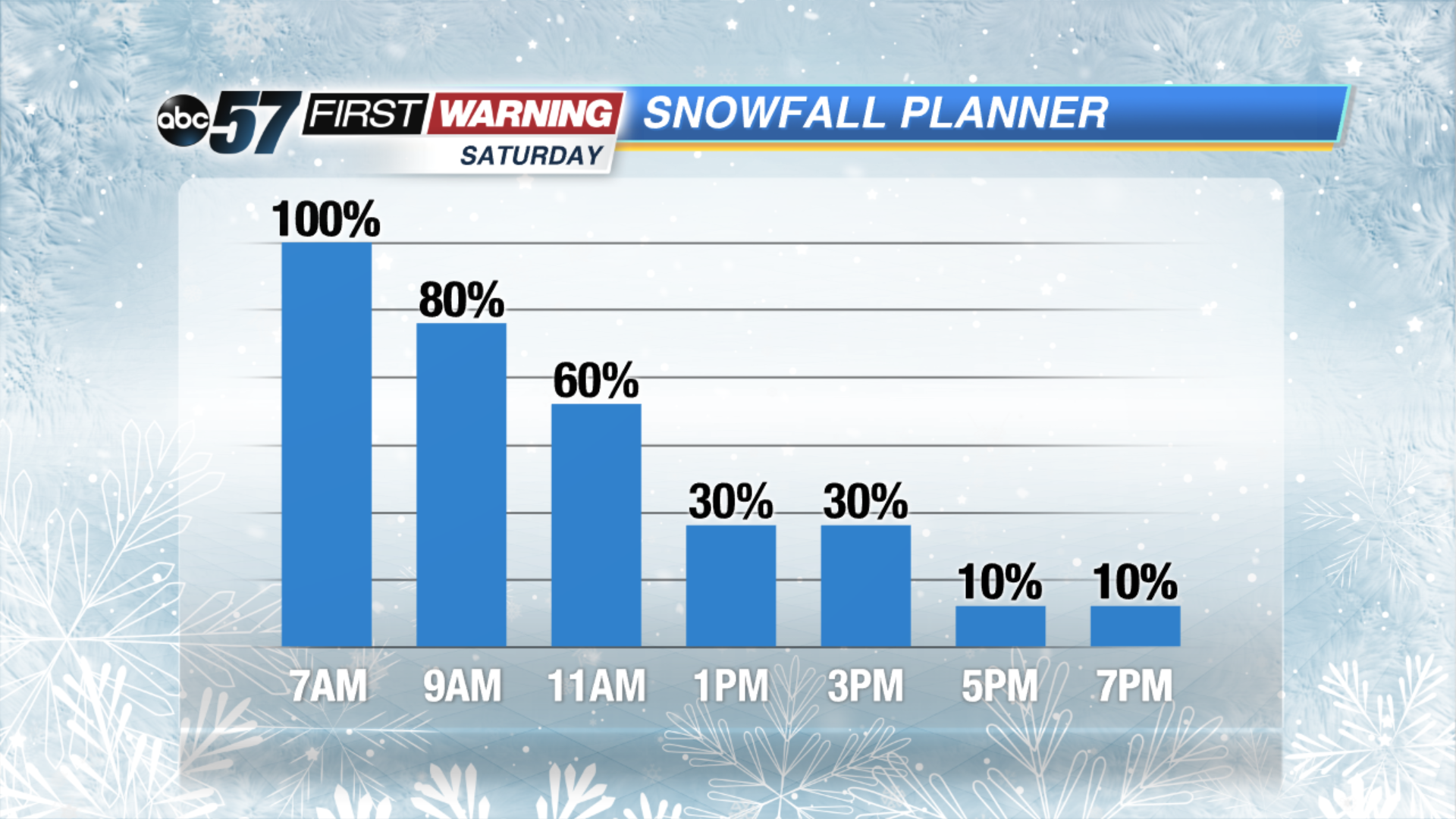
Snow showers begin by late Friday evening, ramping up after midnight. Widespread moderate to heavy snow will last through Saturday morning. By daylight at least three inches of snow is likely for much of the area.
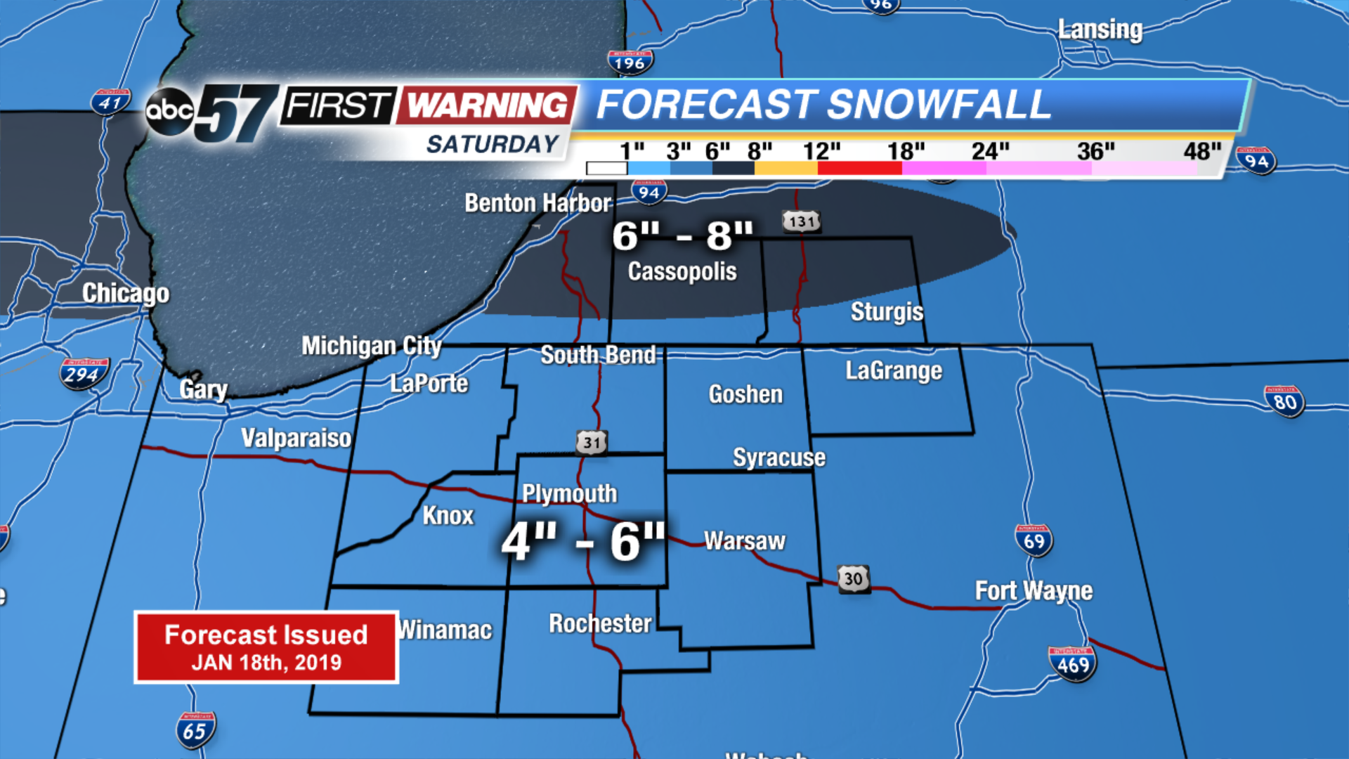
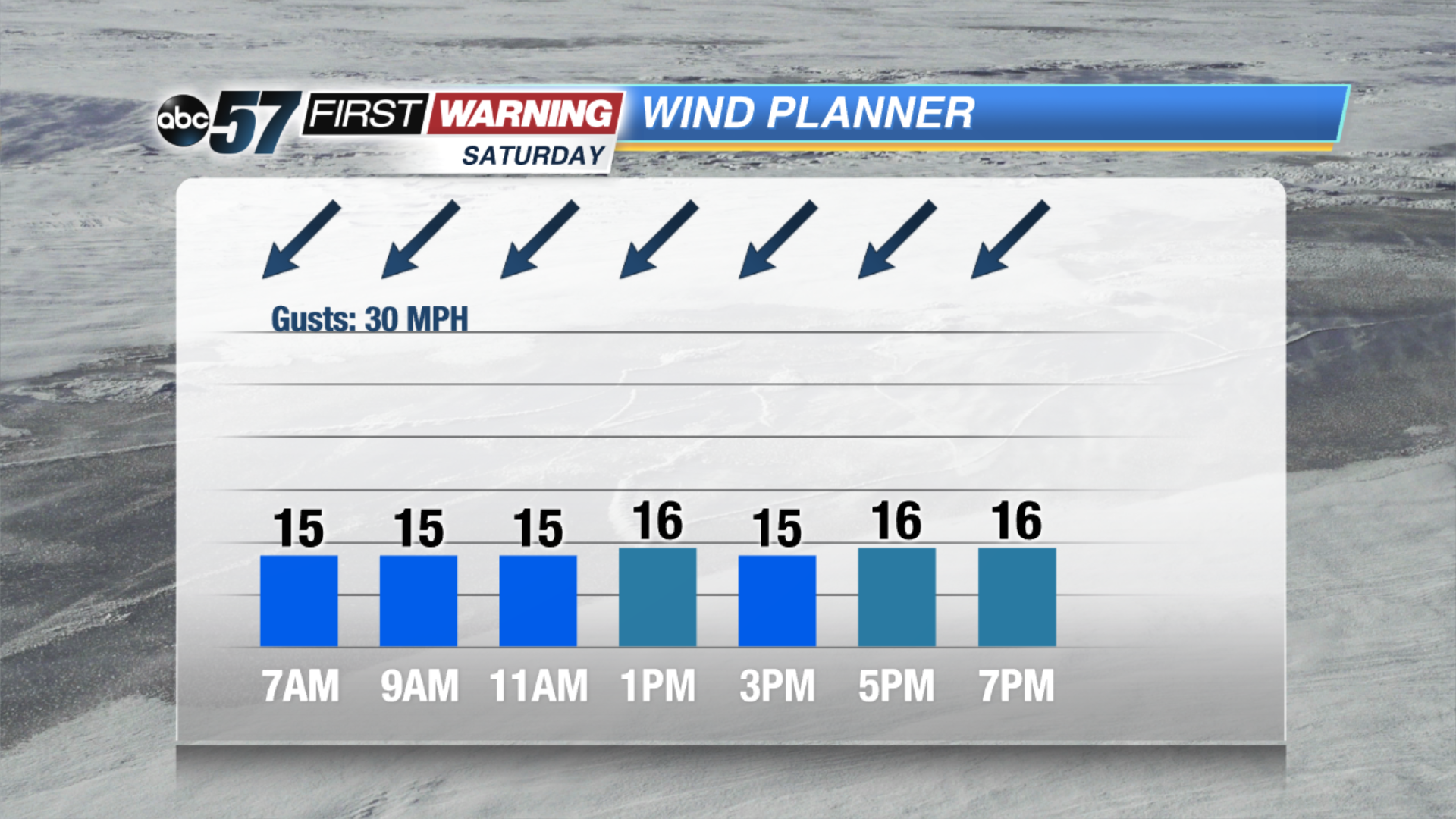
Snow and blowing snow will make for an impactful weather day across Michiana. Snow lasts through at least noon Saturday, tapering off through the early afternoon. Even after the snow is done falling, blowing and drifting, especially on north-south roads will continue, an east wind will gust up to 30 mph. Temperatures tank into Sunday, lows nearing or dropping below zero and highs in the teens.
Tonight: Increasing snow showers, low of 22.
Saturday: Snowy, heavy at times and breezy, high of 24.
Sunday: Partly cloudy, very cold, high of 16.
Monday: Mostly sunny, high of 14.