Snowy Saturday, Michiana on the edge of a Midwest storm
By:
Tom Coomes
Posted: Jan 11, 2019 4:41 PM EDT

-
0:36

Eddies Circuit Robotics holds competition Saturday
-
0:32

21st annual Nappanee Model Train Show
-
0:38

Local boys basketball team headed to IHSAA state finals
-
3:49

Midwest Meowfest brings kitten advocacy to attendees, new homes...
-
1:52

Mild tonight, showers tomorrow
-
1:43

Pleasant to start the weekend
-
3:06

Pulaski County weighs stricter solar rules amid resident concerns
-
0:40

Marian High School hosts World Down Syndrome Awareness Walk
-
2:33

South Bend leaders call for an end to gun violence
-
2:01

Tae Johnson, Notre Dame secondary stands out as Irish open spring...
-
2:21

Backup quarterback competition, position battles highlight Notre...
-
2:25

A new Pathway to the Golden Dome

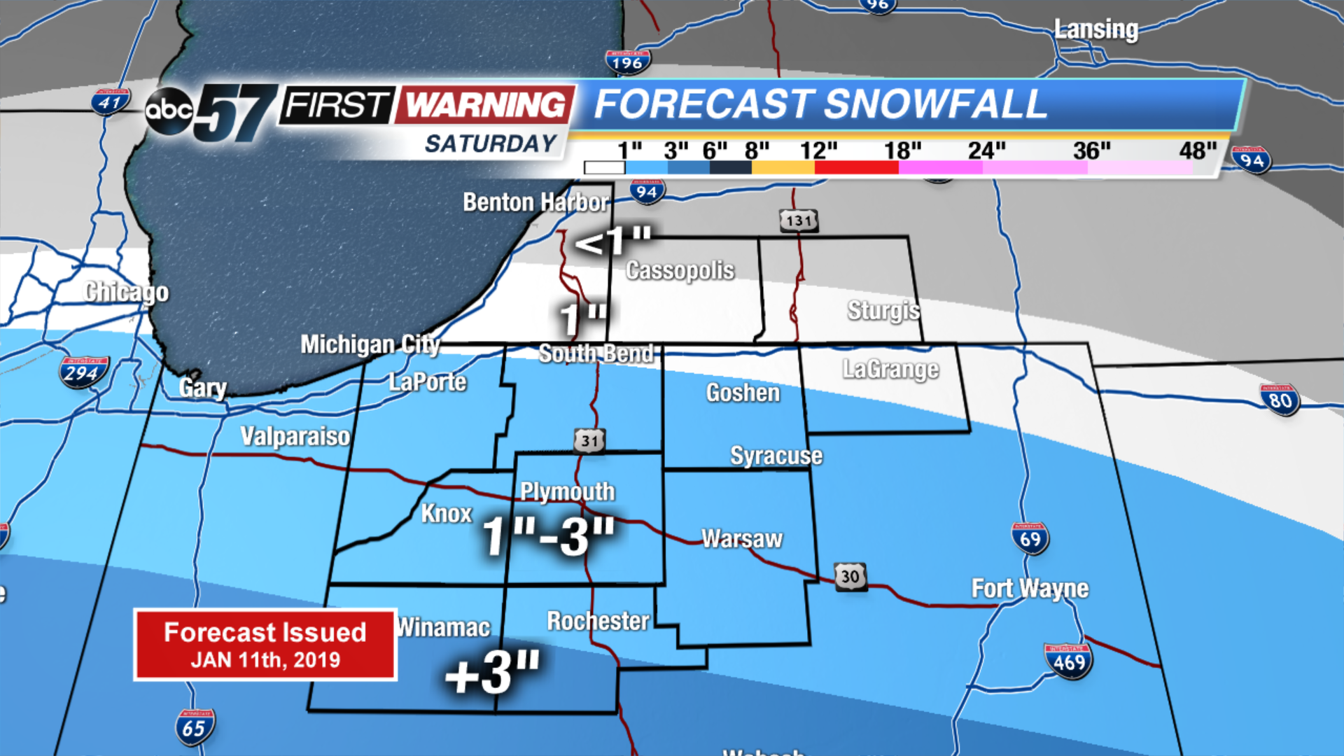
Snow starts for some Saturday morning, increasing northward with a peak of steady snow through the afternoon and evening, ending around midnight. Michiana remains on the edge of this headline Midwest storm with marginal amounts predicted mostly in the one to three inch range. Areas south of U.S. Highway 30 will see the most snow, with the likelihood of six inches towards Indianapolis. Skies clear into Sunday, fair weather to end the weekend and to start next week.
Tonight: Cloudy. Low of 24.
Saturday: Snow showers. High of 32.
Sunday: Mostly sunny. High of 32.
Monday: Mostly sunny. High of 34.
Sign up for the ABC 57 Newsletter