Snowy Wednesday evening, very cold Thursday morning


Mix and snow this afternoon / evening. This could cause for some slick travel during the evening commute. Temperatures will be near the freezing mark before dropping sharply tonight into the teens. Overall accumulation will be minor with the highest amounts in the one to three inch range for many. 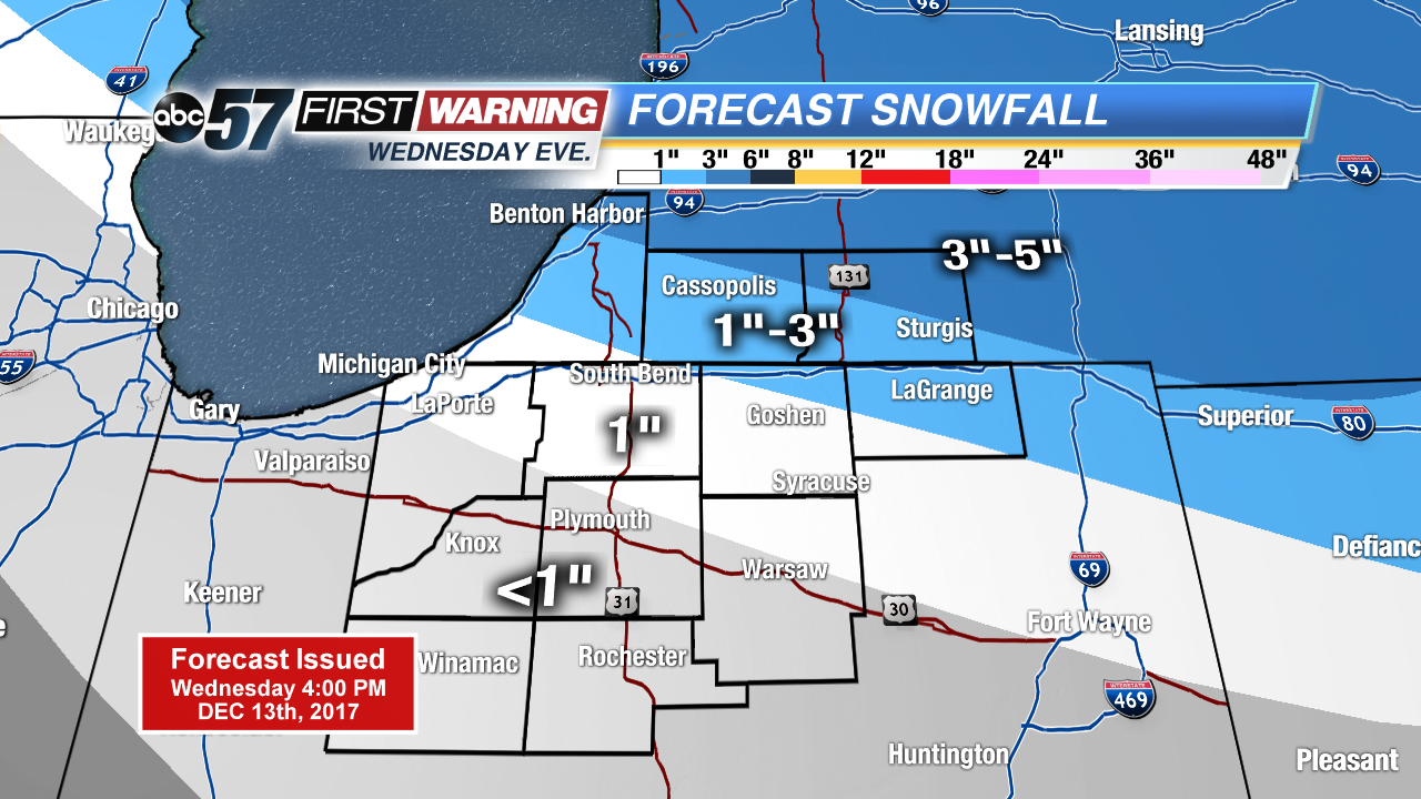
Thursday will be another cold day in the wake of a clipper system. There’s a chance of a few light lake effect snow showers but no significant accumulation is expected. The pattern stays active through Friday with another clipper that could bring another one to three inches of snow to the area.
The pattern changes this weekend with a highs above freezing and wintry mix of rain in the forecast through early next week.
Tonight: Evening snow showers, low 15.
Thursday: Mostly cloudy, chance of snow, high of 24.
Friday: Scattered snow showers, high of 28.
Saturday: Partly cloudy, highs in the mid-30s.
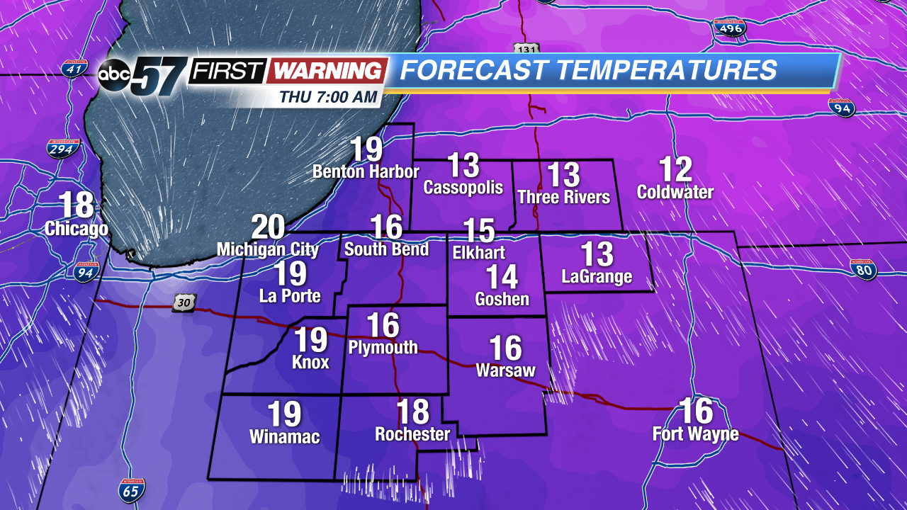 Very cold Thursday morning , mid to lower teens