Steamy and stormy through the weekend.


Update: Weakening showers and storms after midnight fade into the early morning. Another round of storms to start Thursday.
Steamy and stormy, those are the two words that will best describe the next three to four days. Thursday will be the hottest day with a heat index of 95 to 100. The mugginess will feed showers and thunderstorms, one round could start Thursday with heavy rain and the day/night stormy pattern continues through Saturday. The threat of heavy rain will continue a flood threat for the already soggy area through the weekend.
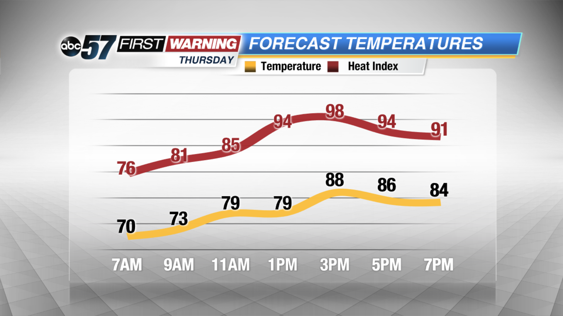 Heat index near 100 Thursday afternoon
Tonight: Partly to mostly cloudy, chance of storms by morning low 70.
Thursday: Very humid, scattered storms, high 90.
Friday: Very humid, scattered storms, high 88.
Saturday: Very humid, scattered storms, highs in the mid-80s.
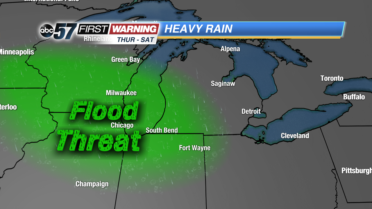 Heavy rain threat through Saturday could bring more flooding to the region.