Storm threat tonight as hot and humid weather continues


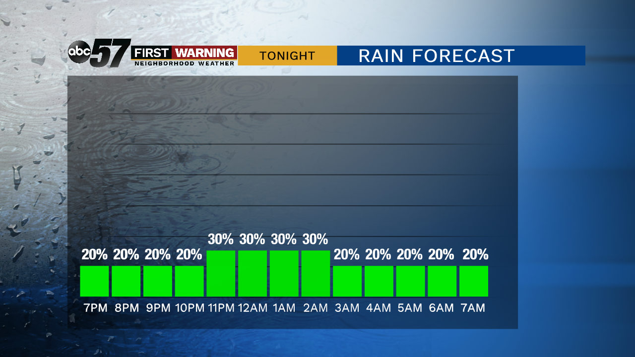
A complex of storms could move through western Michigan Wednesday evening. This could skirt the area along and north of the state line or produce a few isolated storms from its outflow. A widespread rain and severe threat remains low but thunderstorms are possible.
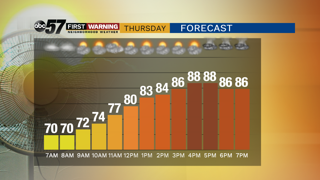
Hot and humid weather lasts through Friday until a cold front moves through, dropping the humidity for the weekend. As the front nears Thursday evening, the chance of showers and storms will increase across the area. Timing may not be favorable for storms as the front nears Friday morning and storms may only be in their infancy as the fire Friday afternoon as the front clears. The weekend is less humid and sunny.
Tonight: Partly cloudy, isolated storms. Low of 70.
Thursday: Partly cloudy, isolated t-storms. High of 88.
Friday: Scattered showers and storms, breezy. High of 80.
Saturday: Mostly sunny. High of 80.