Storms and gusty winds Wednesday; cooler to end the week


POTENTIAL FOR STRONG OR SEVERE STORMS TODAY
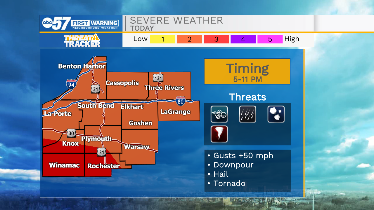
Stay weather aware on Wednesday, as a round of thunderstorms get ready to move through Michiana. Some storms could be strong or even severe.
The first wave of showers and storms is late this morning and into the lunch hour. A few of these storms could have severe potential, but that potential is low.
The strength of the first round of storms will help determine the strength of storms this evening.
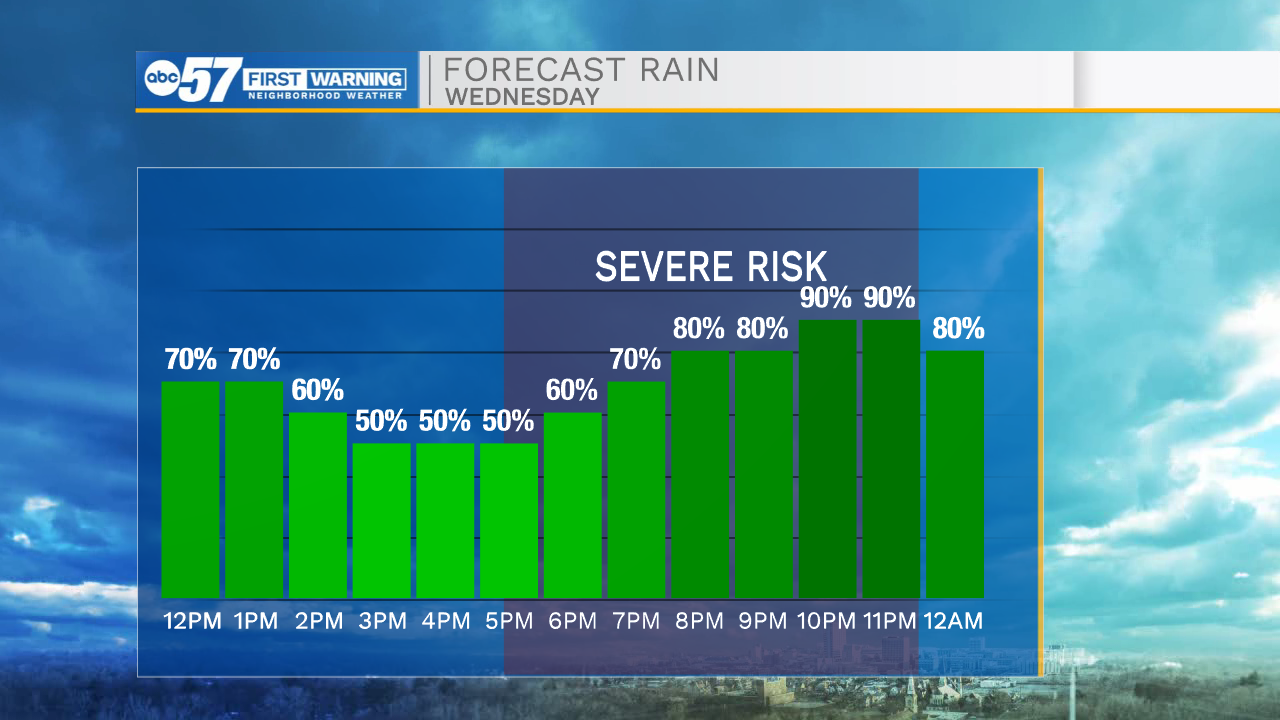
Right now, the most likely timeframe for any severe weather today is from 5-11 p.m.
The primary hazard is gusty, potentially damaging, winds. It stays windy all day, with gusts up to 30 mph, but within storms, gusts could reach 40 or 50 mph.
Additional hazards include hail and heavy rain downpours. A tornado cannot be ruled out for today yet.
The entire system moves out of Michiana after midnight tonight.
It’s cooler, windy, but sunny for Thursday. Wind gusts tomorrow could reach 40 mph. The wind starts to taper off late Thursday, but it’s still breezy Friday.
Easter weekend is trending mostly dry, but cool, with highs in the 40s to low 50s.
Today: Showers and thunderstorms. Some could be severe later in the day. High 70.
Tonight: Showers and thunderstorms early. Windy. Low 40.
Thursday: Mostly sunny and windy. High 53. Winds could gust above 40 mph.
Friday: Partly cloudy and breezy. High 55.