
-
1:46

A chilly and calm start to the weekend
-
1:00

NIPSCO workers rally in South Bend for new contract
-
1:53

Severe weather threat is over, MUCH colder Friday
-
3:43

South Bend Mayor James Mueller delivers 2026 State of the City...
-
0:52

Family and friends of Adrian Cruz voice frustration in sentencing...
-
2:13

Potawatomi Zoo prepares for opening day with new attractions
-
2:54

Local expert weighs in on landmark social media trials
-
1:33

Round one of storms moving east, Round two arriving soon
-
2:38

Bourbon residents recall tornado as severe weather strikes again
-
1:34

Tornado threat decreasing, but severe weather still expected...
-
1:42

Damaging winds and hail move in this evening
-
2:51

Severe weather expected in Michiana later today

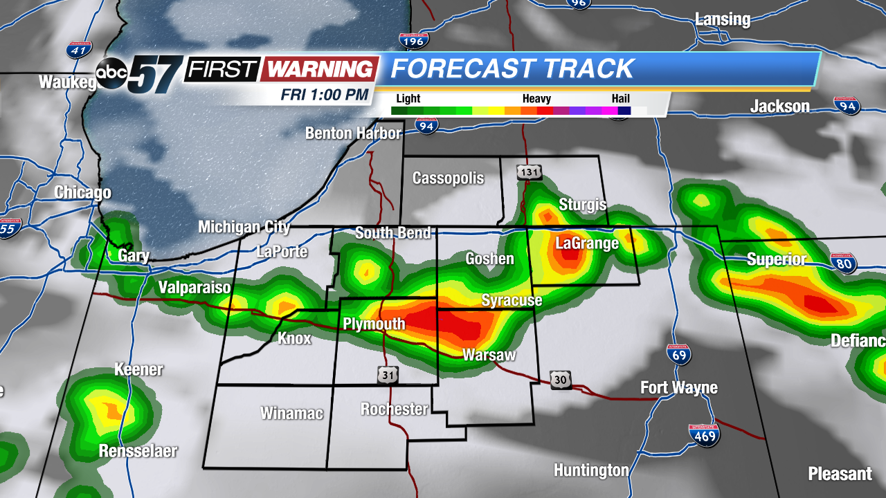 Short-Range RPM model with storms firing around 1 PM Friday.
Big changes in how storms look to develop Friday morning. A front that was expected to bring storms early is expected to stall overnight. The fewer showers we see early, the more likely storms could fire around noon Friday. Michiana will now be the starting point for storms Friday versus the ending point for Thursday night's storms. This scenario would still keep our severe threat low but storms could still bring heavy rain and gusty wind. Storms clear by mid afternoon and the humidity drops into Saturday.
Sign up for the ABC 57 Newsletter