Stormy Monday morning; Second round of thunderstorms Monday evening


Many are waking up to storms and showers this Monday morning. These should clear by noon. Monday afternoon is mostly cloudy and humid. Temperatures will be in the upper 80s, but heat indices are in the low to mid 90s.
A second round of showers and thunderstorms starts after 4 p.m. There is a moderate severe threat for these storms, or threat level 2/5. The main impacts are gusty, potentially damaging winds, periods of heavy rain, and frequent lightning.
There are a few showers early Tuesday morning. The rest of Tuesday is partly sunny and dry with temperatures in the mid 80s. Wednesday and Thursday should also stay dry. On Friday there is a chance for isolated showers and thunderstorms by afternoon.
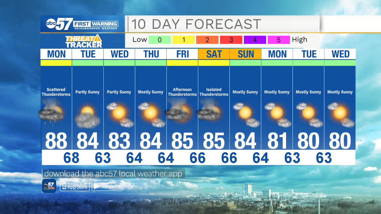
Today: Showers and thunderstorms early. Dry afternoon. High 88.
Tonight: Scattered evening thunderstorms. Showers overnight. Low 68.
Tuesday: Few showers early. Dry and partly sunny afternoon. High 84.
Wednesday: Partly sunny. High 83.