Stormy Saturday night, severe weather possible.
Posted: Jun 16, 2017 4:29 PM EDT


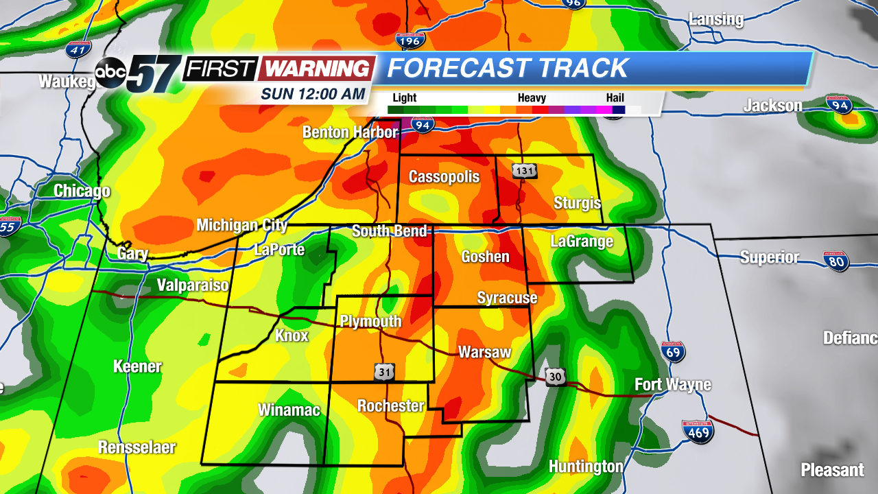 Forecast Track pinpoints the main line of storms around and before midnight Saturday night.
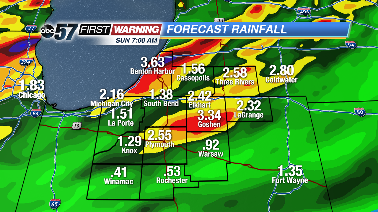 Heavy Rain, estimates of 1 to 3 inches, most of that falling around midnight.
The muggy and stormy pattern continues through Saturday, ending with heavy rain and possible severe weather Saturday night. The first round of storms Saturday morning will be highly scattered and not severe. Most of the daytime hours look dry, partly cloudy and muggy with high in the mid-80s. Saturday night, ahead of the cold front a line of storms will sweep through Michiana, latest timing around midnight. Heavy rain is likely, flooding is possible along with damaging wind and hail.
Tonight: Partly cloudy, shower chance, low of 68.
Saturday: Morning scattered storms, partly cloudy with a high of 86, storms likely late.
Sunday: AM shower possible, partly cloudy, high 78.
Monday: Mostly sunny, highs in the mid-70s